Hiking Michigan’s Famous Trails? Prepare for the Worst and Hope for the Best

Hiking Michigan’s Famous Trails? Prepare for the Worst and Hope for the Best

By someone who’s hiked Michigan, survived a storm with just a tarp, and never goes into the woods without duct tape and a magnesium fire starter.

Hiking Trails: Michigan Hiking

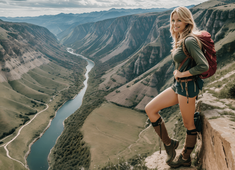
Let me tell you something straight: if you’re heading out into Michigan’s backcountry and you’re not prepared, you’re not just foolish—you’re bait. I love this state. I’ve hiked every trail worth its salt, pitched tents under pine canopies, and woken up to black bears snuffling around camp. Michigan is beautiful—no doubt. But she’s also wild, unpredictable, and merciless if you come unprepared.

If you’re planning to hike Michigan’s famous trails, you’d better treat every trip like it’s the one that tests your mettle. Because one day, it will be.

You see, the average hiker brings a granola bar, a water bottle, and a phone. The smart hiker brings that and then some—fire-starting tools, a map and compass (yes, paper and metal), a good fixed-blade knife, paracord, a tarp, extra socks, and a working knowledge of how to filter pond water through a bandana if the Sawyer filter fails.

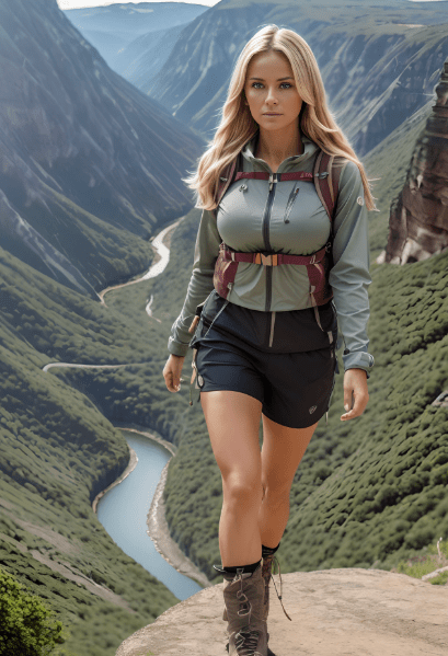
Now that we’ve got that squared away, let’s get into what you really came for: the best trails in Michigan. I’ve walked them, camped along them, and, in one case, slept in a tree to avoid coyotes. Here are the Top 20 Hiking Trails in Michigan, each one worth your boots, but not without its own risks.


Top 20 Hiking Trails in Michigan (and Why You’d Better Be Ready)

  1. Porcupine Mountains Escarpment Trail (Upper Peninsula)
    • Wild views, black bears, and weather that changes faster than your GPS signal. Always have a compass.
  2. North Country Trail (Multi-State, including Michigan)
    • 1,150+ miles through Michigan alone. You’re not hiking this without a plan, and I mean a real plan.
  3. Pictured Rocks National Lakeshore (Munising to Grand Marais)
    • Cliffside trails, Lake Superior’s wind, and cold that cuts to the bone. Bring layers, even in July.
  4. Manistee River Trail (Manistee National Forest)
    • Popular, but don’t let that fool you. Poison ivy, ticks, and river crossings galore. Good boots are mandatory.
  5. Jordan River Pathway (Northern Lower Peninsula)
    • A 2-day loop with terrain that punches above its weight. Don’t underestimate the hills—pack light, but smart.
  6. Isle Royale Greenstone Ridge Trail (Isle Royale National Park)
    • Remote? Try “ferry-access only and no roads.” Bring everything you need and expect no cell signal—ever.
  7. Sleeping Bear Dunes Dune Climb Trail (Empire, MI)
    • Beautiful but brutal. Sand hiking is like walking through syrup. Bring electrolytes and a wide-brim hat.
  8. Waterloo-Pinckney Trail (Southeast Michigan)
    • Rolling hills, marshes, and sudden storms. Keep your gear dry and your sense sharp.
  9. Tahquamenon Falls State Park Trails (Upper Peninsula)
    • Boardwalks, backwoods, and blackflies. Bug spray is non-negotiable.
  10. Lakeshore Trail (Pictured Rocks, shorter alternative)
    • Easier, but with slippery cliffs and sudden fog. Always keep to the marked path.
  11. High Country Pathway (Northeast Lower Peninsula)
    • 80+ miles through remote backcountry. Good for solo testing—if you know how to make shelter from scratch.
  12. Hogback Mountain Trail (Marquette, MI)
    • Steep, rocky, and short—but treacherous in wet conditions. Watch your footing, and bring trekking poles.
  13. McCormick Wilderness Trails (Upper Peninsula)
    • True wilderness. Navigation skills required. Don’t rely on marked paths—they’re faint or nonexistent.
  14. South Manitou Island Trails (Lake Michigan)
    • Ferry access only, soft terrain, and ghost-town vibes. Water sources are limited—filter everything.
  15. Pinckney Recreation Area – Potawatomi Trail
    • Loop trail with solid forest cover. Watch for cyclists, and keep an eye on your pace.
  16. Shingle Mill Pathway (Pigeon River Country State Forest)
    • Elk sightings, peaceful woods—but it gets dark fast. Keep a headlamp in your top pouch.
  17. Chapel Loop Trail (Pictured Rocks)
    • Arches, cliffs, and serious drop-offs. Don’t hike it in flip-flops. Yes, I’ve seen that. Don’t be that person.
  18. Porcupine Mountains Lake of the Clouds Trail
    • Amazing views, but a wrong step near the overlook and it’s game over. Respect the edge.
  19. Nordhouse Dunes Wilderness Area (Near Ludington)
    • Dunes, wind, and navigation hell if you’re not good with a map. Mark your trail.
  20. Arcadia Dunes – Baldy Trail
    • Family friendly until weather rolls in. Keep that emergency poncho handy—you’ll need it eventually.

Prepping for Michigan Trails: The Hard Truth

You’re not just walking through the woods—you’re entering nature’s domain. She doesn’t care about your phone battery or your Instagram reel. Out there, it’s about preparation, awareness, and respect.

Gear You Must Carry:

  • Water purification system (plus backup tablets)
  • Knife or multitool (not the cute keychain kind)
  • Fire starter kit (lighter, waterproof matches, ferro rod)
  • First aid kit (include tweezers for ticks)
  • Map and compass (learn how to use them before you go)
  • Rain gear (always assume it will rain)
  • Shelter (tarp, bivy, or ultralight tent)
  • High-calorie snacks (trail mix, jerky, energy bars)
  • Emergency whistle and signal mirror

Mindset You Need:

  • Expect your GPS to fail.
  • Expect the weather to betray you.
  • Expect blisters, bruises, and biting insects.
  • Hope for beauty, peace, and solitude—but prepare for the worst.

A Final Word from the Trail

I’m not here to scare you out of hiking. Quite the opposite—I want you on those trails, breathing that wild Michigan air, crossing paths with a fox at sunrise, or watching Lake Superior turn gold at dusk.

But I want you to live through it.

I’ve seen too many folks hike with earbuds in and no clue where they are. Too many day-trippers caught in a storm with no jacket, or campers whose cheap tent poles snapped in a mild breeze. Don’t let that be you.

When you hike these 20 Michigan trails—some of the best this side of the Mississippi—you owe it to yourself and the land to be prepared. You don’t have to be a full-blown bushcrafter. But bring more than the bare minimum. Practice your knots. Read a map. Learn the plants.

Because in the end, the trail doesn’t care if you’re a newbie or a veteran—it treats everyone the same. The question is: are you ready?

So lace up your boots, zip that pack tight, and head out with confidence.

And remember: prepare for the worst, hope for the best, and hike like your life depends on it—because one day, it might.

The Hidden Dangers of Massachusetts’ Most Popular Hiking Trails: Survival Is Key

Let me tell you something most folks don’t want to hear: just because a trail is popular doesn’t mean it’s safe. I’ve been hiking across the rugged backwoods of Massachusetts for over 20 years—off-grid, compass in hand, and pack on my back—and I can tell you from experience: the biggest threat on the trail isn’t always what’s in front of you. It’s what you didn’t prepare for.

Hiking Trails: Maryland Trails

Massachusetts might not have the Rocky Mountains or the vast deserts of the Southwest, but don’t let that fool you. From sudden weather shifts to venomous snakes, ticks, and disorienting terrain, the threats are real—and often underestimated. Whether you’re trekking the Berkshires or tracing the edge of Cape Cod, survival isn’t just a mindset. It’s a necessity.

Before we dive into the top 20 hiking trails in Massachusetts, let’s break down some of the hidden dangers that even seasoned hikers overlook.


Hidden Threats Lurking on the Trail

1. Weather Whiplash

Massachusetts weather is famously unpredictable. One minute you’re basking in 70°F sunshine, the next you’re drenched in a torrential downpour or socked in by dense fog. Hypothermia doesn’t care that it’s spring. Always carry thermal layers and a compact emergency blanket.

2. Ticks and Lyme Disease

Our forests are tick-infested battlegrounds. Deer ticks, which carry Lyme disease, are nearly invisible. Use permethrin-treated clothing, carry a tick removal kit, and check yourself after every hike.

3. Venomous Wildlife

Yes, we have copperheads and timber rattlers—especially out west in the Berkshires. They’re shy but you don’t want a close encounter. Step carefully around rocks and logs.

4. Trail Misguidance

Marked trails can become misleading after storms or in dense forest. GPS can fail. Always carry a topo map and compass, and know how to use them.

5. False Confidence

This is the biggest one. Folks think a “moderate” rating on AllTrails means they can stroll through in sneakers and shorts. Big mistake. Foot injuries, dehydration, and getting lost can happen fast.


Top 20 Hiking Trails in Massachusetts (and What You Need to Survive Them)

These trails are stunning—but don’t be fooled. Every single one requires planning, gear, and respect.


1. Mount Greylock (Lanesborough)

The highest point in the state. Fog rolls in fast, and trails can be slick. Bring trekking poles and always pack a rain shell.

2. Mount Monadnock (Technically in NH, but popular from MA side)

Steep, granite faces make for great views—and twisted ankles. Sturdy boots are non-negotiable.

3. Blue Hills Reservation (Milton)

Don’t be lulled by its proximity to Boston. With over 125 miles of trails, it’s easy to get disoriented. Mark your route and check your six.

4. Mount Holyoke Range (Hadley/Amherst)

Rocky, technical terrain with limited water sources. Carry a purifier or LifeStraw.

5. Mount Tom (Easthampton)

Cliffs and loose gravel. Slips are common, especially after rain. Gloves help on steep ascents.

6. Wachusett Mountain (Princeton)

Good elevation gain with panoramic views. Sudden temperature drops possible at the summit.

7. Bash Bish Falls (Mount Washington)

Gorgeous, but deadly. Slick rocks have caused injuries and even fatalities. No shortcuts. Stay on the trail.

8. Mohawk Trail (Western MA)

An historic route with hidden side trails. Navigation skills are crucial here.

9. Quabbin Reservoir Trails

Peaceful but sprawling. Easy to wander too far. Cell service is spotty—bring a whistle and mirror for signaling.

10. Midstate Trail

92 miles from Rhode Island to New Hampshire. Multi-day section hiking means serious preparation: maps, rations, and shelter.

11. Cape Cod National Seashore Trails

Stunning dunes and coastal forest. But coastal storms hit fast, and sun exposure is brutal. Don’t forget SPF and electrolytes.

12. Mount Everett (Mount Washington)

Part of the Appalachian Trail, it’s isolated and has sudden elevation changes. Watch for snakes.

13. Purgatory Chasm (Sutton)

Rock scrambles and narrow crevices. Great for agility, but bad for the unprepared. Helmets aren’t a bad idea here.

14. Deerfield River Trail

Flood-prone and muddy in spring. Waterproof boots and gaiters are essential.

15. Appalachian Trail Section (Massachusetts portion)

Part of the grand-daddy of all long hikes. This stretch is beautiful and wild—perfect place to test your survival kit.

16. Notch Trail (Amherst)

Quiet, forested paths, but confusing junctions. Trail markers are scarce in spots—rely on compass, not phone.

17. Beartown State Forest (Monterey)

Remote and lush, with minimal traffic. Good spot for seeing wildlife—but also black bears. Carry bear spray.

18. Harold Parker State Forest (Andover)

Lots of loop trails. Easy to lose your bearing. Always note the sun’s direction to help navigate.

19. Pine Hill (Blue Hills, Quincy)

A popular day hike, but the terrain is tougher than expected. Ankle support is key.

20. Ashland State Park Trails

Wetlands and wooded paths. Great in fall, but flooded sections are common. Watch for unstable ground.


My Core Survival Checklist for Massachusetts Trails

If you’re serious about staying safe and seeing every trail to its end, here’s what you need in your pack—every time:

  • Topo map and compass (and the knowledge to use them)
  • Portable water filter or purification tablets
  • Emergency bivy sack or space blanket
  • Knife/multi-tool
  • First aid kit (with tick remover)
  • Fire-starting gear (ferro rod, waterproof matches)
  • High-calorie snacks (jerky, energy bars)
  • Headlamp with extra batteries
  • Paracord (50 feet minimum)
  • Whistle and signal mirror
  • Rain jacket and thermal base layer
  • Sunscreen and insect repellent
  • Bear spray (western MA)

And here’s the truth: survival isn’t about paranoia. It’s about preparedness. It’s about knowing that you might be the only thing standing between you and a real bad day out there. Popular trails attract more hikers—but also more false confidence. That’s where accidents happen.


Final Words from the Trail

Massachusetts is a state of beauty, history, and wild places. But those places deserve respect. Hiking isn’t a hobby—it’s a proving ground. Every trail teaches you something about the land and about yourself. Sometimes it’s humility. Sometimes it’s vigilance. And sometimes, it’s the hard lesson of what happens when you forget that nature always holds the upper hand.

So lace up your boots, pack smart, and hike like your life depends on it—because one day, it just might.

Survival is key. Always has been. Always will be.

Alabama’s Deadliest Hiking Trails: Popular Routes That Could Be Your Last Hike


Alabama’s Deadliest Hiking Trails: Popular Routes That Could Be Your Last Hike

As a seasoned survivalist and avid hiker, I’ve trekked through Alabama’s rugged terrains, where beauty and danger often walk hand in hand. The state’s diverse landscapes—from dense forests to steep ridgelines—offer exhilarating challenges. However, these same features can turn a peaceful hike into a perilous ordeal if you’re unprepared. In this guide, I’ll walk you through Alabama’s most treacherous trails, highlighting the risks and survival strategies to ensure you make it back.


1. Walls of Jericho Trail

Often dubbed the “Alabama Grand Canyon,” the Walls of Jericho Trail in Estillfork is a 6.4-mile out-and-back journey that leads hikers through dense forests to a stunning waterfall. The path is notorious for its steep descents, slippery rocks, and overgrown vegetation. In summer, the area becomes a haven for venomous snakes, and the lack of cell service makes emergencies challenging.A-Z Animals+1runbryanrun.com+1

Survival Tip: Always hike with a buddy, carry a GPS device, and wear snake gaiters.


2. Sipsey Wilderness

Spanning 45 miles of untamed wilderness, Sipsey Wilderness is a labyrinth of sandstone bluffs and dense forests. Hikers often get lost due to the absence of trail markers and the maze-like terrain. The cliffs can be treacherous when wet, leading to fatal falls.A-Z Animals+1AllTrails.com+1

Survival Tip: Stick to well-marked trails, carry a topographic map, and inform someone of your itinerary.


3. Bear Creek Back Country Trail

This 7.3-mile loop in the Bankhead National Forest descends into a canyon, offering breathtaking views and a waterfall. The trail is challenging due to its steep climbs and slippery rocks. Many hikers turn back after reaching the waterfall, leaving the return journey through the canyon’s rugged terrain.

Survival Tip: Wear sturdy boots, bring trekking poles, and carry sufficient water.


4. Odum Trail to Odum Point

A 7.5-mile out-and-back trail featuring three waterfalls in the first mile, Odum Trail becomes increasingly treacherous beyond that. The path is overgrown with thorns, and ticks and snakes are prevalent in warmer months. The trail’s remoteness means that help is often far away.runbryanrun.com

Survival Tip: Wear long pants, carry a machete, and check for ticks regularly.runbryanrun.com


5. Cheaha Lake to Cheaha Mountain

This 3.3-mile out-and-back trail offers a steep ascent of over 1,200 feet. While the elevation gain is substantial, the trail is less trafficked, increasing the risk of encountering wildlife or getting lost.

Survival Tip: Carry a whistle, stay on the trail, and be aware of your surroundings.


6. Skyway Loop Trail

A 17.2-mile loop with nearly 3,000 feet of elevation gain, the Skyway Loop Trail is a favorite among backpackers and trail runners. The trail offers stunning views but is physically demanding. The remote nature means that assistance is not readily available in case of emergencies.runbryanrun.com

Survival Tip: Plan for an overnight hike, carry a first aid kit, and ensure your phone is fully charged.


7. Pinhoti National Recreation Trail

Stretching over 350 miles, the Pinhoti Trail traverses the Talladega National Forest. While the trail is well-marked, its length and isolation pose risks. Hikers have been known to get lost, and the trail’s elevation changes can be strenuous.en.wikipedia.org

Survival Tip: Break the hike into sections, carry a satellite communicator, and stay hydrated.


8. Pin-Chin-Sky Loop

A 19.3-mile loop offering panoramic views, the Pin-Chin-Sky Loop is challenging due to its length and varied terrain. The trail includes rocky ridges, tranquil streams, and open meadows, but the lack of trail maintenance in some areas can lead to injuries.AllTrails.com

Survival Tip: Use trekking poles, wear appropriate footwear, and carry a repair kit for gear.


9. Deer Skull Falls and Wolfpen Falls Loop

This 4.1-mile loop is not officially maintained and deviates from established paths. The trail’s unmarked sections can lead to confusion and potential accidents. The presence of waterfalls adds beauty but also danger due to slippery rocks.AllTrails.com

Survival Tip: Avoid the trail during wet conditions, and always have a map and compass.


10. Cheaha State Park Trails

While Cheaha State Park offers several trails, some paths are steep and can be hazardous during inclement weather. The park’s elevation changes and unpredictable weather patterns increase the risk of hypothermia and other cold-related injuries.

Survival Tip: Check the weather forecast before hiking, and dress in layers to adjust to temperature changes.


11. Monte Sano State Park Trails

Located near Huntsville, Monte Sano State Park features trails with rocky terrains and elevation changes. The park’s popularity means that trails can become crowded, leading to potential accidents.Huntsville

Survival Tip: Hike during off-peak hours to avoid crowds and reduce the risk of accidents.


12. Oak Mountain State Park Trails

As Alabama’s largest state park, Oak Mountain offers a variety of trails. Some paths are challenging due to their length and elevation changes. The park’s size means that getting lost is a real possibility.

Survival Tip (continued): Always download offline maps, carry an emergency whistle, and pack a space blanket—just in case you’re stuck overnight.


13. Dismals Canyon Trail

Don’t let the name fool you—Dismals Canyon is as treacherous as it is beautiful. Known for its glowing dismalites (think glowworms), this 1.5-mile trail winds through deep canyons, tight rock passages, and slippery wooden bridges. Rain can turn this place into a natural slip-and-slide from hell.

Survival Tip: Waterproof everything. Bring dry socks and a headlamp—those caves can go pitch black fast.


14. Ruffner Mountain Trails

Just outside Birmingham, Ruffner Mountain packs a wallop in a small package. With several interconnecting trails, it’s easy to get turned around. The steep grades and unexpected wildlife encounters (including copperheads) make this more than just a Sunday stroll.

Survival Tip: Mark your map, don’t veer off trail, and keep a basic first-aid kit on hand—especially for bites or falls.


15. Lookout Mountain Trails (DeSoto State Park)

The terrain up here changes dramatically—one moment you’re on smooth dirt, and the next you’re scrambling up loose rock or crossing slippery creek beds. It’s beautiful, no doubt, but one wrong step and it’s a broken ankle or worse.

Survival Tip: Invest in quality ankle-high hiking boots and consider taping weak joints before long hikes.


16. Red Mountain Park Trails

Red Mountain Park in Birmingham offers a scenic mix of old mining ruins and nature—but the ruins themselves are part of the danger. Rusty metal, unstable terrain, and the occasional sinkhole make this a trail to take seriously.

Survival Tip: Keep a flashlight and watch your step around structures. This isn’t a playground—it’s survival training wrapped in history.


17. Flint Creek Trail

This 3-mile trail near Decatur may seem innocent, but the marshy terrain hides dangers. Flash floods, cottonmouth snakes, and mosquitoes thick enough to carry off a small dog make this one to prepare for.

Survival Tip: Treat your clothes with permethrin, bring waterproof boots, and never hike during or after heavy rains.


18. Green Mountain Nature Trail

It’s a family favorite, yes—but that’s the trap. The 1.5-mile loop circles a lake with steep, muddy banks that have claimed their share of unprepared hikers. A misstep here means a cold swim, or worse.

Survival Tip: Don’t underestimate short trails. Assume nothing, and bring the same gear you’d take on a 10-miler.


19. Bluff Line Trail (Monte Sano Nature Preserve)

Part of the Land Trust of North Alabama, Bluff Line Trail runs near dramatic cliffs and drop-offs. Combine loose gravel with distraction from the view, and you’ve got a recipe for disaster.

Survival Tip: Stay three feet from cliff edges, especially in fog or rain. A trekking pole can save your life here.


20. Chinnabee Silent Trail

Beautiful and serene, this 7-mile trail traverses creeks and waterfalls. But don’t get lulled into a false sense of security. When water levels rise, crossings become dangerous, and remote sections are far from help.

Survival Tip: Bring water shoes and a lightweight rope for creek crossings. Know how to assess current strength before stepping in.


Final Words From a Survivalist

If you’ve made it this far, you’re not just any hiker—you’re someone who respects the land and understands that Alabama’s beauty has a wild edge. I’ve been hiking these trails for over a decade, and I’ve seen things go sideways in the blink of an eye. One minute you’re soaking in a waterfall, and the next you’re sliding down a 40-foot embankment wondering if that crunch was a tree branch… or your tibia.

Preparation isn’t paranoia—it’s protection. Alabama’s trails might not have the snowy passes of the Rockies or the bear threats of Montana, but they’ve got their own flavor of danger. Heatstroke in July, venomous snakes in spring, sudden floods in fall… If you don’t plan for every eventuality, you’re gambling with your life.

So here’s my survivalist checklist before tackling any of these death-defying beauties:

  • Tell someone where you’re going. Always.
  • Bring three ways to make fire.
  • Carry more water than you think you need.
  • Have a physical map. Phones die.
  • First-aid kit. Not optional.
  • Knife, headlamp, whistle, and emergency bivvy—bare minimum gear.

When you hike with the mindset that “this could be my last hike,” you’re not being dramatic—you’re being smart. And ironically, that mindset might just be the reason it isn’t your last hike.

Stay sharp. Stay wild. And if the trail ever turns on you, be ready to fight your way back to civilization. Because out here in Alabama’s woods, nature doesn’t care how many likes your hiking photo got. The mountains have claimed hikers before—and if you’re not prepared, they’ll gladly take one more.

Beware: These Arkansas Trails Will Test Your Limits and Push You to Survive

Let me make one thing crystal clear: not all hikes are created equal. Some are walk-in-the-park strolls for tourists and yoga influencers with sparkling water bottles. And then there are trails—the kind that don’t just challenge you physically, they demand your respect. These trails grab you by the collar, stare you in the eye, and ask: Are you built for this? If you’re not, Arkansas will chew you up and spit you out.

I’ve spent decades hiking, climbing, surviving off-grid, and prepping for whatever the world throws at me. I don’t do easy, and I sure as hell don’t do predictable. That’s why I keep coming back to Arkansas. The Natural State hides some of the gnarliest, most breathtaking backcountry paths in the entire U.S., and trust me—they’re not for the faint of heart.

These 20 trails will test your limits. They’ll soak your gear, blister your feet, and if you’re not paying attention, they’ll leave you wondering how to get back before dark. But if you’re the kind of person who feels most alive on the edge, if you crave grit, sweat, and raw, wild beauty—then read on.


1. Eagle Rock Loop (Ouachita National Forest)

26.8 miles
This is the crown jewel for survival junkies like me. River crossings, elevation gain, isolation—it has it all. You’ll wade through creeks and scramble up switchbacks. There are spots where cell service is a myth. You want remote? You got it.

2. Buffalo River Trail (Upper Segment)

37 miles (multi-day)
This trail punches hard. Rugged ridgelines and panoramic bluffs tower over the Buffalo River. Water access and camping spots are scattered, but if you mess up your resupply or underestimate the terrain, you’ll regret it.

3. Ozark Highlands Trail

165 miles total
This monster snakes through the heart of the Ozarks. Tackle it in sections or go all-in. Be ready for long, desolate stretches. Water filtration becomes critical. Good boots and better instincts are non-negotiable.

4. Hemmed-In Hollow Trail

5 miles (round trip)
It sounds short, but don’t be fooled. This hike drops over 1,200 feet into a canyon before climbing right back out. The falls are the tallest between the Rockies and Appalachians, but you’ll earn that view with sweat.

5. White Rock Rim Trail

2.3 miles
Don’t let the distance trick you. The trail skirts the edge of White Rock Mountain, offering dizzying cliffside views. In icy or windy conditions, one wrong step is all it takes. Bring layers, and watch that footing.

6. Athens-Big Fork Trail (within Eagle Rock Loop)

10.5 miles (intense elevation)
Eight steep ridgelines. Eight. You’ll curse every ascent, then breathe in views that remind you why you hike. This trail is a lung-buster and a leg-destroyer. Perfect.

7. Indian Rockhouse Trail

3.5 miles
History and wilderness collide here. Caves, waterfalls, and a descent into a box canyon give you plenty to explore. But be warned: this trail turns slick in the rain. Know your traction limits.

8. Lost Valley Trail

2.1 miles
This is Arkansas’s siren song. Easy enough for tourists to attempt, but filled with surprises for preppers: caves, waterfalls, and a bluff shelter once used by Native Americans. Bring a headlamp if you plan to explore the caverns.

9. Pigeon Roost Trail (Hobbs State Park)

8.5 miles loop
Don’t expect luxury here—just you, the trees, and the path. Minimal facilities mean you pack it in and pack it out. A great solo overnighter with terrain that’ll test your pacing and pack weight strategy.

10. Whitaker Point (Hawksbill Crag)

2.9 miles
Instagram loves this place—but the photos don’t show the narrow ledges, loose gravel, and sheer drop-offs. It’s beautiful, yes, but stay alert. One misstep on the crag and it’s a long way down.

11. Pedestal Rocks Loop Trail

4.6 miles
Pedestal rocks and natural arches are your reward—if you make it. This area is remote, with poor signage and plenty of chances to wander off trail. Keep your compass or GPS handy.

12. Lake Ouachita Vista Trail (LOViT)

45 miles total
A multi-day trek with vistas that’ll burn into your memory. Elevation changes are deceptive, and heat is a real threat in summer. Hydrate and ration intelligently.

13. Bear Cave Trail (Petit Jean State Park)

0.5 miles
Short but packed with giant boulders, crevices, and hideaways. Excellent for honing your navigation and close-quarters movement—think of it as survival training in a natural obstacle course.

14. Butterfield Hiking Trail

15 miles loop
Located in Devil’s Den State Park, this loop tests your endurance and navigation. In wet seasons, the trail turns into a swampy mess. Expect to get muddy, and embrace it.

15. Signal Hill Trail (Mount Magazine)

1.8 miles
Arkansas’s highest point. Not grueling in distance, but exposure and elevation can slap you if you’re underdressed or unprepared. A foggy summit? It happens. Bring your bearings.

16. Seven Hollows Trail (Petit Jean State Park)

4.5 miles
Natural bridges, grottos, and steep-sided hollows make for a wild adventure. Wildlife is active here—keep your eyes peeled for snakes, especially copperheads on sun-warmed rocks.

17. Falls Branch Trail (Lake Catherine State Park)

2 miles
Start out scenic, then hit a rocky stretch near the falls. Slippery footing has sent more than one hiker tumbling. This one’s a wet-weather nightmare if you’re not prepared.

18. Kings Bluff and Pedestal Rocks Scenic Area

Multiple trails totaling 5+ miles
What starts as a scenic hike becomes a bushwhacking challenge if you stray off the main loop. Easy to get turned around—ideal for compass work and situational awareness drills.

19. Glory Hole Falls Trail

1.9 miles
Steep descents and tricky terrain lead to a natural waterfall dropping through solid rock. It’s wild, raw, and gets slick in a heartbeat. Bring trekking poles and waterproof gear.

20. Sylamore Creek Trail

23 miles one-way
It’s long, remote, and changes personality with the season. Some sections are a breeze, others are brutal. Expect stream crossings, thick woods, and total isolation.


Prepper Tips for Surviving Arkansas Trails

I don’t head into the woods without a few basics. Whether it’s a 2-mile trail or a 20-mile slog, treat every trip like you could get stuck overnight:

  • Water Filtration: The rivers and creeks here are beautiful, but never drink raw. I use a Sawyer Mini or Katadyn filter—lightweight and reliable.
  • Map & Compass: GPS is great—until it isn’t. Don’t rely solely on electronics.
  • Layered Clothing: Temps can swing wildly in elevation. Always have a dry base layer.
  • Knife and Firestarter: Two items that could save your life in a survival situation. Don’t skimp.
  • Emergency Shelter: Even a mylar bivvy can keep you alive through a surprise cold snap or storm.
  • First Aid: Snakebite kits, blister treatment, and antiseptic are essentials.

Final Warning

These aren’t just scenic walks in the woods—they’re survival tests disguised as hiking trails. If you underestimate the terrain, weather, or your own limits, you’ll find yourself in trouble fast. But if you prep right, move smart, and embrace the suck… these Arkansas trails will reward you with some of the most epic, soul-stirring experiences you’ll ever have on foot.

So pack your gear, tighten your boots, and enter the wilderness like it’s your proving ground—because out here, it is.

These Hiking Trails in Rhode Island Are Stunning—But Deadly

Listen up, fellow trailblazers. You might think Rhode Island—the smallest state in the Union—is all cozy coastlines, clam chowder, and Newport mansions. But you’d be dead wrong to underestimate what this pint-sized powerhouse has to offer. For those of us who live for the crunch of gravel under boots, the slap of wind against our faces, and the ever-present thrill of the unknown, Rhode Island is a rugged gem hidden in plain sight.

But here’s the thing: beautiful can be brutal. And Rhode Island’s trails? Some of them are downright deadly if you don’t respect the terrain, the weather, or your own limitations.

I’m not trying to scare you. I’m trying to prepare you. As a survivalist and backcountry junkie who’s logged thousands of miles, I’ve learned the hard way that even a “moderate” hike can turn south faster than a dropped compass if you’re not mentally and physically squared away.

So, pack your bug-out bag, lace your boots tight, and double-check that med kit. Here are the top 20 hiking trails in Rhode Island that are stunning—but deadly if you go in unprepared.

Hiking Trails: Rhode Island Trails


1. Arcadia Trail (Arcadia Management Area, Exeter)

Rhode Island’s largest recreational area is home to some beastly terrain. With multiple connecting trails, it’s easy to get lost. Bring a paper map—GPS cuts out in the dense forest.

2. Breakheart Pond Loop (Arcadia Management Area)

Don’t let the serene name fool you. The path is riddled with roots and slick rocks, especially after rain. Twisted ankles are a common souvenir. Bring trekking poles and a good headlamp—you may need it.

3. North-South Trail (Statewide)

This 78-mile beast slices through the whole state. You’ll pass bogs, boulder fields, and remote forest—some of which feel like time forgot them. Misjudge your pace, and you could be sleeping with coyotes.

4. Buck Hill Management Area Trails (Burrillville)

Bordering Connecticut and Massachusetts, this area is prime bear country. Not to mention ticks are everywhere. DEET up and carry bear spray. Yes, even in Rhode Island.

5. Pachaug Trail Loop (Mostly in CT, edges into RI)

Remote and rocky, this one eats trail runners for breakfast. The rocks hold moisture year-round, so wear high-traction footwear or risk a face-plant.

6. Jerimoth Hill (Foster)

Don’t laugh. It’s the highest point in Rhode Island. While the trail itself is short, the surrounding woods are dense and disorienting. Easy to wander off-path, especially in fog.

7. Long Pond Woods Trail (Hopkinton)

Staggering views—but they come at a price. Cliffs and ledges make this trail one misstep away from disaster. Watch your footing and don’t go alone.

8. Ben Utter Trail to Stepstone Falls (Exeter)

Gorgeous waterfalls, but the trail can become a muddy, root-riddled obstacle course. You’ll need waterproof boots and solid balance. Too many people forget that water crossings can turn deadly.

9. Tippecansett Trail (Arcadia Management Area)

Remote and overgrown in parts. You’ll need a compass and a solid sense of direction—don’t rely on your phone. Signal can vanish when you least expect it.

10. DuVal Trail (South Kingstown)

It looks simple on a map, but don’t underestimate the terrain shifts. Rocky scrambles and sudden drops make this a great place to snap an ankle if you’re not paying attention.

11. Tillinghast Pond Trail (West Greenwich)

Poison ivy, snapping turtles, and aggressive mosquitoes are the least of your worries. This area floods easily, and trail markers are faint. Bring a topo map and check the weather.

12. Rome Point Trail (North Kingstown)

Great ocean views, but the tide can creep up faster than you’d believe. People have been caught off guard and stranded. Know your tide tables or stay inland.

13. Carr’s Pond and Tarbox Pond Trail (West Greenwich)

Thick brush, snakes, and aggressive hornets in summer. Don’t skimp on long sleeves and bug netting. One sting in the wrong place and you’re in trouble if you’re not close to help.

14. Fisherville Brook Wildlife Refuge (Exeter)

Beautiful, sure. But the trail system is confusing and poorly marked. Take the wrong fork and you could be bushwhacking your way out as the sun sets.

15. Fort Nature Refuge (North Smithfield)

The marshes here are treacherous, and the boardwalks are slick when wet. One wrong step and it’s a dunk in bacteria-infested water. Bring dry socks and iodine tabs.

16. Carolina Management Area Trails (Richmond)

Hunting is allowed here in season—always wear orange. Mistaking you for a deer isn’t just something out of a bad joke. Gunshots in the distance are real. Be alert.

17. Diamond Hill Trail (Cumberland)

Steep ascents and loose gravel make this a risky choice after rain. The summit offers a panoramic view, but getting up there can feel like scaling a washed-out fire road.

18. Blackstone River Bikeway (Various Towns)

You’d think a paved path would be safe, right? Wrong. Bikers fly past at unsafe speeds, and some areas get shady at dusk—human threats can be as real as nature’s. Don’t go without situational awareness.

19. Norman Bird Sanctuary Trails (Middletown)

Cliff Walk views and soaring hawks distract you from the edge of very real drop-offs. Great place for photos—terrible place to lose your balance.

20. Sachuest Point National Wildlife Refuge (Middletown)

Salt air, sweeping ocean views—and very little shelter from the elements. Sudden storms out of the Atlantic can roll in like a freight train. Know your escape route.


Final Word from the Trail

Look, I’m not saying you need to bring a firestarter kit, trauma shears, and an emergency bivy every time you walk your dog—but you do need to respect these trails. Rhode Island may not have the Rockies or the Sierra Nevadas, but its trails come with their own brand of danger: tight paths with poor visibility, unpredictable weather, and a false sense of security.

Too many day hikers roll out with sneakers and a bottle of water, then wonder why they’re lost, limping, or bug-bitten to hell by mile three. Don’t be that person.

Plan. Prepare. Respect the wild.

And remember: survival isn’t about fear—it’s about mindset. The best time to get ready is before you hit the trail.

Stay wild. Stay sharp.

Ranger G, your friendly neighborhood prepper-hiker

Surviving Delaware’s Iconic Hiking Trails: Don’t Let the Beauty Fool You

Surviving Delaware’s Iconic Hiking Trails: Don’t Let the Beauty Fool You
by a Survivalist Who’s Seen Too Much to Be Fooled by Pretty Views


You ever heard someone laugh when you tell ‘em Delaware’s got hiking trails worth prepping for? I have. Every time, I tell ‘em the same thing: don’t let the beauty fool you. Delaware may be small, but it’s a microcosm of everything that can humble a hiker fast—swamps, sudden storms, ticks thicker than fog, and trails that vanish underfoot like a politician’s promise.

This isn’t just a stroll through state parks. This is survival training, cardio with consequence, and serenity with a side of sweat. I hike because I love nature, but I prep because I know nature. Delaware’s trails offer a surprising battleground where beauty meets brute force. Let’s walk through why you should be ready every time you lace your boots—and I’ll arm you with the top 20 trails that’ll challenge, charm, and chew you up if you’re not sharp.


The Prepper’s Trail Creed: “Plan for Trouble, Enjoy the Peace”

You’re gonna want to romanticize those leafy canopies and marsh views. I get it. But first, prep right:

  • Water: Minimum 3L on any hike over 5 miles. Delaware’s humid—dehydration hides behind shade.
  • Navigation: Even on a 2-mile loop, bring a compass and a map. Cell service cuts out in wooded hollows.
  • Bug Defense: Ticks are tiny time bombs. Permethrin-treated clothes, DEET, and daily checks are non-negotiable.
  • Weather Gear: Delaware thunderstorms roll in like cavalry—lightning-fast and loud. Carry rain gear year-round.
  • First Aid: Blisters, stings, heatstroke—you’ll want your kit tight. Know how to use every item.

Top 20 Hiking Trails in Delaware: Tested by Trail, Hardened by Experience

Hiking Trails: Delaware Trails

These aren’t just pretty walks—they’re proving grounds for every would-be trail warrior. I’ve broken down the essentials for each, so you know where the land lies… literally.


1. Gordon’s Pond Trail – Cape Henlopen State Park

Length: 5.2 miles (out & back)
Why It Tests You: Shifting sand, sudden winds, and blazing sun. This coastal trail is a heat trap—hydrate or crawl.

2. Junction and Breakwater Trail – Lewes to Rehoboth

Length: 6 miles
Challenge: Boardwalk sections can get slick with rain. Packed with bikers—stay alert and don’t wear headphones.

3. Alapocas Woods Trail – Alapocas Run State Park

Length: 1.8 miles
Prep Note: Feels tame until you slip on wet shale near the Blue Ball Barn. Hidden roots love ankles.

4. Brandywine Creek River Loop – Brandywine Creek State Park

Length: 4.5 miles
Hard Truth: River crossings after rain get dicey. Flash floods happen faster than you think.

5. Swamp Forest Trail – Lums Pond State Park

Length: 6.4 miles
Threats: True to its name. Expect mud, insects, and unexpected marshy sinkholes. Watch your step.

6. Pomeroy and Newark Rail Trail – White Clay Creek

Length: 4.4 miles
Hazard: Feels urban-safe until you hit secluded zones. Always hike in pairs here—just good sense.

7. White Clay Creek Twin Valley Trail – White Clay Creek Preserve

Length: 3.7 miles
Terrain: Rolling hills hide roots and rocks. Tiring if you’re not conditioned. Good boots make the difference.

8. Northern Delaware Greenway Trail

Length: 10.4 miles
Survival Tip: Urban-rural blend. Inconsistent trail markings. GPS can glitch near rock outcroppings—use map backups.

9. Killens Pond Loop – Killens Pond State Park

Length: 2.6 miles
Risk: Algae blooms near the pond can be toxic—keep dogs and kids clear of still water.

10. Trap Pond Loop Trail – Trap Pond State Park

Length: 4.4 miles
Warning: Cypress knees sticking up like landmines. Watch your footing or twist a knee fast.

11. Boundary Line Trail – White Clay Creek

Length: 3.1 miles
Reality Check: Parts run close to PA border—watch for hunters if you’re hiking during season.

12. Assawoman Canal Trail – Bethany Beach

Length: 1.2 miles
Short But Savage: Mosquito-central in summer. Dusk here is bug apocalypse time. Bring spray or suffer.

13. Loop Trail at Fort Delaware – Pea Patch Island

Length: 1.4 miles
Historical Terrain: Remote island setting means ferry-dependent access. Pack like you won’t get off till tomorrow.

14. Horseshoe Trail – Auburn Valley State Park

Length: 2.5 miles
Alert: Horse crossings leave the trail muddy and uneven. Easy to misstep if you’re rushing.

15. David English Trail – Brandywine Creek

Length: 1.7 miles
Nuisance Factor: Popular with dog walkers. High chance of distraction or dogs off-leash—stay aware.

16. Bike Loop Trail – Cape Henlopen

Length: 3.3 miles
Surface Shift: Switches from gravel to pavement fast. Keep your ankles strong and eyes ahead.

17. Middlesex Trail – New Castle

Length: 3 miles
Challenge: Quiet, suburban-feeling until you realize you’re boxed in by thorn bushes and dead zones. Stay on trail.

18. Sea Hawk Trail – Fenwick Island State Park

Length: 2.8 miles
Wind Tunnel: Brutal crosswinds come off the Atlantic. Sand in your gear, eyes, and food if you’re not sealed up.

19. Prickly Pear Trail – Delaware Seashore State Park

Length: 3.5 miles
Dangers: The name doesn’t lie—brambles and sun exposure can rip and cook you in one pass.

20. Rocky Run Loop Trail – Brandywine Creek State Park

Length: 3.2 miles
Reality Check: Some of the steepest elevation changes in Delaware. You’ll feel it in your calves and pride.


Trail Survival Essentials for Delaware

Let’s go beyond basics. You’re not just a walker—you’re a survivalist in a wild disguised as a state park.

  • Knife or Multi-Tool: Cutting cordage, slicing snacks, fixing gear.
  • Headlamp: Trails close at dusk, but survivalists know batteries don’t judge by the hour.
  • Paracord: From tourniquets to bear bagging snacks, this cord has saved more than feet.
  • Tarp or Emergency Bivy: Weather swings fast near the coast. Be your own shelter.
  • High-Calorie Snacks: Jerky, protein bars, trail mix. Eat before you feel hungry.

Final Word: Beauty with Teeth

The biggest mistake I see is folks treating Delaware like a backyard stroll. Just because you’re not in the Rockies doesn’t mean the land won’t turn on you. Prepping isn’t paranoia—it’s respect. And when you prep right, something magical happens: you’re free. Free to notice that osprey overhead, that frog chorus at dusk, the pine-sweet air in your lungs.

Delaware doesn’t boast. Its trails aren’t screaming for Instagram fame. But they’ve got bite. They’ve got backbone. And if you’ve got the grit to prep and the will to wander, they’ll reward you with something better than pretty pictures—they’ll make you sharper, tougher, and more alive.

So go. Lace up. Load out. And remember: don’t let the beauty fool you.


See you on the trail—and if not, I’ll assume you didn’t prep.

Danger Lurks on These Maine Hiking Trails—Are You Ready for the Challenge?

Danger Lurks on These Maine Hiking Trails—Are You Ready for the Challenge?

I’ve hiked in every state, braved hail in the Rockies, baked under the Arizona sun, and slept through storms in the Appalachians. But if there’s one state that demands your respect—or it’ll chew you up and spit you out—it’s Maine.

Hiking Trails: Maine Trail Finder

This isn’t a place for flip-flop hikers or GPS-only wanderers. This is a state where the wilderness is wild. Where moose have the right of way. Where temperatures drop 30 degrees in a flash. Where trails vanish under fog, mud, or snow depending on the season. It’s beautiful, sure. But it’s also unforgiving.

Whether you’re a trail-hardened prepper like me, or just someone who thinks hiking sounds like a good weekend idea, hear me loud and clear: Maine’s hiking trails don’t care how tough you think you are. They’ll test you, break you, and if you’re not careful—leave you out there.

So pack right, prep smart, and read this list of Maine’s most stunning—and deadliest—hiking trails. Then ask yourself: Are you ready for the challenge?


1. Katahdin (Baxter State Park)

The crown jewel—and a beast. This 5,269-foot peak is no joke. Knife Edge Trail is as narrow and exposed as they come. One wrong step? You’re airborne. Bring your grit and your game face.

2. Mahoosuc Notch (Mahoosuc Range)

Often dubbed the “hardest mile on the AT.” Boulder scrambles, ice pockets in July, and sketchy footing every step. Claustrophobics and the unprepared, stay far away.

3. Mount Abraham (Kingfield area)

Loose shale, high winds, and rapidly changing weather make this a tough climb. Gorgeous alpine terrain, but don’t linger long—lightning storms hit fast here.

4. Gulf Hagas (The Grand Canyon of the East)

This slate-walled gorge is stunning—but slick. The trail hugs narrow ledges above raging water. Crossings get nasty fast in rain. Bring water shoes and a rope if you’re smart.

5. Tumbledown Mountain (Weld)

Three routes, all steep. The Loop Trail? Practically a rock climb. Add in snowmelt or a surprise storm, and it’s a slip ‘n slide to the ER.

6. Bigelow Mountain Range (Appalachian Trail section)

Remote and steep. You’ll climb multiple summits with limited bailout points. Cold, wind, and exposure define this trail. Pack layers—even in August.

7. Mount Redington via South Crocker (Carrabassett Valley)

A true bushwhack. No maintained trail to the summit means you’re relying on compass, instinct, and maybe prayer. Stay sharp—or stay home.

8. Mount Blue (Mount Blue State Park)

Moderate on paper. But throw in fog, slick rocks, and poor visibility, and you’re playing a dangerous game. Cell signal? Forget it.

9. Deboullie Mountain (North Woods)

Black bears, black flies, and backcountry remoteness. There’s zero support out here—bring everything, and I mean everything. Don’t expect to see another soul.

10. Old Speck Mountain (Grafton Notch)

Steep, rooty, and muddy even on the best days. The fire tower view is worth it—but don’t underestimate the toll of the climb. Knees will suffer.

11. Cadillac Mountain via West Face Trail (Acadia National Park)

Sure, everyone does the sunrise thing. But take the back route and it’s a serious climb—sun exposure, steep rock faces, and tourists who won’t yield the path. Be patient and prepared.

12. Precipice Trail (Acadia National Park)

Steel rungs, narrow ledges, and a vertical climb. This is a no-fall zone. People have died here. Not for kids, dogs, or anyone with a fear of heights. Test your nerve—or turn back.

13. Beehive Trail (Acadia National Park)

Short, but no less risky. One wrong move on these ladders and you’re done. Rain makes the rock slick as glass. This trail has claimed lives—respect it.

14. Baldpate Mountain (Grafton Loop Trail)

A brutal ascent followed by exposed ridges that ice over quickly. You’ll need microspikes half the year. Don’t expect trail markers to help once fog rolls in.

15. Mount Kineo (Moosehead Lake)

Getting here involves a boat. The hike itself features steep drop-offs and loose terrain. Cell signal is iffy. Bring a whistle and tell someone where you’re going—before you vanish.

16. Cranberry Peak (Bigelow Preserve)

Beautiful summit, treacherous path. Slick slabs, sudden drop-offs, and thick brush. Summer storms sweep through with fury. Waterproof everything.

17. Pleasant Mountain (Bridgton)

Don’t be fooled by its name. The Ledges Trail is steep and exposed, and injuries are common on busy weekends. Heatstroke in summer, frostbite in winter—choose your poison.

18. Borestone Mountain (Piscataquis County)

Part nature trail, part scramble. The final ascent is all steep rock. Add in slick moss and poor footing and it becomes dangerous real fast.

19. Traveler Mountain Loop (Baxter State Park)

This loop is long, remote, and rugged. You’ll cross several peaks with little tree cover and no water access. Don’t go without a filter, food, and emergency shelter.

20. Mount Megunticook via Ridge Trail (Camden Hills State Park)

Sharp granite edges and steep ridges define this climb. Stunning views of Penobscot Bay, but sudden winds off the coast can send you flying. Don’t linger on the summit.


Final Thoughts from the Field

Maine’s trails are drop-dead gorgeous—emphasis on the “drop-dead” if you’re not careful. Every year, people get injured—or worse—because they treat these trails like a stroll through the park. But this isn’t your average park. This is survival country. You want the view? You’ve got to earn it—and stay alive to enjoy it.

Here’s what I pack when I hit these trails:

  • Navigation: Map, compass, GPS (redundancy saves lives)
  • Water: More than you think you’ll need + a filter
  • Clothing: Layers, waterproof shell, gloves, and hat—even in summer
  • Shelter: Emergency bivy or tarp
  • Food: High-calorie, non-perishable
  • First Aid: Full kit, not just a Band-Aid and hope
  • Light: Headlamp + extra batteries
  • Tools: Knife, multitool, and fire starter
  • Communication: Satellite messenger or PLB

And above all: tell someone where you’re going and when you plan to return. Don’t rely on cell signal—it’s laughable out there.

So ask yourself again: Are you ready for the challenge?

If so, I’ll see you out there—on the edge, where the views are better, the air’s a little wilder, and the margin for error? Razor thin.

Stay alert. Stay alive.

Ranger G, Survival Prepper, Trail Junkie, Maine Believer

Think You Can Handle Montana’s Most Popular Hiking Trails? Think Again

Listen, I don’t know what you heard about hiking in Montana—but let me lay it out straight for you: these trails aren’t just weekend distractions or feel-good photo ops. They’re wild, remote, and full of the kind of unforgiving terrain that makes or breaks a hiker. This is Big Sky Country. Out here, Mother Nature’s the boss—and she doesn’t hand out second chances.

I’ve been hiking since before half the folks on Instagram could spell “trek.” I’ve bushwhacked through bear country with a map, a compass, and a hand-me-down pack. I don’t hike for likes—I hike because the backcountry tests your grit, builds your instincts, and reminds you what it means to survive.

So if you think you’re ready for Montana’s most popular hiking trails, I’ve got news for you: popular doesn’t mean easy. It means these places are so damn beautiful they draw crowds—despite the fact that they’ll chew you up and spit you out if you’re not ready.

Now, I’m not saying don’t go. I’m saying pack right, train harder, and take these trails seriously. Because once you get out there, you’ll see why they’re worth every ounce of effort—and then some.

🥾 Top 20 Hiking Trails in Montana

1. Highline Trail – Glacier National Park

Start at Logan Pass and hang on—this 11.8-mile point-to-point trail clings to cliffs and hugs the Garden Wall. The drop-offs are real, the views are even more real, and yes—you’re hiking right through grizzly country. You ready?

2. Grinnell Glacier Trail – Glacier National Park

About 10.3 miles round-trip, this hike brings you face to face with a glacier that’s slowly disappearing. It’s a stiff climb, especially with the sun bouncing off those turquoise lakes—but the payoff? Absolutely savage beauty.

3. Avalanche Lake Trail – Glacier National Park

A solid 4.5-mile round-trip through a canyon carved by glaciers, ending at Avalanche Lake. Perfect warm-up for those testing their legs and lungs. Waterfalls, cliffs, and cold alpine air? Check.

4. Iceberg Lake Trail – Glacier National Park

9.6 miles of rugged trail that leads to an icy lake filled with floating icebergs even in July. It’s surreal, remote, and packed with wildlife. I’ve seen mountain goats eyeball me from 10 feet out on this one.

5. Lava Lake Trail – Gallatin National Forest

A moderate 6-mile hike up into the Lee Metcalf Wilderness. Steady incline, stream crossings, and boulder-strewn paths that’ll remind your knees they’re alive. But when you reach that alpine lake? Pure serenity.

6. Storm Castle Peak – Gallatin National Forest

5 miles round-trip and 2,000 feet of gain. You’ll be gasping for air while scrambling over switchbacks and scree, but the summit view is a full 360-degree panorama of the Gallatin Range. Bring your camera—but also bear spray.

7. Ousel Falls Trail – Big Sky

This 1.6-mile trail is short but sweet. Great for families or when you want an easy day. Still, don’t let your guard down—Montana’s wild even near the parking lot. I’ve seen moose wander through here more than once.

8. Ross Creek Cedars Trail – Kootenai National Forest

Easy 1.5-mile stroll through massive old-growth cedar trees. It feels like stepping into a prehistoric world. Quiet. Cool. Full of soul. The kind of place where you can hear your thoughts—or a branch snap when something big moves nearby.

9. The Beaten Path – Absaroka-Beartooth Wilderness

If you want a multi-day challenge, this 26.6-mile trek from East Rosebud to Cooke City will test your mettle. Glacial lakes, high passes, and solitude like you’ve never known. Not for rookies. Bring layers, maps, and grit.

10. Mount Helena Ridge Trail – Helena

5.5 miles of ups and downs along ridgelines that overlook the capital city. Feels remote but easy to access. Good hike to shake the city dust off and watch storms roll in from 40 miles away.

11. Trapper Peak – Bitterroot National Forest

Montana’s highest peak outside of Glacier. 10 miles round-trip, with the last couple absolutely brutal. No switchbacks—just up. Then up some more. You want views and bragging rights? This is the one.

12. Sacagawea Peak – Bridger Range

An 8-mile hike with a rewarding scramble at the summit. On clear days, you can see five mountain ranges. High winds and loose rocks make this a gear-check trail. I never go without trekking poles and a wind shell.

13. Mount Sentinel “M” Trail – Missoula

Short and steep, about 3 miles round-trip if you hit the summit. The “M” is popular with students and casual hikers, but don’t underestimate the incline. I’ve seen flatlanders coughing by the halfway mark.

14. Hidden Lake Overlook – Glacier National Park

3 miles round-trip from Logan Pass to a mind-blowing overlook. Wildlife galore—mountain goats, marmots, maybe even a bear in the meadows. Go early to beat the crowd and catch the sun cresting the peaks.

15. Siyeh Pass Trail – Glacier National Park

Start at Sunrift Gorge and hike 10.3 miles through wildflower fields, over alpine passes, and down through glacial valleys. This one’s a one-way if you plan a shuttle—or a monster loop if you don’t.

16. Pine Creek Lake Trail – Absaroka Range

A punishing 12-mile hike with serious elevation gain. One of my all-time favorites. The lake sits nestled below rugged cliffs, and if you stay overnight, the stars are unreal. Bring a filter—the water’s pure but glacial cold.

17. Blodgett Canyon Overlook – Bitterroot Valley

A moderate 2.8-mile out-and-back with killer views of one of Montana’s most epic canyons. Sharp granite walls tower over the valley. Good warm-up hike or quick afternoon escape.

18. Bear Trap Canyon Trail – Madison Range

10 miles through canyon country with raging rapids and jagged cliffs. Hot in summer, icy in spring—pack accordingly. It’s remote and lightly trafficked, which means you better know how to handle yourself.

19. Rattlesnake National Recreation Area Trails – Missoula

This whole network offers dozens of miles for hiking, trail running, and backcountry exploration. Great place to train. Just keep an eye out for—you guessed it—rattlesnakes.

20. Electric Peak – Yellowstone NP/North Entrance

A full-day or overnight assault on one of the park’s most dramatic peaks. You’ll cross rivers, dodge bears, and gain over 4,000 feet of elevation. Not for the faint of heart—but definitely for the serious adventurer.


🧭 Final Word from a Trail-Hardened Prepper

Montana’s trails are no joke. They’re stunning, but they don’t suffer fools. I’ve patched busted boots, hauled out busted knees, and spent nights huddled under emergency tarps because someone thought a hoodie was enough for mountain weather.

Whether you’re a day hiker or a thru-hiker, you better prep like your life depends on it—because out here, sometimes it does.

Always carry:

  • A map and a compass (and know how to use ’em)
  • A water filter or purifier
  • First aid kit
  • Bear spray (and know how to use that too)
  • Layers, including waterproof gear
  • A fire starter and emergency blanket
  • Extra calories and high-protein snacks
  • And most important—respect for the trail

So go ahead, test yourself. Just don’t say I didn’t warn you. These trails are as real as it gets. And once you feel that crisp mountain air fill your lungs at 9,000 feet? You’ll know—you’re alive, and you’re exactly where you’re supposed to be.

See you out there.

Hiking Trails in South Carolina That Could End Your Journey and Your Life

Hiking Trails in South Carolina That Could End Your Journey—and Your Life
By A South Carolina Survivalist Who Trusts Nature, but Never Underestimates It

Let me tell you something straight—when you lace up your boots and head into the South Carolina wilderness, you’re entering a realm that doesn’t care about your fitness tracker, social media posts, or backcountry swagger. It’s just you, your gear, your grit—and Mother Nature, who doesn’t give second chances.

I’m not saying this to scare you. I say it because I love hiking. I’ve spent decades bushwhacking through Carolina thickets, trekking Blue Ridge ridgelines, and surviving conditions that would make your average weekend warrior cry for their phone signal. South Carolina is a land of deep woods, swift water, sharp drop-offs, and creatures that don’t take kindly to being cornered.

This list isn’t a guide for your average stroll. This is a rundown of the 20 hiking trails in South Carolina that, if you’re not prepared, could absolutely end your journey—and your life. I’ve walked them. I’ve sweated over them. And I respect every single one of them like a loaded rifle.

1. Foothills Trail (77 miles)

Don’t be fooled by the beauty—this trail covers remote wilderness, serious elevation changes, and long stretches without help. It’s a rite of passage and a potential death trap for the unprepared.

2. Table Rock Trail – Table Rock State Park

Straight up for 3.5 miles, and if you’re not conditioned, it’s like climbing a vertical tomb. Slick rocks, steep grades, and sudden storms turn this postcard into a peril.

3. Raven Cliff Falls Trail – Caesars Head State Park

Stunning views, sure—but one wrong step near the overlook or suspension bridge, and gravity will do the rest. The mist makes rocks slippery year-round.

4. Pinnacle Mountain Trail – Table Rock State Park

Think the views are worth it? They are. But at 2,000 feet elevation gain in under five miles, your lungs and legs better be ready—or you’ll tap out hard.

5. Dismal Trail – Caesars Head State Park

They named it Dismal for a reason. It’s brutal. You’re going to lose elevation fast and climb back harder. You fall here, and you’ll be crawling out.

6. Sassafras Mountain Trail

South Carolina’s highest point draws all types—but don’t be the guy who wanders off-trail. It’s easy to get disoriented, and you’ll be out of range in a heartbeat.

7. Chattooga Trail

Follow the same river that claimed lives in Deliverance. This wild and scenic river is no joke—floods, slippery river crossings, and no help for miles.

8. Jones Gap Trail

Don’t let the waterfalls distract you. Wet, rooty trails, unstable bridges, and venomous snakes are waiting. The water’s cold year-round if you slip in.

9. Ellicott Rock Wilderness

Where the borders of Georgia, North Carolina, and South Carolina meet—so does the wilderness. No blaze marks, no help, and no mercy for folks without map and compass.

10. Middle Saluda Passage – Palmetto Trail

Rugged, remote, and riddled with water crossings that swell fast in storms. Flash floods in this corridor have swept folks away before.

11. Rainbow Falls Trail – Jones Gap State Park

This ain’t a trail—it’s a 1,000-foot climb over 1.5 miles of slick granite and tight switchbacks. You want heart rate training? Try not dying.

12. Hospital Rock Trail – Jones Gap

Irony in the name—because if you trip on one of those rock scrambles, the hospital is miles and hours away. Falls are common and rescues are rare.

13. Palmetto Trail: Oconee Passage

This one lulls you in with pretty forest and solitude, but it’s remote enough that a twisted ankle could be a multi-day ordeal.

14. King Creek Falls Trail

Short and deadly if you ignore signs. People try to scramble past the overlook for a selfie and end up getting airlifted—or worse.

15. Laurel Fork Falls Trail

Hidden gem with high consequences. Poison ivy, ticks, slick crossings, and it’s easy to get turned around without GPS.

16. Lake Jocassee Gorges Trails

This wild gorge system can be breathtaking and bone-breaking. Weather changes fast, and visibility drops like a hammer in fog.

17. Congaree National Park – Kingsnake Trail

Swamp hiking is for the mentally strong. Gators, snakes, and knee-deep muck make this a test of endurance and nerve. The boardwalk isn’t the trail—you are.

18. Issaqueena Falls Trail

Tourist trail? Maybe. But folks go off the trail every year, chasing selfies and slipping down mossy rocks. Don’t be the next stat.

19. Firebreak Trail – Harbison State Forest

It’s urban, yes. But when temps hit triple digits in summer, you’re basically hiking in a convection oven. Dehydration knocks folks out quick here.

20. Sulphur Springs Trail – Paris Mountain State Park

Looks tame—until you hit that relentless climb in humid heat. People underestimate it and get taken out by heatstroke or heart strain.


Rules That Will Keep You Alive

Now, I know what some of you are thinking. “I’ve hiked tougher terrain.” Maybe you have. But overconfidence gets more hikers killed than mountain lions ever will.

Let me give you the Prepper’s Rule of Three for hiking:

  1. Three Mistakes = Death – You forget your water, lose your map, ignore the weather report. Boom. You’re on a body recovery list.
  2. Three Hours Without Shelter – In summer heat or winter chill, your body will fail you faster than you think.
  3. Three Days Without Water – It won’t matter how expensive your pack is if you didn’t pack a purifier.

Gear Checklist from Someone Who’s Carried Corpses (Figuratively Speaking)

  • Topo map & compass (yes, even with GPS)
  • 3L water minimum, purification tablets/filters
  • Trauma kit, not just a boo-boo bag
  • Bear spray (it works on people too)
  • Solid boots—not sneakers
  • Whistle, signal mirror, headlamp (even for day hikes)
  • Emergency bivvy or tarp
  • Calorie-dense food (you’ll burn through 1,000+ kcal fast)
  • Knife + multi-tool
  • Backup phone power source

In Conclusion: You’re Not Invincible

These South Carolina trails are not just scenic walks—they’re tests. Tests of endurance, mental toughness, and preparedness. Nature doesn’t want to kill you. But it will if you insult it with ignorance or arrogance.

You step onto one of these trails thinking it’s a simple walk, and you could be writing your own obituary. Or worse—making someone else carry your pack out.

Respect the land, train your body, prep your gear, and always—always—hike like your life depends on it. Because it does.


Top Hiking Trails in Alaska: Conquer Them, But Don’t Underestimate Their Threat

If you’re the kind of person who thinks a good day starts with a full pack, a topo map, and boots laced tight, then you already know: Alaska is the crown jewel of American wilderness. It’s raw, unforgiving, and more beautiful than any postcard could ever show. But don’t let the splendor fool you. These trails are not for the complacent. They’ll test your gear, your grit, and your ability to adapt when plans go sideways—which they will in The Last Frontier.

I’m not just some guy with a CamelBak and a GoPro. I’m a survival prepper. I hike with purpose, and I live by one rule: hope for the best, prepare for hell. Alaska doesn’t coddle the unprepared, and every trail up here is a reminder that Mother Nature doesn’t care about your cell signal.

Let’s talk about the top 20 hiking trails in Alaska—routes every serious hiker should aspire to conquer. But heed my words: these aren’t scenic strolls. They’re battles between you and the wild. You might win, but only if you respect the terrain, the weather, and your own limitations.


1. Crow Pass Trail (Girdwood to Eagle River)

Distance: 21 miles (point to point)
This is no walk in the park. You’ll cross icy rivers, traverse avalanche chutes, and spot bears if you’re lucky—or unlucky, depending on your prep. Don’t skimp on waterproofing your gear. Weather flips fast here.

2. Harding Icefield Trail (Kenai Fjords National Park)

Distance: 8.2 miles (round trip)
If you’re not in shape, this trail will chew you up. It’s a relentless climb with glacial views that’ll steal your breath—literally and figuratively. Bring traction devices, and know how to use them.

3. Kesugi Ridge Trail (Denali State Park)

Distance: 27.4 miles (one-way, multiple access points)
This ridgeline trek offers views of Denali, assuming the clouds give you a break. The exposure is real. Bring layers, an emergency bivy, and always know where your next water source is.

4. Mount Marathon Trail (Seward)

Distance: 3.1 miles (round trip)
This short trail is brutal. A vertical grind followed by a sketchy descent. It’s famous for a reason. People have been lost, hurt, and worse. Don’t let its size fool you—it’s one of the deadliest races in America.

5. Flattop Mountain Trail (Anchorage)

Distance: 3.3 miles (round trip)
Flattop is popular, but overconfidence here can get you in trouble. Ice, high winds, and sheer drops make this a fine training ground for tougher climbs. Watch the weather like a hawk.

6. Resurrection Pass Trail (Hope to Cooper Landing)

Distance: 39 miles (point to point)
Perfect for a multi-day trek if you want solitude and scenery. Moose, bears, and even wolves prowl this route. Bring a bear can, a good map, and boots that won’t quit on mile 25.

7. Savage Alpine Trail (Denali National Park)

Distance: 4 miles (one way)
A high-elevation hike with killer views. The switchbacks will punish you if you come unfit. Stay alert—wildlife is everywhere, and there’s no cell coverage for miles.

8. Chilkoot Trail (Skagway)

Distance: 33 miles (one way, permit required)
This historic Gold Rush trail is a beast. It’s rugged, remote, and crosses into Canada. Bring ID, your passport, and the mental fortitude to carry a 40-pound pack over the pass.

9. Winner Creek Trail (Girdwood)

Distance: 5–9 miles (depending on route)
More beginner-friendly, but don’t relax too much. The hand tram over the gorge is intense, and rain can make the trail slicker than oiled granite.

10. Mount Healy Overlook Trail (Denali NP)

Distance: 5.4 miles (round trip)
A steep climb, but the views at the top are a big reward. Weather can shift rapidly, and the trail turns icy in shoulder seasons. Carry microspikes—always.

11. Exit Glacier Overlook (Kenai Fjords)

Distance: 2.2 miles (round trip)
Short but spectacular. Glacial terrain changes yearly, so don’t trust old maps. Glaciers can collapse or calve without warning. Stay behind the ropes.

12. Deer Mountain Trail (Ketchikan)

Distance: 6.8 miles (round trip)
This trail goes straight up and into clouds more often than not. Slick rocks and deep fog make route-finding tricky. Don’t rely on your phone’s GPS—it can and will fail you.

13. Granite Tors Trail (Chena River State Rec Area)

Distance: 15 miles (loop)
Hot springs nearby lull people into a false sense of ease. The tors are alien and brutal in bad weather. Insects here bite like they’re paid to.

14. Portage Pass Trail (Whittier)

Distance: 4 miles (round trip)
Quick access to Portage Glacier, but even in summer, the wind here cuts like a knife. Rain gear isn’t optional—it’s survival.

15. Bonanza Mine Trail (Wrangell-St. Elias)

Distance: 9 miles (round trip)
You’ll be climbing an old mining road into pure wilderness. Bring extra water, and don’t trust the structures near the mine—collapse risk is real.

16. Russian Lakes Trail (Cooper Landing)

Distance: 21 miles (point to point)
Bears love this trail—especially in salmon season. Make noise, carry spray, and never hike alone unless you’ve got a death wish or a grizzly-sized ego.

17. Mount Baldy (Eagle River)

Distance: 2.5 miles (round trip)
Popular with locals, but high winds and exposure mean this little peak can still surprise you. Great training hike, but don’t skip the layers.

18. Slaughter Gulch Trail (Cooper Landing)

Distance: 4 miles (round trip)
Don’t let the name scare you—unless you’re unprepared. This one goes straight up with little reprieve. Trekking poles are your best friends here.

19. Lost Lake Trail (Seward to Primrose)

Distance: 15 miles (point to point)
Alpine meadows and panoramic views make this a favorite. Mosquitoes are relentless in summer—bring DEET, and pack for overnight even if you plan a day hike.

20. Twin Peaks Trail (Eklutna Lake)

Distance: 5 miles (round trip)
Steep switchbacks and epic views over the lake. If the clouds roll in, you’re blind. Bring GPS, a whistle, and let someone know where you’re headed.


Final Words from the Trail

You don’t conquer Alaska. You earn every mile, every summit, every view. The price? Preparation. Knowledge. Discipline. And a healthy dose of fear.

Before you lace up, check the forecast, tell someone your route, and carry the ten essentials. Add a couple extras too—because in Alaska, redundancy isn’t paranoia. It’s wisdom.

These trails will give you memories that last a lifetime, if you respect them. If not? Well, let’s just say the wilderness doesn’t care about your intentions—it cares about your execution.

Happy trails, and keep your knife sharp.

Stay ready out there.