The Deadly Truth About New Mexico’s Most Popular Hiking Trails

The Deadly Truth About New Mexico’s Most Popular Hiking Trails

By a Survival Prepper Who Knows the Wild’s Wrath and Its Wonder

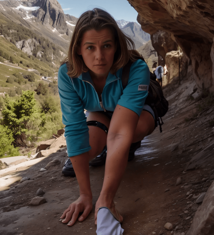
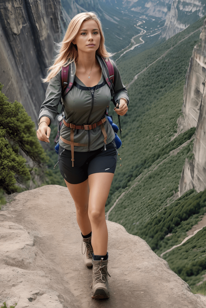
Hiking Trails: New Mexico Hiking

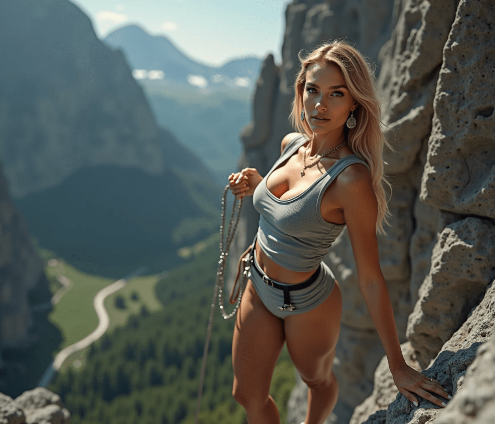
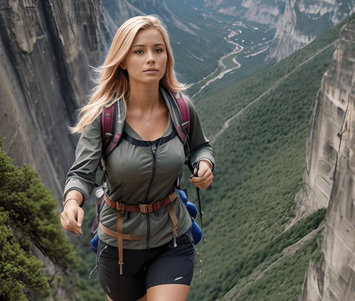
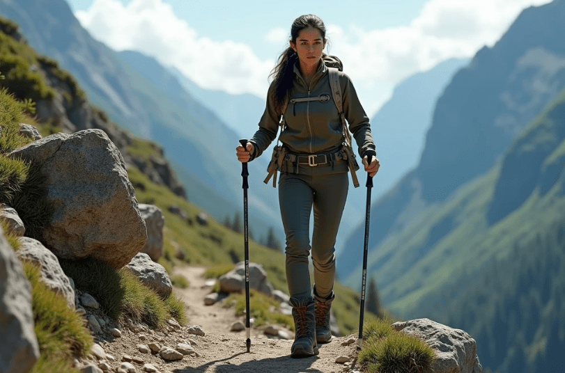
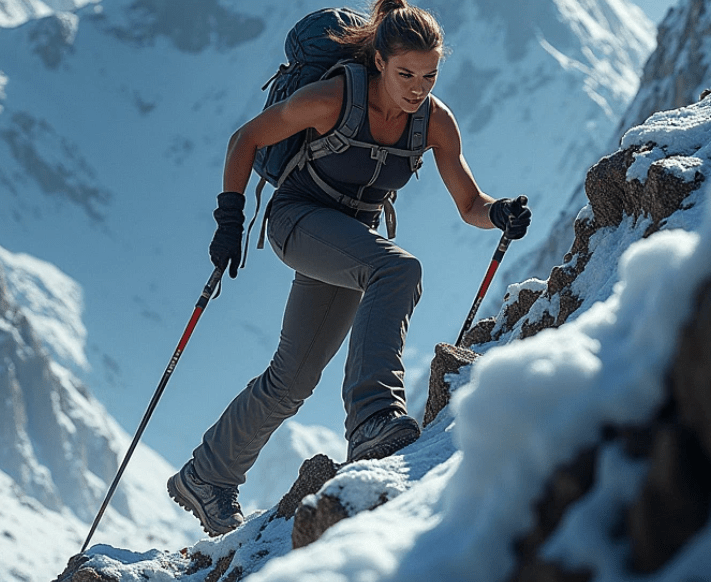
I’ve hiked nearly every ridge, canyon, and desert trail this side of the Rockies—and if there’s one thing I’ve learned while trekking through the Land of Enchantment, it’s this: New Mexico’s beauty will seduce you, but its wilderness can kill you.

I’m not trying to scare you for the thrill of it. I’ve seen it firsthand. Too many casual hikers head out in sneakers, with half a bottle of water, and no idea what they’re stepping into. I’m a survivalist by nature and by choice. I carry a 40-pound pack not because I enjoy the weight, but because I know how fast a bluebird day turns deadly when the wind shifts or a wrong turn leads you off-trail.

If you think hiking in New Mexico is just a walk in the park, think again.


Why New Mexico Is So Dangerous—And So Worth It

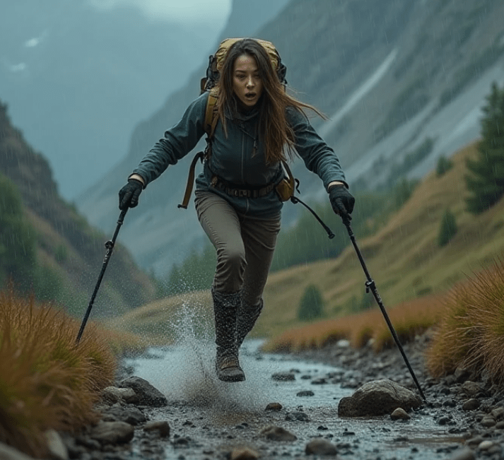
New Mexico’s landscape is like no other. One minute you’re in alpine forests, the next you’re crossing sun-baked badlands. Elevation changes here are no joke, and the weather? It can go from scorching heat to hypothermia-inducing storms within an hour.

People think desert equals dry and boring. Wrong. Desert equals disorientation, dehydration, and death—if you’re not ready. I carry a map, compass, and a GPS. Redundancy saves lives. Don’t rely on your phone alone. Too many have, and they didn’t come back.


Common Dangers Lurking on New Mexico Trails

  • Dehydration: You lose water faster than you think. Bring twice what you believe you’ll need. Then double it again.
  • Altitude Sickness: Even experienced hikers underestimate how quickly the high elevation hits.
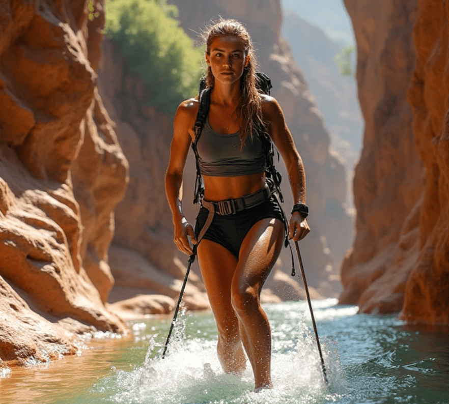
  • Flash Floods: Especially in slot canyons—one storm miles away can send a deadly torrent barreling your way.
  • Wildlife: Bears, mountain lions, rattlesnakes—they’re not looking for you, but they’ll defend their ground if you stumble into their path.
  • Getting Lost: Trails are poorly marked in some regions. A lot of the wilderness here is unforgiving if you lose your way.

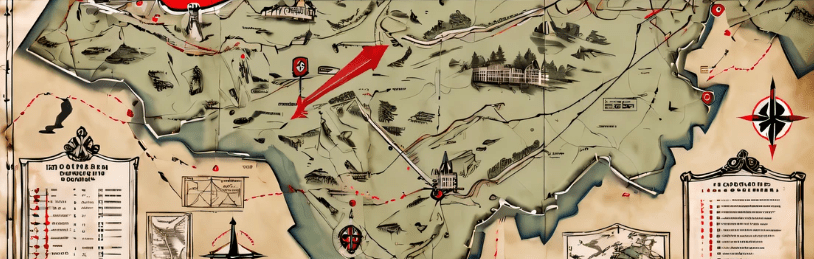
Top 20 Hiking Trails in New Mexico (Ranked by Beauty, Challenge, and Danger)

Here’s my list of the top 20 hiking trails in New Mexico. Some are famous, others are lesser-known gems. All of them demand respect.

1. La Luz Trail (Sandia Mountains)

One of the most iconic—and deceptive. It’s beautiful, yes, but with over 3,000 feet of elevation gain, you better be in shape and prepped for rapidly changing weather.

2. Wheeler Peak Trail (Taos)

New Mexico’s highest peak. Don’t underestimate the effects of altitude. Snow can linger into summer.

3. White Sands Alkali Flat Trail

A surreal experience—but the lack of shade, heat reflection off the gypsum, and a maze-like landscape make this a suntrap for the unprepared.

4. Gila Loop (Gila Wilderness)

This remote area is one of the oldest designated wilderness areas in the U.S. Pristine, isolated, and easy to get lost in.

5. Slot Canyon Trail (Kasha-Katuwe Tent Rocks National Monument)

Stunning geology, but flash floods are no joke. Always check the weather forecast before you go.

6. Emory Pass Vista Trail (Black Range)

Incredible views—and fire-scorched areas that create loose terrain and unpredictable footing.

7. Nambe Lake Trail (Santa Fe National Forest)

A high-altitude alpine lake rewards those who brave the steep incline. Bring layers—it gets cold fast.

8. Travertine Falls Trail (Sandia Foothills)

Short and sweet, but deceptively slippery in rainy months. Watch your footing.

9. Jemez Falls Trail

A scenic trail, great for beginners—but it’s surrounded by rougher terrain if you venture off the path.

10. Bandelier National Monument Trails

Cave dwellings, petroglyphs, and ancient ruins—also steep drop-offs, ladder climbs, and sudden storms.

11. Organ Needle Trail (Organ Mountains)

This is a grinder. Rough, rocky, and vertical. You’ll earn every foot you climb.

12. Pecos Baldy Lake Trail

Gorgeous, wild, and remote. Not many people make it here—and there’s a reason. You need to be fully self-sufficient.

13. Desert Loop Trail (Petroglyph National Monument)

Deceptively easy—but the open terrain and lack of landmarks can mess with your sense of direction.

14. Continental Divide Trail Segment (Various Access Points)

This thru-hike legend cuts through the state. Choose your segment wisely. Water sources are scarce and terrain shifts from alpine to arid in hours.

15. Dripping Springs Natural Area (Las Cruces)

Easy access with historic ruins, but high desert heat can bake the unprepared in minutes.

16. Rio Grande Gorge Rim Trail

The wind here can be fierce, and the cliffs? Sheer drops. One stumble and it’s over.

17. Atalaya Mountain Trail (Santa Fe)

Close to town, popular—but when snow hits, it becomes treacherous. Ice spikes recommended in colder months.

18. Boca Negra Canyon

Known for its petroglyphs and family-friendliness. Still, the rocky paths can be ankle-breakers.

19. Chicoma Mountain Trail

Remote and underappreciated. That also means fewer people to help if things go south.

20. Blue Lake via Valle Vidal

A spiritual and ecological gem—permits required. Remote, sacred, and wild.


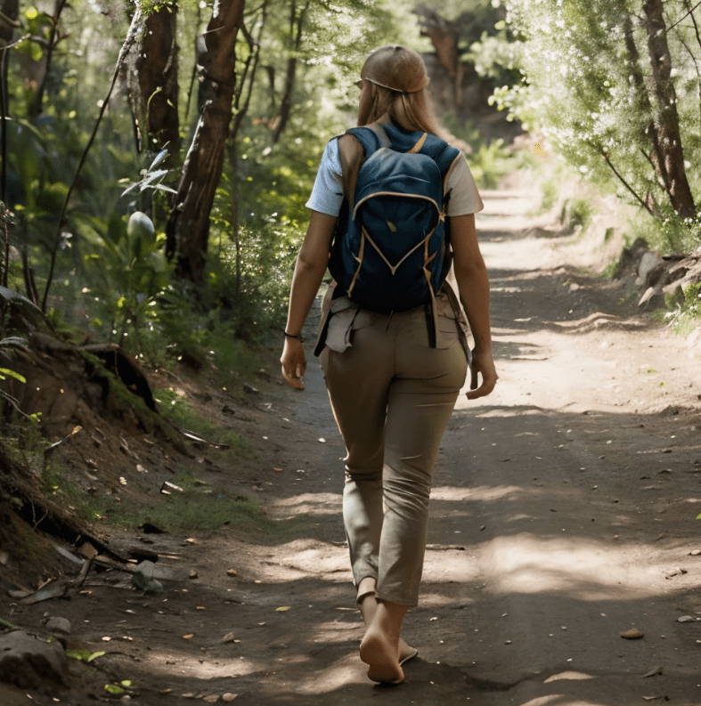
How to Hike Like Your Life Depends on It (Because It Does)

  1. Water is Life. Carry a gallon minimum. Filter or purify from wild sources.
  2. Navigation is Survival. Map. Compass. GPS. Backup batteries. Know how to use them.
  3. Dress for the Elements. Layers. Rain gear. Insulation. New Mexico’s weather turns fast.
  4. Tell Someone. Always let someone know your trail and expected return time.
  5. First Aid. Know how to handle sprains, bites, dehydration, and exposure.
  6. Fire and Shelter. Even on day hikes—carry a way to start a fire and an emergency bivy or tarp.

The Bottom Line

New Mexico doesn’t coddle you. It challenges you. It tests your preparedness, your mindset, your endurance. And if you don’t take it seriously, it’ll chew you up and leave no trace.

But if you respect it, if you come prepared—there’s no place more rewarding to hike. I’ve crossed deserts under stars, filtered water from alpine streams, and stared into canyons that felt like they stretched into other worlds.

So hike New Mexico. Love it. But fear it just enough to prepare like your life depends on it.

Because out here—it just might.

These Popular Maryland Hiking Trails Are a Beauty, But They’ll Test Your Survival Instincts

These Popular Maryland Hiking Trails Are a Beauty, But They’ll Test Your Survival Instincts

Let’s get one thing clear: Maryland may not have the Rockies or 14,000-foot peaks, but if you think hiking here is just a casual walk in the woods, you’ve got another thing coming. These trails will lull you in with scenic beauty, then hit you with sharp elevation changes, slippery rock scrambles, sudden storms, and thick, disorienting forest. Out here, you don’t just hike—you earn your miles.

Hiking Trails: Maryland Trails

As a survival-minded hiker, I don’t take any trail lightly. Doesn’t matter if it’s a 2-mile loop or a 20-mile ridge run. If you head out unprepared, nature will humble you. That’s not fear-mongering. That’s respect.

Now grab your pack, lace up your boots tight, and check your gear twice. Because here are the top 20 hiking trails in Maryland that’ll test your stamina, challenge your skills, and remind you that surviving—and thriving—in the wilderness takes more than just good shoes.


🥾 Top 20 Hiking Trails in Maryland That Test Your Grit

1. Billy Goat Trail (Section A) – Great Falls

Only 1.7 miles? Don’t laugh. This baby’s got Class 3 rock scrambles, steep drops, and enough twisted ankles per year to keep the rangers busy. Hugging the Potomac, it’s scenic—and unforgiving. No dogs. No shortcuts. No kidding.

2. Catoctin National Recreation Trail – Catoctin Mountain

Stretching over 26 miles, this trail isn’t just a hike—it’s a multi-day grind. Expect steep ridgelines, thick brush, and elevation gain that’ll tax even the fittest. Do this one in sections or go full beast mode in a weekend.

3. Weverton Cliffs – South Mountain

Short (1.9 miles), but it climbs hard and fast. Switchbacks test your cardio, and the rock ledge at the top gives you sweeping views—if the wind doesn’t knock your hat off first. Sunrise hikes here? Stunning. Cold. Brutal.

4. Chimney Rock – Catoctin Mountain Park

This 2.2-mile loop climbs steeply through forest to a rocky overlook. It’s a fan favorite because it combines just enough challenge with killer views. Wet days turn rocks into ice rinks, so pack grippy boots.

5. Cunningham Falls Trail – Thurmont

Maryland’s tallest waterfall is the payoff, but you’ll earn it. Whether you take the steeper Cliff Trail or the longer Lower Trail, expect roots, rocks, and tourists who forgot to bring water. Don’t be that person.

6. Sugarloaf Mountain – Dickerson

This 5-mile circuit offers 1,200 feet of gain and all kinds of terrain—scrambles, switchbacks, and exposed overlooks. Great training for bigger mountains. Watch your step on the summit trails—loose gravel makes the descent tricky.

7. Patapsco Valley State Park – Ellicott City

Don’t let the family picnics fool you—this park hides a web of rugged trails with creek crossings, steep hills, and offshoots that’ll get you lost if you don’t stay sharp. Perfect place to practice map-and-compass skills.

8. Carderock – Potomac River

Not just a hike—this is a legit bouldering and rock climbing area. The Billy Goat extension trail here runs right beside the water and offers knife-edge ledges, slick mossy rocks, and unpredictable terrain.

9. Rock Creek Park – Washington, D.C.

Right next to the city, but deep in the woods. Miles of unpaved trails weave through hills, creeks, and historic ruins. Bring a trail map or you’ll wind up hiking twice as far as you planned.

10. Fort Foote Park – Oxon Hill

What this one lacks in mileage, it makes up for in muddy trails, ravine scrambles, and Civil War history. Easy to underestimate. Don’t—it’s a solid test run for wet-weather gear.

11. Green Ridge State Forest – Flintstone

Now we’re talking remote. Over 50 miles of trails in western Maryland with serious solitude, rattlesnakes, and terrain that swings from hardwood forest to piney ridgelines. No cell signal. No backup. Just you and your skills.

12. Black Hills Regional Park – Boyds

Winding trails around Little Seneca Lake. Wet leaves, hidden roots, and sudden storms can make even the flat sections tricky. Great for endurance and bad-weather drills.

13. Elk Neck State Park – North East

4 miles to the Turkey Point Lighthouse, and it’s a stunner. Coastal cliffs, loose sand, and changing weather mean you’ll need sturdy shoes and situational awareness. Watch for ticks and drink before you’re thirsty.

14. Assateague Island National Seashore – Berlin

The challenge here isn’t elevation—it’s wind, sand, and the blazing sun. Hike the dunes and salt marshes with no cover and maybe a few wild ponies as company. Bring sunscreen, water, and something to keep the bugs off your face.

15. Seneca Creek State Park – Gaithersburg

Well-marked, but don’t let that fool you. This is prime training ground for mud, uneven trail footing, and long-distance stamina. The Lake Shore Trail loop (5.8 miles) offers a solid cardio push.

16. Harpers Ferry Overlook via Maryland Heights

This 4.5-mile climb to the overlook is brutal and beautiful. You’ll gain over 1,500 feet and feel every step—but the view where the Shenandoah meets the Potomac? Worth every bead of sweat.

17. Greenbelt Park – Greenbelt

Just outside the Beltway but quiet enough to hear your thoughts—or the crack of a branch when a deer (or something else) moves through the brush. A good place to test stealth hiking or solo practice runs.

18. Little Bennett Regional Park – Clarksburg

Hilly terrain with narrow paths, unexpected creek crossings, and enough elevation to wear you down if you aren’t conditioned. Most folks don’t bring enough water here. Don’t be them.

19. Piney Run Park – Sykesville

Gentle at first, but the shoreline trails wind, dip, and get overgrown in the summer. A great place to practice route finding and bushwhacking-lite.

20. Torrey C. Brown Trail (Northern Central Rail Trail) – Cockeysville

It’s a flat, packed gravel trail that stretches 20 miles north into Pennsylvania. The challenge here is distance, pacing, and staying sharp despite the “easy” terrain. Perfect for long-haul prep.


🔥 Final Word From a Trail-Tested Prepper

Let’s not kid ourselves. Hiking in Maryland won’t have you hanging off a glacier with an ice axe—but that doesn’t mean it’s soft. Between the heat, humidity, slick rocks, and unexpected elevation, these trails will chew up the cocky and reward the cautious.

So, before you hit any of these trails:

  • Pack more water than you think you need
  • Always carry a first aid kit and multitool
  • Wear layered clothing and waterproof boots
  • Don’t forget your compass and paper map (phones die)
  • Carry high-protein snacks, a flashlight, and extra socks
  • Bear spray? Not here—but tick spray? Essential

In the wild, confidence gets you moving. Preparation keeps you alive.

So get out there. Breathe in that pine-scented air. Let the mud stain your boots and the wind whip across your face from a mountaintop.

Just remember—nature always has the last word. Whether you thrive out there or limp home with blistered pride? That’s entirely up to you.


If you want a custom gear checklist, route advice, or trail prep guide, just say the word. I’ve got your back—until you’re on the trail. Then, it’s all up to you.

Think You’re Ready? These Iowa Hiking Trails Could Be More Than You Bargained For

Think You’re Ready? These Iowa Hiking Trails Could Be More Than You Bargained For

Let me tell you something right now: Iowa may not be the first place that comes to mind when folks talk about rugged landscapes and survival-ready terrain—but that’s exactly why you should pay attention. The Hawkeye State hides its challenges behind fields of corn and easygoing hospitality, but trust me, out on the trail, Mother Nature doesn’t care how flat it looks from your windshield.

Hiking Trails: Iowa Hiking Trails

I’ve been hiking for over 20 years, and I don’t just carry a water bottle and a granola bar—I carry a pack built for five days off-grid. That’s how I roll. When you’ve been caught in a surprise thunderstorm, had to navigate through dense woodland with no signal, or watched the sun drop fast behind a ridge with six miles left to go, you learn quick: being prepared isn’t optional. It’s survival.

So, if you think you’re ready to lace up those boots and hit Iowa’s trails, I’ve got a list that’ll test your skills, stamina, and how well you packed that first aid kit. These aren’t just “walks in the park”—they’re opportunities to test your mettle. Here are Iowa’s top 20 hiking trails that might be more than you bargained for—especially if you underestimate them.


1. Yellow River State Forest – Paint Creek Trail

This is the real deal. Remote, steep ridges, stream crossings, and primitive campsites. One of the wildest places in Iowa. Bring topo maps and prep for elevation swings.


2. Effigy Mounds National Monument – Fire Point Trail

Historical, yes—but don’t let the ancient burial mounds lull you. The Fire Point Trail gives you elevation, overlooks of the Mississippi, and a heavy sense of the past. Respect it.


3. Ledges State Park – Canyon Road & Lost Lake Trail Loop

Erosion-carved canyons and stone staircases make this more than just a cardio workout. Slippery when wet and blindingly beautiful in the fall. Good ankle support mandatory.


4. Backbone State Park – Backbone Trail Loop

They call it the “Devil’s Backbone” for a reason. Rugged rock outcrops and narrow ridges challenge your balance and resolve. Not a trail to hit in worn-out sneakers.


5. Maquoketa Caves State Park – Natural Trail System

Dark, damp, and full of surprises. Bring a headlamp, extra batteries, and watch your step. You’ll crawl, climb, and possibly get a little claustrophobic.


6. Wildcat Den State Park – Wildcat Den Trail

Twisting, tight paths through wind-carved sandstone formations. It’s easy to lose your sense of direction here if you’re not paying attention. Stay sharp.


7. Pikes Peak State Park – Bridal Veil Falls Trail

Short? Sure. Easy? Hardly. One misstep near the cliffs and you’re in trouble. This one’s about attention to detail—bring trekking poles if it’s been raining.


8. Waubonsie State Park – Sunset Ridge Trail

Loess Hills terrain, wind exposure, and drastic drop-offs make this a test of stamina and pacing. Great training for backcountry scenarios.


9. Lake Macbride State Park – Lake Macbride Trail

Don’t get too comfortable. Long distance, exposed sections, and minimal emergency access mean a turned ankle or heat stroke can become a real problem fast.


10. Stone State Park – Dakota Point Trail

Views for miles and steep climbs mean this isn’t your average Sunday stroll. Good for building trail conditioning and dealing with unpredictable footing.


11. Neal Smith National Wildlife Refuge – Tallgrass Trail

The tall prairie grass will mess with your navigation. Sun exposure is brutal, and the terrain is deceptively uneven. A compass and wide-brim hat are essential.


12. Hitchcock Nature Center – Badger Ridge Trail

Up in the Loess Hills again—an endurance test with switchbacks and exposure. Take plenty of water, and maybe leave a trail marker if you’re solo.


13. Preparation Canyon State Park – Main Loop Trail

How fitting is that name? Off-grid vibes and minimal signage mean your route-finding better be on point. Great for stealth camping practice.


14. Brushy Creek State Recreation Area – Lake Trail

Nearly 13 miles around the lake, with variable elevation and mud-prone sections. This one tests your physical stamina and gear loadout.


15. Brown’s Woods – Main Trail Loop

Urban-adjacent, but don’t let that fool you. Dense woods, wildlife sightings, and trail washouts make this a sneaky challenge. Go light, but smart.


16. Volga River State Recreation Area – Ridge Trail Loop

An underdog trail with real grit. River crossings, tight valleys, and shifting weather patterns make this a great training ground for wet-weather hiking.


17. Clinton County’s Eden Valley – Bluff Trail

Boardwalks, bridges, and bluff views hide real risks—slippery conditions, uneven terrain, and wildlife encounters. Ticks love it here. Permethrin-treated clothes recommended.


18. Union Grove State Park – Lake Loop Trail

Short but packed with elevation gain and technical footwork. Great for after-work training hikes with a weighted pack.


19. Pilot Knob State Park – Observation Tower Trail

One of Iowa’s highest points. Trail can be icy late into spring, and the tower itself? Not for the faint of heart. Worth the climb for prepping mental endurance.


20. Loess Hills State Forest – Brent’s Trail

This is Iowa’s Appalachian-style challenge. Remote, hilly, and long. 13 miles of nearly untouched terrain. Carry a water filter, layered clothing, and don’t rely on signal.


Final Thoughts from the Trail

Now let’s get something straight: these trails won’t kill you—but your overconfidence might. I’ve seen it happen. Folks hit the trail in flip-flops, no map, and a water bottle the size of a soda can. They think, “It’s just Iowa.” And that’s how you end up cold, lost, or worse.

Every trail listed above has its own flavor of danger—steep elevation, slick rock, heat exposure, deep woods, or poor cell coverage. That’s not something to fear—it’s something to respect.

Whether you’re training for thru-hikes in the Rockies or just trying to get in shape, these Iowa trails are a proving ground. They’ll push your gear, your mind, and your body.

So here’s what I always say before a hike:
Check your boots.
Pack your layers.
Charge your headlamp.
Tell someone your plan.
And never, ever, underestimate the wild—especially the wild close to home.

You ready?

Then get out there. Iowa’s waiting.

Hiking Trails in Ohio: Are You Prepared for What Lies Beyond the Path?

Hiking Trails in Ohio: Are You Prepared for What Lies Beyond the Path?

As a seasoned prepper, I’ve learned the hard way that the wilderness doesn’t wait for anyone. Whether you’re trekking through Ohio’s forests, scaling its ridgelines, or wading along its waterways, there’s more to hiking than just putting one foot in front of the other. Sure, you can admire the scenery and bask in the peaceful moments that come with escaping the chaos of daily life, but if you aren’t prepared, you might not make it back in one piece. As preppers, we understand that the wild can be both unforgiving and beautiful—and that’s why we go prepared.

Ohio is a state filled with lush forests, towering cliffs, meandering rivers, and countless trails that offer both tranquility and danger. From the rugged terrain of the Appalachian foothills to the serene vistas of the state parks, Ohio offers plenty of opportunities to test your survival skills. But no matter how well you think you know the outdoors, you need to prepare for what lies beyond the path.

Let’s get one thing straight: hiking isn’t just about getting to the summit or finding the best photo op. It’s about making sure you can handle whatever nature throws at you. Whether it’s a sudden storm, a twisted ankle, or a sudden need for shelter, you need to be ready. And the best way to do that? Knowing the trails you’re about to step onto, how to navigate them safely, and understanding the terrain you’ll face.

Now, let’s talk about some of the top hiking trails in Ohio. These trails will push you, challenge you, and reward you—but only if you’re prepared.

Hiking Trails: Ohio Hiking Trails

1. Old Man’s Cave Trail (Hocking Hills State Park)

This trail is a must-do for anyone exploring Ohio’s outdoor beauty. As one of the state’s most iconic trails, it’s famous for its towering cliffs, hidden caves, and stunning waterfalls. However, its popularity means it can get crowded, so be prepared for a lot of foot traffic. With its steep inclines, muddy paths, and rocky terrain, this trail demands that you have sturdy boots, a reliable backpack, and sufficient water.

2. Ash Cave Trail (Hocking Hills State Park)

Another gem in Hocking Hills, Ash Cave is a breathtaking sight with a massive recessed cave and waterfall. The trail to the cave is short and relatively easy, but it’s not without its challenges, especially after rain. You’ll want a rain jacket and some anti-slip traction for your boots to make sure you don’t take a tumble.

3. Buckeye Trail (Statewide)

The Buckeye Trail is the backbone of Ohio hiking. Stretching for over 1,400 miles, it loops around the entire state. If you’re a prepper, this is one of the most important trails to know, because it teaches you long-term survival strategies. It crosses all types of terrain, from dense forests to steep ridges, and it’s a great way to test your endurance and preparedness skills.

4. Mohican State Park Trail

Mohican is a true wilderness experience, and the trails here are not for the faint of heart. The Mohican State Park Trail is an extensive network of paths that lead you through thick forest, past rugged cliffs, and along the scenic Clear Fork Gorge. The varying elevation and tricky footing will put your skills to the test.

5. Cuyahoga Valley National Park Trail

One of Ohio’s most treasured national parks, the Cuyahoga Valley offers an array of trails, including the popular Towpath Trail. The terrain ranges from easy to moderately difficult, but you’ll want to keep an eye out for the occasional swampy patch or mudslide. This park is a great place for multi-day hikes if you’re looking to test your stamina and ability to navigate the wilderness for extended periods.

6. Ravenna North and South Trails

This rugged trail system is perfect for those who enjoy a challenge. With rocky outcrops, thick woodlands, and steep ascents, these trails demand your full attention. You’ll need a good pair of hiking boots and a steady pace to ensure you don’t lose your footing. If you’re planning on staying overnight, be sure to have proper shelter and fire-starting equipment.

7. Lake Metroparks Greenway Corridor

Located in Lake County, this trail stretches for miles and offers an ideal mix of terrain for prepping. The Greenway Corridor takes you through wetlands, forests, and alongside creeks. As with all Ohio trails, you’ll want to bring water, a map, and, most importantly, a solid first aid kit. The longer sections of the trail offer ample opportunity for testing out your long-distance trekking skills.

8. Glen Helen Nature Preserve

This is a perfect spot for a relatively easy day hike or an overnight adventure. The trails here are well-marked and take you through lush forests and past cascading streams. Keep in mind, however, that you’re in a preserve, which means the wildlife could get up close. It’s always good practice to carry some bear spray, especially if you’re hiking in more remote areas.

9. Great Seal State Park

If you’re looking for a hike that challenges your physical and mental endurance, Great Seal State Park is where you need to go. The trails here offer challenging climbs and rugged terrain that will test your fitness and survival skills. Be prepared for steep ascents and plenty of rocks—this is a trail where your prepper skills will shine.

10. Kohler Nature Preserve Trail

A peaceful but slightly more difficult trail, the Kohler Nature Preserve offers a serene environment filled with rich wildlife and dense forest. The trail is relatively short but can become slippery in the rain. Bring along some dry clothes in case things get a little too wet.

11. Zaleski State Forest

The Zaleski State Forest is Ohio’s second-largest state forest, and it offers a mix of easy, moderate, and challenging trails. It’s a great spot for practicing survival tactics, like navigation and foraging. The trails here are sometimes less trafficked, making it a perfect location to practice prepping for more isolated scenarios.

12. Scioto Trail

This 1.6-mile loop near Chillicothe offers some moderate elevation and a beautiful view of the surrounding landscape. It’s an ideal spot for a day hike and is a great place to practice packing light and moving efficiently.

13. Hocking Hills Trail

Much like Old Man’s Cave, the Hocking Hills Trail is one of Ohio’s top spots for both beginner and experienced hikers. The trail winds through various geological features, including sandstone cliffs and lush forests. It’s one of the best places to practice navigating tricky terrain, so make sure you pack a reliable compass.

14. Tuscawaras River Trail

Winding along the Tuscawaras River, this trail is perfect for a peaceful, low-stress hike. It’s a great place to get some practice in navigating wetland and riverbank terrain, and it’s ideal for a day trip. Don’t forget a waterproof bag for your gear!

15. Mill Creek Park Trails

This urban park in Youngstown offers a series of scenic, well-maintained trails that lead you through wooded areas and beside peaceful lakes. While the park is close to town, you can still experience real wilderness. It’s a great place to practice prepping for a hike in more populated areas, where quick exits may be necessary.

16. Wayne National Forest

Spanning 240,000 acres, Wayne National Forest offers over 300 miles of trails. These are long-distance hiking trails perfect for prepping. They’ll help you work on your endurance and develop your skills in long-term, self-sufficient hiking.

17. Salt Fork State Park

Ohio’s largest state park, Salt Fork offers hiking trails for all skill levels. The trails wind through thick forests and along the shores of Salt Fork Lake. If you’re planning a multi-day hike here, you’ll have plenty of opportunities to test your shelter-building and fire-starting skills.

18. Clifty Wilderness Trail

This trail is perfect for those looking to push their limits. It’s known for its rugged terrain and difficult access points. Be prepared for steep inclines, sharp rocks, and mud. Make sure you’ve packed your survival gear, especially in case of a longer-than-expected trip.

19. Blue Rock State Park Trails

The trails at Blue Rock State Park are perfect for those who are looking for a bit of solitude. This park offers a variety of trails that are less crowded but still pack a punch. With its steep inclines and dense woods, this park offers a great opportunity to practice navigating less-populated trails.

20. Vesuvius Wilderness Area

A remote and rugged trail located in the Appalachian foothills, the Vesuvius Wilderness Area offers incredible views and difficult terrain. This area is perfect for testing out your preparedness for extended wilderness stays. The trail system is challenging, with rugged hills and dense forest that require good navigation skills.


No matter which trail you choose in Ohio, you need to be prepared for everything the wilderness can throw your way. From sudden weather changes to potentially dangerous wildlife, the outdoors are unpredictable. Bring a solid emergency kit, a map, a first-aid kit, enough food and water, and always be prepared to improvise. These trails are there to challenge you, but with the right mindset and prepper mentality, you’ll come out stronger and more knowledgeable.

So, are you ready to step off the beaten path and test your survival skills on Ohio’s most challenging trails?

Kansas Hiking Trails: Popular Routes That Could Lead You to Disaster

Hiking Kansas’ Hiking Trails: Popular Routes That Could Lead You to Disaster

If you’re the type of person who gets a thrill from navigating the wild backcountry, you’ve probably heard of Kansas—an often overlooked state in the realm of hiking and outdoor exploration. Known for its sweeping plains and gentle hills, Kansas may not immediately seem like a hiking hotspot. But as any seasoned survival prepper knows, the most dangerous scenarios often arise when you least expect them. And while Kansas’ trails might seem harmless, they can pose serious risks if you’re not prepared.

Hiking in Kansas can lead you to some beautiful vistas, serene forests, and tranquil lakes. But, as with any adventure in the wild, you must always remain vigilant and prepared for the unexpected. In this article, we’ll explore the top 20 hiking trails in Kansas, along with the potential disasters that could arise if you’re not fully prepared. From unpredictable weather to wildlife encounters, you need to know what you’re getting yourself into before hitting the trails. Kansas Hiking Trails: Kansas Trails Council

1. Flint Hills Trail State Park

The Flint Hills Trail is one of the longest trails in Kansas, stretching over 100 miles. It follows the old railroad tracks and offers some of the most picturesque views of the Flint Hills. But don’t let the gentle slope fool you; a lack of water sources and rapid weather changes can quickly turn a pleasant hike into a life-or-death situation.

Potential disaster: The terrain can be harsh, especially when dealing with sudden thunderstorms. Flash flooding can occur in some of the valleys, and without proper gear, you could find yourself trapped or disoriented. Always check the weather forecast before setting out.

2. Konza Prairie

Located near Manhattan, Konza Prairie offers an easy-to-moderate hike through rolling hills and native grasslands. It’s a beautiful trail, but its beauty can mask the dangers of its isolation. Cell service is spotty at best, and you’ll be far from help if something goes wrong.

Potential disaster: The open prairie is vulnerable to sudden high winds and intense heat during the summer months. Dehydration and heatstroke are common risks for hikers who underestimate the sun. Be sure to carry enough water and know the signs of heat-related illnesses.

3. Tallgrass Prairie National Preserve

The Tallgrass Prairie National Preserve is home to one of the last remaining expanses of tallgrass prairie in the U.S. This park offers several hiking options, ranging from easy to difficult, but all hikers should be cautious. The terrain can get slippery after rain, and rattlesnakes are common in the area.

Potential disaster: Rattlesnakes are a real danger, especially during warmer months. Wearing sturdy boots and keeping a lookout for them is a must. Be aware of your surroundings and always carry a first-aid kit.

4. Perry Lake Trails

Perry Lake offers multiple hiking trails that wind through forests and along the shoreline. The trails are well-maintained, but the combination of water and dense vegetation can make it easy to get lost. Wildlife, such as deer and wild boar, also inhabit the area.

Potential disaster: Getting lost is the biggest concern here. Without a good map or GPS device, you could wander off the trail and end up in a dense thicket with no way to find your way back. Stay oriented by marking landmarks as you go.

5. Clinton Lake Trail

Situated in the heart of the state, Clinton Lake Trail offers both scenic views and technical challenges. The trail meanders through dense forest and hilly terrain, which could be dangerous if you’re not prepared.

Potential disaster: If you’re caught off guard by a sudden rainstorm, the trail can turn muddy and slippery. And if you slip or fall, it could be hard to get help due to the trail’s seclusion. Always pack essential survival tools like a whistle and a small, portable radio.

6. Kaw River State Park Trails

The Kaw River State Park offers a variety of hiking options along the Kansas River. Its combination of wetlands and wooded areas provides an opportunity to encounter local wildlife, including coyotes and wild turkeys.

Potential disaster: River banks can be unpredictable, especially during the spring thaw when water levels rise rapidly. Don’t attempt to cross rivers unless you know the conditions. Strong currents and flash flooding can sweep away an unprepared hiker.

7. El Dorado State Park

This 1,000-acre park is home to multiple hiking trails, including paths that wind along the shores of El Dorado Reservoir. The area is beautiful, but it’s also prone to heatwaves and the occasional severe storm.

Potential disaster: Sudden storms or heat exhaustion are significant threats. It’s easy to underestimate how quickly weather conditions can change, so always check weather reports before venturing out.

8. Cedar Bluff State Park

Cedar Bluff is known for its stunning cliffs and canyon views. The park offers several scenic trails, but it also has dangerous, rocky areas where you can easily slip and fall.

Potential disaster: A fall from the cliffs or rocks can lead to serious injury. Always stay alert and don’t push yourself beyond your limits, especially near drop-offs.

9. Sand Hills State Park

The sandy hills of this park offer unique terrain for a challenge. While it might look like a peaceful oasis, the lack of trees and shelter means you’re exposed to the elements for long stretches of the trail.

Potential disaster: Heatstroke and dehydration are top concerns here. The lack of shade and limited water sources mean you’ll need to plan your hydration carefully. Make sure you carry enough water and plan your hike for early morning or late afternoon when temperatures are cooler.

10. Wilson State Park

Wilson State Park offers both rugged and easy trails, making it a favorite for locals. The trails weave through woodlands and alongside the lake, but it’s important to watch for wildlife, especially during dawn and dusk.

Potential disaster: While the wildlife is mostly harmless, aggressive animals can become a problem if you surprise them. Bring bear spray or pepper spray for protection, and never approach wild animals.

11. Lake Scott State Park

Lake Scott’s scenic trails offer diverse landscapes, from forested hills to rocky outcroppings. However, the region’s occasional flash floods and unpredictable wildlife should not be underestimated.

Potential disaster: Sudden flash floods and slippery terrain make this trail dangerous if you’re not paying attention to weather conditions. Know the signs of flash flooding and avoid low-lying areas during heavy rains.

12. Chase County State Fishing Lake

This quiet, peaceful trail is a great escape from the hustle and bustle of city life. However, the dense vegetation and isolated nature of the area can make it easy to become disoriented.

Potential disaster: Getting lost in dense woods is a real concern here. Carry a compass or GPS device, and make sure you have a reliable map before you start.

13. Kanopolis State Park

Kanopolis State Park offers a variety of hiking trails, including routes that take you through the rolling hills and wooded terrain. The park is home to various wildlife, including bison, and presents plenty of potential hazards.

Potential disaster: The risk of encountering large wildlife like bison or even mountain lions makes this trail particularly risky. Keep your distance from any wildlife you encounter, and always be alert for sudden movements in the underbrush.

14. Big Basin Prairie Preserve

The Big Basin Prairie Preserve offers a glimpse into Kansas’ original prairie ecosystems. Though it’s peaceful, the lack of cell service and high winds can make it a difficult place to navigate.

Potential disaster: The wind can be relentless here, which increases the likelihood of getting lost. Never venture out without a good map and compass, and plan for emergency exits if things go sideways.

15. Prairie Spirit Trail

This long, straight trail stretches across the central part of Kansas and offers a good balance of flat terrain and shaded areas. However, it’s often isolated, and the weather can change rapidly.

Potential disaster: Being stranded in isolated sections of the trail is a concern. Always carry a satellite phone or other means of communication in case you get into trouble.

16. Smoky Hill Scenic Byway

While technically more of a scenic byway than a traditional trail, the Smoky Hill Scenic Byway offers the opportunity for a hike through diverse landscapes. The difficulty comes in navigating between the various regions.

Potential disaster: The potential for dehydration and overheating during the summer months is high. Make sure you’re prepared with plenty of water and some form of shade.

17. Cross Timbers State Park

This park offers trails that pass through oak-hickory forests and glades. While the terrain is beautiful, it’s also steep and challenging.

Potential disaster: The steep inclines increase the risk of falls and sprains. Stay safe by moving at a steady pace and never hiking alone.

18. Wabaunsee County Trails

The Wabaunsee County trails are less known but incredibly scenic, offering various routes along the Kaw River and into the hills.

Potential disaster: Isolated areas with limited access make this trail dangerous in emergencies. Bring a partner and have a clear exit plan.

19. Shawnee Mission Park Trails

While it’s located near Kansas City, Shawnee Mission Park has a network of trails that vary in difficulty. The proximity to urban areas can be deceiving, as wild animals can sometimes wander into the park.

Potential disaster: Unexpected wildlife encounters and sudden changes in trail conditions are risks to consider. Always hike with caution and stay aware of your surroundings.

20. Greenwood County State Lake

This lake offers a peaceful hiking experience, but it’s remote and lacks cell service. A wrong step could result in a twisted ankle or worse.

Potential disaster: If injured, help may not be easily accessible. Always carry a first-aid kit and inform someone of your hiking route before venturing out.


Conclusion: Kansas may not be the first state that comes to mind when you think of hiking, but its trails can offer some serious challenges to the unprepared. From unpredictable weather patterns to encounters with wildlife, the danger is real. Always ensure you’re equipped with the right gear, emergency tools, and a solid understanding of the terrain you’re about to conquer. When hiking in Kansas, your survival depends on your preparation. Stay safe out there, and don’t underestimate the wild beauty of this often forgotten landscape.

Only the Strong Survive: Illinois’ Most Treacherous Hiking Trails

Only the Strong Survive: Illinois’ Most Treacherous Hiking Trails
By a Survivalist Who Sleeps Under Stars and Wakes With the Coyotes


You want the truth about hiking in Illinois? Strap on your boots, tighten your pack, and let’s get something straight: the flat stereotype is for the uninitiated. Illinois has teeth. And if you’re not ready to face the wild with calloused hands and an iron will, then you best stick to your city parks and paved trails.

Illinois Hiking Trails: Illinois Hiking Trails

I’ve hiked every trail that dares call itself rugged in this state. From the wind-swept cliffs of southern Illinois to the dense, mosquito-thick woods up north, I’ve battled ticks, trudged through sudden downpours, and slept in my tarp tent with nothing but a fire and a knife. You learn real quick out here—Mother Nature doesn’t care about your expensive gear or Instagram hashtags. Out here, only the strong survive.

So if you’re ready to challenge yourself—if you hear the forest call your name in the howl of the wind—read on. I’m giving you the 20 most treacherous, soul-testing hiking trails in the Land of Lincoln. These are for those who eat freeze-dried beef stew and call it gourmet, who know how to make fire without matches, and who never hike without a compass and grit in their gut.

Let’s dive in.


1. River to River Trail (Shawnee National Forest)

Length: ~160 miles
This beast stretches across southern Illinois and demands everything you’ve got. It’s a true thru-hiker’s trial with switchbacks, stream crossings, and isolation that humbles even seasoned backpackers. You’ll cross bluffs, forests, and remote ridges. Water can be scarce—filter often and plan smart.


2. Jackson Falls Trail (Shawnee National Forest)

Length: 4.5 miles
Don’t let the short distance fool you. The rock formations here attract climbers for a reason—sheer drops, slick surfaces, and a trail that disappears if you’re not watching. Always check weather; rain turns this area into a natural Slip ’N Slide with deadly edges.


3. Garden of the Gods Observation Trail (Shawnee National Forest)

Length: 1/4 mile (loop)
Sure, this one’s short—but dangerous? You bet. The rock outcroppings are Instagram-famous, but one wrong step and you’re 100 feet down on unforgiving stone. Seen too many overconfident hikers fall prey to these deceptively pretty ledges.


4. Panther Den Wilderness Trail

Length: 3 miles (loop)
Narrow, winding, and surrounded by sandstone mazes. You’ll need navigation skills here, as the trail often vanishes. No cell service, and wildlife is active. Once saw a bobcat less than 20 yards out—beautiful, but a clear message to stay alert.


5. Little Grand Canyon Trail

Length: 3.6 miles (loop)
Slick stone stairways, moss-covered paths, and one of the few places in Illinois where you’ll descend into a true canyon. After rainfall, expect treacherous footing and water crossings that could knock a grown man sideways.


6. Rocky Bluff Trail (Crab Orchard National Wildlife Refuge)

Length: 2 miles
Remote and often overgrown, this trail offers stunning bluff views and steep descents. Watch for copperheads basking on sunny days—saw one curled under a ledge just last spring.


7. Cedar Lake Trail (Shawnee National Forest)

Length: 7 miles
A remote loop with water crossings, elevation gains, and tight switchbacks. You’ll be out there on your own—no frills, no trail signs, just you and the sounds of the wild. Bring a topo map and know how to use it.


8. Bork Falls Trail

Length: 1 mile (out-and-back)
More a bushwhack than a trail at times. Steep ravines and rapid water levels make this short hike a wet, risky challenge. Great for testing your agility and balance with a pack on.


9. Red Cedar Trail (Giant City State Park)

Length: 12 miles
A backcountry loop with limited foot traffic. You’ll find yourself crossing rocky creeks, negotiating root-laden paths, and wondering if that rustle in the brush was a deer—or something else. Camp overnight if you want to embrace the full trial.


10. Indian Kitchen Trail (Lusk Creek Wilderness)

Length: 4 miles
Unmarked, barely maintained, and remote. GPS signal? Forget it. This is bushcraft territory. Bring your own markers and never travel alone unless you’ve got skills to rival Grizzly Adams.


11. Heron Pond Trail (Cache River State Natural Area)

Length: 1.5 miles
Trekking across ancient cypress swamps with slick boardwalks and murky waters beneath. The danger here is in the subtleties—poisonous snakes, biting insects, and the eerie stillness that gets into your head.


12. Tunnel Hill Trail (Full Route)

Length: 55 miles
While primarily a bike trail, foot travelers tackling the full length deal with long, desolate stretches, broken terrain, and unreliable water sources. Endurance hikers only.


13. Illinois Canyon Trail (Starved Rock State Park)

Length: 1.2 miles
Flash flooding makes this narrow canyon a deadly trap during and after storms. The path is washed out frequently, and the rock faces are slick as glass when wet. Don’t get cocky.


14. Dells Canyon and Bluff Trail (Matthiessen State Park)

Length: 2 miles
Drop into a sandstone gorge, cross streams, and climb vertical roots. The raw natural beauty distracts many hikers from the real danger—loose footing and sudden falls. Best tackled after dry weather.


15. White Pines Forest Trails

Length: Varies
Deep ravines, moss-covered logs, and wooden footbridges straight out of a survivalist’s daydream. You’ll be challenged more by terrain than distance, especially after storms.


16. Sentinel Tree Trail (Trail of Tears State Forest)

Length: 4 miles
Up and down with relentless elevation gain for Illinois. Tree roots snake through the path like tripwires. A great trail to test your pack setup and stamina. Carry water—you’ll sweat it out quick.


17. LaRue Pine Hills Trail

Length: 6 miles
A rugged ridge trail overlooking the Mississippi bottomlands. Expect exposed cliff faces and steep drops. Bring binoculars—you’ll spot eagles, but don’t get distracted. One stumble here and you’re buzzard bait.


18. Shawnee Bluffs Canopy Trail

Length: 8 miles
A newer trail with some exposed climbs and raw, unprotected overlooks. The forest here whispers—it’s ancient. But watch your footing, and respect the heights.


19. Blackjack Oak Trail (Sand Ridge State Forest)

Length: 7.5 miles
Hot, dry, and sandy—this one’s the desert of Illinois. No water, no cover. You better have survival training to handle dehydration and navigation in this pine-oak wilderness.


20. Pine Hills Trail (Shawnee National Forest)

Length: 10 miles
Old-school rugged. Expect everything—downed trees, washed-out paths, snakes, steep ascents. There are no shortcuts here. Just pain, solitude, and the reward of knowing you’ve conquered something real.


Final Words from a Trail-Hardened Prepper

Illinois might not be Yellowstone or the Rockies, but let me tell you something—these trails will test you. Out here, every blister teaches a lesson. Every ounce of sweat reminds you why you prep, why you hike, why you seek solitude in the struggle. Hiking these treacherous paths isn’t about ticking boxes—it’s about surviving, thriving, and becoming something more than you were.

Bring the basics: water, shelter, blade, map, compass, and knowledge. Leave your ego at the trailhead. Respect the land—it was here before you, and it’ll bury you if you’re careless.

Now lace up. There’s ground to cover.

Only the strong survive.

Woodsman Jake, Survivalist, Hiker, and Knower of Trails

These Missouri Hiking Trails Will Test Your Strength—and Your Will to Live

These Missouri Hiking Trails Will Test Your Strength—and Your Will to Live

If you’re reading this, you’re not just a hiker—you’re a survivalist, a trail warrior, a seeker of solitude in the wild. You don’t just walk trails; you conquer them. Missouri, with its rugged Ozark hills, dense forests, and unpredictable weather, offers some of the most challenging and rewarding hikes in the Midwest. These trails aren’t for the faint of heart; they’re for those who thrive on adversity and seek to push their limits.

1. Ozark Trail – Taum Sauk Section

The Ozark Trail is Missouri’s crown jewel, stretching over 350 miles through the heart of the Ozarks. The Taum Sauk section, in particular, is notorious for its rugged terrain, steep ascents, and breathtaking vistas. It’s not just a hike; it’s a test of endurance and mental fortitude. The trail traverses dense forests, crosses babbling streams, and offers panoramic views that make every grueling step worth it.

2. Mina Sauk Falls Trail – Taum Sauk Mountain State Park

At 1,772 feet, Taum Sauk Mountain is the highest point in Missouri, and the Mina Sauk Falls Trail is its crown jewel. This 3-mile loop takes you to the state’s tallest waterfall, a 132-foot cascade that plunges over three ledges. The trail is steep and rocky, requiring careful navigation, but the reward is a stunning natural spectacle.

3. Whispering Pines Trail – Hawn State Park

This 10-mile loop is a favorite among backpackers seeking solitude. The trail winds through a mix of shortleaf pine and hardwood forests, following the meandering Pickle Creek and the River Aux Vases. The terrain is varied, with sandstone bluffs and seasonal waterfalls, offering a challenging yet serene hiking experience.

4. Mudlick Trail – Sam A. Baker State Park

For those seeking a true wilderness experience, the Mudlick Trail offers an 11-mile journey through one of Missouri’s most undisturbed natural landscapes. The trail begins in Big Creek Valley and climbs to the top of Mudlick Mountain, traversing rugged terrain and offering sweeping views of the surrounding hills.

5. Bell Mountain Wilderness Trail – Mark Twain National Forest

This 12-mile trail in the Mark Twain National Forest is not for the faint of heart. It climbs to the 1,702-foot-high peak of Bell Mountain, offering breathtaking views of the St. Francois mountain system. The trail features rocky outcroppings and shut-ins, providing a challenging yet rewarding hike for experienced adventurers.

6. Devil’s Icebox Trail – Rock Bridge Memorial State Park

This 2.2-mile loop is a geological wonder. The trail leads to the Devil’s Icebox, a natural tunnel 63 feet tall, and the double sinkhole, where a stream runs underground. Hikers can descend into Connor’s Cave, a 150-foot-long cave entered by wading through a shallow stream. The terrain is uneven and requires careful footing, but the unique features make it a must-see. All Outdoors Guide

7. Buford Mountain State Forest Trail – Buford Mountain Conservation Area

Just shy of being the state’s highest natural point, Buford Mountain offers a 10.5-mile trail that ascends to the first summit, then follows a series of saddles, glades, and summits. The highlight is the overlook from Bald Knob, about 3 miles from the trailhead, offering a spectacular view of southeast Missouri’s rugged landscape. St. Louis Magazine

8. Devil’s Backbone Wilderness Area

This 13-mile trail in the Mark Twain National Forest near Ava, Mo., offers a challenging hike through rugged terrain. The trail features steep inclines, dense forests, and offers a true wilderness experience for those seeking solitude and adventure. Kansas City Star

9. Paddy Creek Wilderness Loop

This 17-mile loop in the Mark Twain National Forest near Roby, Mo., is a true test of endurance. The trail brings hikers through thick forests, scenic creeks, and rocky outcroppings, offering a challenging and rewarding hike for experienced adventurers. Kansas City Star

10. Gans Creek Wild Area Trail

Located near Columbia, Mo., this 6.6-mile trail offers a challenging hike through rugged terrain. The trail features steep inclines, dense forests, and offers a true wilderness experience for those seeking solitude and adventure.

11. Roaring River Fire Tower Trail

This 4.4-mile trail features rugged Ozark terrain, dense hardwood forests, and open dolomite glades. The views from its wildflower-filled meadows remain pure wilderness, offering a challenging and rewarding hike for experienced adventurers. AllTrails.com

12. Devil’s Kitchen Trail

This 1.5-mile trail offers a beautiful walk along the bluffs above Roaring River. The trail features limestone bluffs, ledges, caves, and springs, providing a variety of flora and fauna native to the area. It’s considered a favorite walk around the park and offers a wide variety of natural features.

13. Elephant Rocks State Park – Braille Trail (continued)

This short, accessible loop allows visitors of all abilities to experience the stunning rock formations up close. The trail is paved and offers a unique opportunity to explore the massive granite boulders that resemble a train of elephants, some over a billion years old. Don’t let the ease fool you—these stones are ancient sentinels of the Earth. While it’s not physically punishing, it challenges your imagination and reminds you of the power of time and tectonics.

14. Ozark Trail – Eleven Point Section

Remote. Wild. Untamed. That’s how I describe the Eleven Point section of the Ozark Trail. Stretching over 44 miles through the Irish Wilderness, it’s one of Missouri’s most isolated hikes. You’ll cross creeks, dodge thorny underbrush, and sleep under canopies where cell signal dares not tread. It’s perfect for multi-day backpacking if you’re packing your bug-out bag and want to test it under real conditions.

15. Clifty Creek Natural Area Trail

This 2.5-mile loop in Gasconade County may seem short, but the terrain is unforgiving, with steep ridges and a creek crossing that often becomes a raging flow after storms. The trail rewards your grit with a natural bridge, 40 feet long and 13 feet high, carved by water and time. You’ll need sturdy boots, trekking poles, and a willingness to get wet and wild.

16. Hughes Mountain Natural Area – Devil’s Honeycomb Trail

The name alone ought to tell you what you’re in for. Just over a mile, this trail takes you to some of the most bizarre geology in the Midwest. The “Devil’s Honeycomb” is a field of hexagonal rhyolite columns, like nature’s own minefield. The rock is slick when wet and juts up like broken teeth—don’t take this hike lightly, especially if it’s rained recently.

17. Taum Sauk to Johnson’s Shut-Ins (Part of the Ozark Trail)

This roughly 12-mile point-to-point section is one of the most punishing stretches of the entire Ozark Trail. You’ll be contending with switchbacks, rocky drops, and relentless elevation changes. Water crossings? Oh, they’re there—and some might sweep your boots right off. The scenery, though? Otherworldly. Waterfalls, shut-ins, igneous bluffs—this stretch feels like nature showing off just to see if you’ll stick around.

18. Peck Ranch Conservation Area – Elk Restoration Zone Trails

Want to hike where the elk roam? These trails, spread across 23,000 acres, will test your ability to navigate without constant signage. Many parts are unmaintained and primitive, and wildlife encounters (bears, anyone?) aren’t rare. Your compass, GPS, and knowledge of orienteering aren’t optional—they’re essential.

19. Rockpile Mountain Wilderness Trail

This 2-mile out-and-back trail in the Mark Twain National Forest is a bushwhacker’s paradise. No maintained paths here. You follow faint traces through old oak and pine, across boulder-strewn ridgelines, and toward the massive stone mound for which the area is named. It’s believed to be ancient—possibly Native American—but no one really knows. That mystery alone makes the trek worth it.

20. Ha Ha Tonka State Park – Devil’s Kitchen and Colosseum Trails

The name might make you chuckle, but this park means serious business. Between the Devil’s Kitchen cave, sinkholes, spring-fed creeks, and the stone ruins of a 20th-century castle perched above a karst bluff, this is a surreal hike that’s as eerie as it is awe-inspiring. The trails wind up and down steep terrain, and the heat and humidity can suck the will right out of you in summer months.


Final Thoughts from the Trail

If you’re the kind of person who hears “strenuous” and thinks “sign me up,” then Missouri is your proving ground. These trails aren’t just about pretty views (though you’ll get those too); they’re about grit, gear, and guts.

When you hike in Missouri, you’re not just fighting elevation and fatigue—you’re contending with the unpredictability of the wild Midwest. The ticks are relentless, the humidity is brutal, and the weather can flip from serene to savage in minutes. I’ve hiked in storms that made me question my life choices, I’ve run out of water miles from the nearest stream, and I’ve ended days with bloody shins, soaked boots, and a smile that only a trail-worn hiker knows.

So gear up right. Waterproof your map, double-check your first aid kit, and always, always pack more snacks than you think you’ll need. Because when you’re deep in the Ozarks and you still have six miles to go and the sun’s dipping low, it’s not your legs that’ll carry you home—it’s your will to survive.

These trails will break you down, wear you out, and build you back up. And if you’re lucky? They’ll remind you why you fell in love with the trail in the first place.

See you out there, prepper. Stay sharp. Stay strong. And keep walking.

Only the Prepared Survive Mississippi’s Most Popular (and Deadly) Hiking Trails

Only the Prepared Survive: Mississippi’s Most Popular (and Deadly) Hiking Trails

Let me tell you something straight: Mississippi may not be the first place you think of when it comes to hiking adventure—or survival-level terrain—but that’s a mistake that could cost you. This state may not boast towering peaks or desert wastelands, but what it does have are thick, humid forests, swamps that’ll swallow your boots, and trails that’ll chew up the unprepared and spit them back out.

I’m a survivalist. A prepper. Someone who carries a ferro rod like other folks carry chewing gum. I hike to test myself, to stay sharp, and to keep my instincts tuned. And let me tell you, Mississippi offers plenty of opportunities to do exactly that. This list isn’t just about beautiful strolls through nature—this is a warning. A challenge. These trails are the real deal, and if you step onto them with anything less than full preparation, you’re asking for trouble.

So tighten your pack straps, check your compass, and let’s get into the top 20 hiking trails in Mississippi where only the prepared survive.

Hiking Trails: Mississippi Hiking Trails


1. Black Creek TrailDe Soto National Forest

Length: 41 miles
This is Mississippi’s only nationally designated scenic trail, and it’s not for the faint of heart. Between high humidity, venomous snakes, and long remote stretches, this is where your gear gets tested. Don’t forget your water filter and backup fire starter.


2. Tuxachanie TrailDe Soto National Forest

Length: 12 miles
A fan favorite among survivalists. Lots of swamp crossings and foot-sucking mud. Carry insect repellent, wear gaiters, and be ready to bivouac if the weather turns.


3. Clark Creek Natural AreaWoodville

Length: Up to 5 miles
Home to over 50 waterfalls, but also steep elevation changes and slick rocks. Flash floods can come fast—know your exits and keep your topo map handy.


4. Bear Creek Outcropping TrailTishomingo State Park

Length: 3.5 miles
A gorgeous trail with rocky terrain rare in this state. A good place to practice rock scrambling and watch your footing—ankle injuries are common here.


5. Natchez Trace National Scenic TrailMultiple Sections

Length: 60+ miles
Five separate sections parallel the Natchez Trace Parkway. It’s easy to underestimate this one due to proximity to civilization, but prolonged exposure in Mississippi heat is no joke.


6. Laurel Hill Wildlife TrailNatchez

Length: 3 miles
A short trail, but thick brush and limited visibility make it prime snake country. Don’t forget to practice situational awareness—your life might depend on it.


7. Wall Doxey State Park TrailHolly Springs

Length: 2.5 miles
Easy for beginners, but don’t let your guard down. Water crossings can spike after rains, and mosquitoes are relentless. Always hike with layered protection.


8. Clarkco State Park TrailQuitman

Length: 5 miles
Rolling hills and pine forest make this scenic—but it’s also home to unpredictable weather. Hypothermia isn’t just a winter thing in the South. Pack dry gear.


9. Hugh White State Park TrailGrenada

Length: 2.5 miles
Lake views mask the danger of slick terrain and sudden weather shifts. Watch cloud cover and keep your poncho accessible.


10. Bonita Lakes Trail SystemMeridian

Length: 10+ miles
A series of interconnected trails around reservoirs. Nice scenery but easy to get turned around. A GPS is helpful, but don’t rely on tech alone—carry your compass.


11. LeFleur’s Bluff State Park TrailJackson

Length: 2 miles
You’re in the city, but nature here doesn’t care. Wild hogs roam this area, and they won’t wait for a polite introduction. Keep alert and carry a whistle or deterrent.


12. Puskus Lake TrailHolly Springs National Forest

Length: 5 miles
Remote, quiet, and sometimes eerie. This is a great place to test your solo hiking readiness. Bring a backup flashlight and know how to self-rescue.


13. Choctaw Lake TrailTombigbee National Forest

Length: 3.3 miles
Often underestimated because of its length, but you’re deep in the woods here. Cell reception is minimal, and water sources are questionable—boil before you sip.


14. Sam D. Hamilton Noxubee Refuge TrailsStarkville

Length: 12+ miles total
This wetland preserve is full of gators and dense vegetation. Perfect for practicing stealth hiking and wildlife awareness.


15. Tanglefoot TrailNorthern MS (New Albany to Houston)

Length: 43.6 miles
Not technically remote, but long and exposed. This trail is excellent for testing endurance and pacing over days. Don’t forget electrolyte replenishment.


16. Golden Memorial State Park TrailWalnut Grove

Length: 1 mile
Short doesn’t mean safe. This is one of the slickest trails after a rainstorm. Good for wet-weather boot testing and balance training.


17. Red Bluff Trail (Unofficial)Foxworth

Length: ~1 mile
Known as “Mississippi’s Little Grand Canyon,” this trail is unofficial and dangerous. The bluffs are eroding fast, and one wrong step can mean a vertical fall. Only attempt with a buddy and extreme caution.


18. Lake Lincoln TrailWesson

Length: 2.5 miles
Quiet and rarely trafficked—meaning if something happens, you’re on your own. A good trail to practice solo communication protocols.


19. Trace State Park TrailsPontotoc

Length: 8+ miles
Mountain bike trails overlap with hiking here, so stay aware. Also great for map-and-compass training due to a web-like trail system.


20. Roosevelt State Park TrailMorton

Length: 5 miles
Hilly, forested terrain that’s good for prepping bug-out routes. Practice building natural shelters or setting up a stealthy overnight camp.


Final Word from the Trail

If you’ve read this far, you’re probably not a weekend stroller who brings a selfie stick and calls it a day. You’re someone who understands that nature doesn’t care how many followers you have or what brand your hiking boots are. It cares about one thing: Are you prepared?

Mississippi’s trails may not all be deadly by design, but complacency is the most dangerous predator out there. Down here, heat exhaustion can creep up quicker than a cottonmouth. Flash floods don’t knock. And if you get injured three miles deep in the Pine Belt with no cell reception? You’d better have more than granola bars and optimism in that pack.

So whether you’re testing a bug-out bag, practicing land nav, or just looking to toughen up your mental game—these trails are your proving ground.

Load up, get your topo maps, tell someone your plan, and hike smart.
Because out here, only the prepared survive.

Surviving Vermont’s Hiking Trails: Popular Routes That Will Test Your Limits

Let me get something straight right out of the gate: hiking in Vermont is not just some casual stroll through pretty woods while sipping a matcha latte. This isn’t an Instagrammable walk in the park. This is rugged, wild, unpredictable terrain. And if you think you’re just going to lace up a pair of brand-new boots and “find yourself” in the Green Mountains without bleeding, sweating, or seriously questioning your life choices—then you’re the one who needs to be found.

Now don’t get me wrong—I love Vermont. I live for these trails. But I also believe in preparation, awareness, and respect for nature. That’s why I don’t go anywhere without a basic survival kit (knife, water filter, firestarter, trauma kit), and neither should you. Because the truth is, Vermont’s wilderness doesn’t care about your GPS signal. It doesn’t care about your ultralight pack. Out here, the only thing that matters is whether you can handle what the trail throws at you.

So, if you’re ready to push yourself, test your limits, and maybe even earn some blisters that you’ll brag about later, then buckle up. Here are the Top 20 Hiking Trails in Vermont that will challenge your grit, build your resilience, and if you’re not careful—leave you eating granola with a raccoon for company.


1. The Long Trail (Full Route)

Difficulty: Expert
Length: 272 miles
The backbone of Vermont hiking. Oldest long-distance trail in the U.S., and it hurts. If you want to know what it feels like to conquer mountains, sleep with wet socks, and learn the true meaning of solitude, this is it.

2. Camel’s Hump via Monroe Trail

Difficulty: Moderate to Hard
Length: 6.8 miles round trip
My personal favorite summit in the state. Exposed alpine ridges, steep inclines, and jaw-dropping views. Bring layers and watch for sudden weather changes—it can turn fast.

3. Mount Mansfield via Sunset Ridge Trail

Difficulty: Hard
Length: 6.6 miles round trip
The tallest mountain in Vermont and one of the most varied trails. Don’t underestimate this one—it gets technical near the top. If it’s wet, the rocks become death traps.

4. Jay Peak via Long Trail South

Difficulty: Hard
Length: 3.6 miles round trip
Steep, rocky, and brutally beautiful. Jay Peak’s summit gives a 360-degree view that’ll make you feel small in the best way. Go light but go prepared.

5. Sterling Pond Trail

Difficulty: Moderate
Length: 2.6 miles round trip
Short but don’t be fooled—it’s a rocky climb that’ll wake your legs up. The pond is a peaceful payoff, but you’ll earn it.

6. Mount Abraham via Battell Trail

Difficulty: Moderate
Length: 5.4 miles round trip
One of Vermont’s iconic 4,000-footers. The summit offers alpine tundra (yes, real tundra in Vermont!)—a rare biome you should respect. Stay on trail.

7. Burrows Trail to Camel’s Hump

Difficulty: Hard
Length: 4.8 miles round trip
Steep climb to the same summit, but faster. More exposed and direct. Great if you’re short on time but not on stamina.

8. Stowe Pinnacle Trail

Difficulty: Moderate
Length: 3.7 miles round trip
Crowded in summer, but a good test of speed and endurance if you hit it at dawn. The wind at the top is no joke—secure your gear.

9. Mount Hunger via Waterbury Trail

Difficulty: Hard
Length: 4 miles round trip
Don’t let the name fool you—you’ll burn more calories than you can carry. Views of the Worcester Range are killer. So are the final scrambles.

10. Hellbrook Trail to Mount Mansfield

Difficulty: Expert
Length: 4.4 miles round trip
This one is not for the faint of heart. Almost vertical in places, wet, slick, and dangerous. My kind of fun. If you take this route, bring grippy footwear and nerves of steel.

11. Mount Pisgah North Trail

Difficulty: Moderate
Length: 4.1 miles round trip
Lake Willoughby far below, cliffs beside you, and falcons above. Beautiful and haunting. Watch your footing near the overlook—it’s a long way down.

12. Lye Brook Falls Trail

Difficulty: Moderate
Length: 4.6 miles round trip
Good training hike. Waterfall reward at the end is cold and strong. Not technical, but muddy and root-covered. Good for pack weight testing.

13. Mount Ascutney via Weathersfield Trail

Difficulty: Moderate to Hard
Length: 5.7 miles round trip
Steady climb with old growth forest and a fire tower at the top. Great to simulate longer-distance climbs with a reward. Bugs here are ruthless—bring spray.

14. Killington Peak via Bucklin Trail

Difficulty: Hard
Length: 7.2 miles round trip
A beast in winter, still tough in summer. The final stretch is steep and brutal. Summit often clouded, but when it clears—unreal.

15. Bald Mountain Trail (Westmore)

Difficulty: Moderate
Length: 4 miles round trip
Fire tower at the top gives panoramic views. Excellent spot to test compass skills and trail navigation. Not very crowded, and that’s how I like it.

16. Haystack Mountain Trail

Difficulty: Easy to Moderate
Length: 5 miles round trip
Don’t underestimate it. Quiet, steady climb with a killer summit view. Excellent for cold-weather gear testing or kids learning to hike.

17. White Rocks Ice Beds Trail

Difficulty: Moderate
Length: 3.2 miles round trip
Want to see ice in summer? You got it. Cold air funnels out of rock crevices like nature’s AC. Good trail for cooling off and geology nerds.

18. Equinox Preserve Trail System

Difficulty: Variable
Length: Up to 6 miles round trip
Multiple trails that crisscross around Mount Equinox. Choose your pain level. Hidden springs and old stonework make this place a time capsule.

19. Glastenbury Mountain via Long Trail

Difficulty: Hard
Length: 22.4 miles out and back
Remote and a little eerie. Famous for being part of the “Bennington Triangle.” Great for multi-day treks or testing emergency shelter skills. Bring bear bagging gear.

20. Stratton Mountain via Long Trail/Appalachian Trail

Difficulty: Moderate
Length: 7.6 miles round trip
Historic as the birthplace of both the Long Trail and Appalachian Trail. The fire tower here is worth the climb. Good test hike with significant historical weight.


Final Thoughts From a Trail-Hardened Survivalist

Vermont isn’t Alaska, but don’t let that fool you into underestimating it. Between the dense woods, fast-changing weather, and deceptive elevation gains, you can find yourself in trouble quick if you’re not squared away. Here’s what I always pack, no matter the trail length:

  • Water filter (Sawyer Squeeze or similar)
  • Knife or multitool
  • Headlamp (yes, even on day hikes)
  • Compass and trail map
  • Layered clothing, wool socks
  • High-protein snacks
  • Duct tape (saves lives, literally)
  • Basic first aid
  • Bear spray (northern Vermont’s got traffic)

Bottom line: respect the trail and it will teach you things no classroom ever could. Get out there, push yourself, bleed a little, get rained on, curse the incline—and then feel that fire in your chest when you make it to the summit. You’re not just hiking; you’re becoming someone the wilderness doesn’t scare.

See you out there.

Virginia’s Deadliest Hiking Trails: Popular Paths You Shouldn’t Underestimate

As a seasoned prepper who’s spent countless hours navigating the rugged backcountry of Virginia, I can tell you that there’s no such thing as a “safe” trail when it comes to hiking. The wilderness is an unforgiving place, and while hiking might be one of the most exhilarating ways to connect with nature, it’s also a humbling reminder of the elements’ raw power. Virginia, with its lush forests, dramatic mountains, and winding rivers, offers some of the most picturesque hiking routes in the country. But don’t be fooled by the beauty – these trails can be dangerous if you’re unprepared.

Whether you’re a weekend warrior, an experienced hiker, or a full-blown survivalist, you must respect these trails. It’s crucial to understand that even the most popular paths can lead to perilous situations if you’re not properly prepared. So, let’s dive into the top 20 hiking trails in Virginia that you should approach with caution – trails that can easily take you by surprise if you’re not vigilant. And remember, the difference between a successful hike and a disaster often boils down to preparation, knowledge, and awareness.

1. Old Rag Mountain (Shenandoah National Park)

This is perhaps the most iconic trail in Virginia, and also one of the most dangerous. The ascent to Old Rag is a challenging rock scramble, and one wrong move can send you tumbling hundreds of feet down the mountainside. The trail is extremely steep, with narrow ridgelines and exposed rock faces. Weather conditions can change rapidly, making the trail slippery and treacherous. Don’t let the popularity of this trail lull you into a false sense of security.

2. McAfee Knob (Appalachian Trail)

Known for its jaw-dropping panoramic views, McAfee Knob draws hikers from all over. However, the exposure on the summit is not for the faint of heart. High winds and unstable footing on the rocky outcrop have led to numerous accidents. It’s important to stay focused and avoid the temptation to take risky selfies near the edge. The descent is steep and can be just as dangerous, particularly when the trail is wet.

3. The Devil’s Marbleyard (Jefferson National Forest)

The Devil’s Marbleyard offers an exciting rock-hopping adventure, but it’s not one to underestimate. The trail leads you across a massive boulder field, which is exhilarating but extremely hazardous. It’s easy to twist an ankle, lose your footing, or get stuck between rocks. This trail requires agility and caution – it’s a thrill, but a dangerous one if you’re not paying attention.

4. The Three Ridges Trail (George Washington National Forest)

The Three Ridges Trail is a demanding hike that rewards you with incredible views, but it’s also notorious for its challenging terrain. It climbs rapidly, and the summit can be treacherous, especially in wet conditions. With loose rocks, steep drop-offs, and tricky navigation, it’s easy to get lost or injured. This is not a beginner’s trail, and it should be approached with experience and the right gear.

5. Buzzard Rock Trail (George Washington National Forest)

While this trail offers some of the best views of the Shenandoah Valley, it can be a risky one to navigate. The route is rocky and steep, and the climb can be physically taxing, especially for those not accustomed to long, intense hikes. There’s also a significant exposure near the top, and falling rocks are common on windy days. Be cautious of sudden weather changes and the potential for icy conditions during the colder months.

6. Linville Gorge Trail (George Washington National Forest)

This trail leads hikers into one of Virginia’s most rugged and remote wilderness areas, and it doesn’t hold back when it comes to difficulty. The Linville Gorge Trail is steep, with unstable footing and uneven surfaces that can make it treacherous, especially when descending. The dense forest can disorient you, and the remoteness means you’re far from help if something goes wrong.

7. The Mount Rogers Trail (Mount Rogers National Recreation Area)

This trail is the highest point in Virginia, and its ascent is no small feat. The terrain is harsh, with dense forests, rocky slopes, and unpredictable weather. Hikers often underestimate the strenuous nature of the climb, which can lead to exhaustion and altitude sickness. The weather at higher elevations can change without warning, so always be prepared for rapid temperature drops and storms.

8. The Appalachian Trail (Southern Section)

While the Appalachian Trail itself isn’t inherently deadly, certain sections, particularly in the southern part of Virginia, are prone to flash floods, tricky rock scrambles, and steep inclines. The terrain varies widely, from soft, muddy patches to slippery rock outcroppings. Hikers should take note of weather patterns, as heavy rains can make certain portions of the trail impassable.

9. The Timber Hollow Trail (Shenandoah National Park)

This relatively short trail is deceptively tough. It is steep, and although it doesn’t have the same notoriety as some other trails in Virginia, the climb is demanding. The terrain can be muddy, and exposure to the sun can lead to overheating, especially in summer months. Overuse has eroded parts of the path, making footing tricky and creating opportunities for slips and falls.

10. The Bearfence Mountain Trail (Shenandoah National Park)

Short but steep, this trail features a rock scramble that requires both strength and stamina. One false step can send you off balance, and the exposed ridge is not for those afraid of heights. This trail can be particularly dangerous in rainy or snowy weather, making it vital to check conditions before heading out.

11. The North Mountain Trail (George Washington National Forest)

The North Mountain Trail offers panoramic views, but it’s a tough, strenuous hike. The trail is steep, and the rocky paths can quickly become slippery in wet weather. The lack of shelter on the trail makes it dangerous if you get stuck during bad weather or at night.

12. The Dark Hollow Falls Trail (Shenandoah National Park)

This trail, although short, is one of the steepest in the park. The trail to the falls can become treacherous, especially after a rainfall. The rocks near the waterfall are often slick, and the descent can quickly turn into a dangerous slide if you’re not careful. Inexperienced hikers should avoid this path when conditions are wet or icy.

13. The Tye River Trail (George Washington National Forest)

The Tye River Trail is less frequently hiked, but its difficulty makes it worthy of attention. The path is rough and overgrown, and it’s easy to lose your way if you’re not following the markers closely. The river crossings can be dangerous, and the steep climbs can exhaust you quickly, leaving you vulnerable.

14. The South Fork Trail (Shenandoah National Park)

This trail leads you along the South Fork of the Shenandoah River and provides stunning views. However, it is also notorious for its muddy, slippery patches and difficult navigation. The trail can be especially hazardous after rain or during the spring thaw. The riverbanks are steep, and getting too close to the water can lead to an accident.

15. The Dragon’s Back Trail (George Washington National Forest)

This trail’s sharp inclines and dramatic ridges are why it has earned its place on this list. The exposed sections can be treacherous in wind or rain, and the narrow ridgelines can leave you feeling vulnerable. If you’re not prepared for the technical sections, this trail can easily lead to missteps or injury.

16. The Stony Man Trail (Shenandoah National Park)

Though it’s a relatively short hike, the Stony Man Trail is steep and rocky, and it can be particularly dangerous during winter. Ice can form quickly, making the rock surfaces extremely slick. The lack of guardrails or handholds on the rocks makes it more hazardous for those who are not steady on their feet.

17. The Laurel Fork Trail (Jefferson National Forest)

Known for its isolation, the Laurel Fork Trail can be a dangerous route to take if you’re not prepared for its remoteness. The path is overgrown in sections, and getting lost is a real risk. Add to that the fact that it’s a strenuous hike, and you’ve got a trail that demands attention and respect.

18. The Big Schloss Trail (George Washington National Forest)

Big Schloss offers fantastic views, but the climb to the summit is tough, and the descent is no easier. The rocky outcrops and high elevation mean that this hike can be challenging in any weather, especially if conditions change unexpectedly. Hiking during off-season months increases the risk of ice and snow on the rocks, making it slippery and hazardous.

19. The Little Devil Stairs Trail (Shenandoah National Park)

This trail’s name should be enough to tell you that it’s not for beginners. The trail is short but steep, and it includes an aggressive descent along an unstable rock-strewn path. The rocky steps and uneven terrain make this a difficult and risky hike, particularly during wet or snowy conditions.

20. The North Fork Mountain Trail (George Washington National Forest)

The North Fork Mountain Trail is known for its cliffside views and challenging terrain. The trail includes steep rock faces and narrow ridgelines that make it incredibly dangerous, especially if you’re unprepared. The exposure to the elements is extreme, and it requires a steady hand to traverse safely.


In conclusion, these trails all have one thing in common: they’re not to be underestimated. Each of them offers a beautiful, albeit dangerous, experience in Virginia’s wild landscapes. Before you head out, make sure you’ve got the right gear, a solid understanding of the trail, and a preparedness mindset. The wilderness doesn’t play favorites, and even experienced hikers can find themselves in a tough spot if they’re not vigilant. Stay safe, respect the trail, and prepare for the unexpected – that’s the key to surviving these deadliest hikes in Virginia.