Surviving Vermont’s Hiking Trails: Popular Routes That Will Test Your Limits

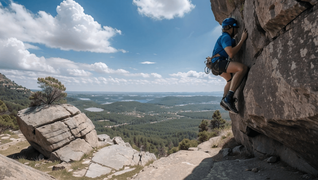
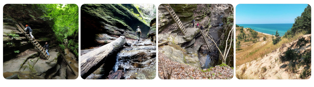
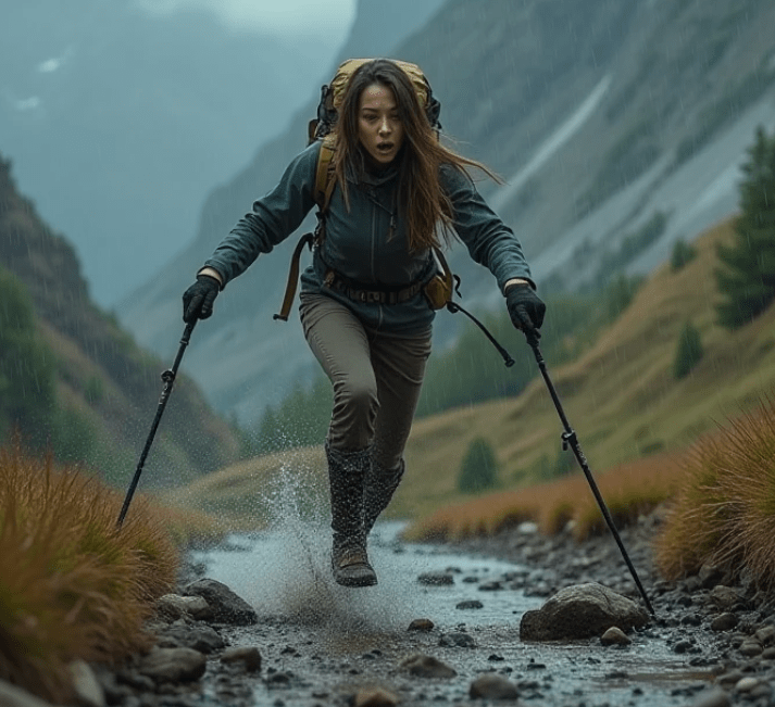
Let me get something straight right out of the gate: hiking in Vermont is not just some casual stroll through pretty woods while sipping a matcha latte. This isn’t an Instagrammable walk in the park. This is rugged, wild, unpredictable terrain. And if you think you’re just going to lace up a pair of brand-new boots and “find yourself” in the Green Mountains without bleeding, sweating, or seriously questioning your life choices—then you’re the one who needs to be found.

Now don’t get me wrong—I love Vermont. I live for these trails. But I also believe in preparation, awareness, and respect for nature. That’s why I don’t go anywhere without a basic survival kit (knife, water filter, firestarter, trauma kit), and neither should you. Because the truth is, Vermont’s wilderness doesn’t care about your GPS signal. It doesn’t care about your ultralight pack. Out here, the only thing that matters is whether you can handle what the trail throws at you.

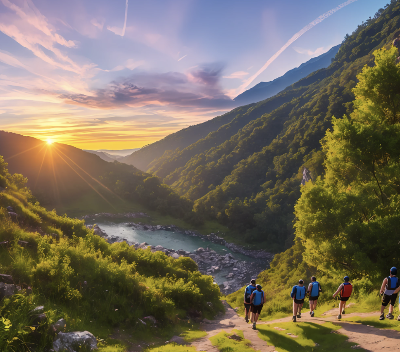
So, if you’re ready to push yourself, test your limits, and maybe even earn some blisters that you’ll brag about later, then buckle up. Here are the Top 20 Hiking Trails in Vermont that will challenge your grit, build your resilience, and if you’re not careful—leave you eating granola with a raccoon for company.


1. The Long Trail (Full Route)

Difficulty: Expert
Length: 272 miles
The backbone of Vermont hiking. Oldest long-distance trail in the U.S., and it hurts. If you want to know what it feels like to conquer mountains, sleep with wet socks, and learn the true meaning of solitude, this is it.

2. Camel’s Hump via Monroe Trail

Difficulty: Moderate to Hard
Length: 6.8 miles round trip
My personal favorite summit in the state. Exposed alpine ridges, steep inclines, and jaw-dropping views. Bring layers and watch for sudden weather changes—it can turn fast.

3. Mount Mansfield via Sunset Ridge Trail

Difficulty: Hard
Length: 6.6 miles round trip
The tallest mountain in Vermont and one of the most varied trails. Don’t underestimate this one—it gets technical near the top. If it’s wet, the rocks become death traps.

4. Jay Peak via Long Trail South

Difficulty: Hard
Length: 3.6 miles round trip
Steep, rocky, and brutally beautiful. Jay Peak’s summit gives a 360-degree view that’ll make you feel small in the best way. Go light but go prepared.

5. Sterling Pond Trail

Difficulty: Moderate
Length: 2.6 miles round trip
Short but don’t be fooled—it’s a rocky climb that’ll wake your legs up. The pond is a peaceful payoff, but you’ll earn it.

6. Mount Abraham via Battell Trail

Difficulty: Moderate
Length: 5.4 miles round trip
One of Vermont’s iconic 4,000-footers. The summit offers alpine tundra (yes, real tundra in Vermont!)—a rare biome you should respect. Stay on trail.

7. Burrows Trail to Camel’s Hump

Difficulty: Hard
Length: 4.8 miles round trip
Steep climb to the same summit, but faster. More exposed and direct. Great if you’re short on time but not on stamina.

8. Stowe Pinnacle Trail

Difficulty: Moderate
Length: 3.7 miles round trip
Crowded in summer, but a good test of speed and endurance if you hit it at dawn. The wind at the top is no joke—secure your gear.

9. Mount Hunger via Waterbury Trail

Difficulty: Hard
Length: 4 miles round trip
Don’t let the name fool you—you’ll burn more calories than you can carry. Views of the Worcester Range are killer. So are the final scrambles.

10. Hellbrook Trail to Mount Mansfield

Difficulty: Expert
Length: 4.4 miles round trip
This one is not for the faint of heart. Almost vertical in places, wet, slick, and dangerous. My kind of fun. If you take this route, bring grippy footwear and nerves of steel.

11. Mount Pisgah North Trail

Difficulty: Moderate
Length: 4.1 miles round trip
Lake Willoughby far below, cliffs beside you, and falcons above. Beautiful and haunting. Watch your footing near the overlook—it’s a long way down.

12. Lye Brook Falls Trail

Difficulty: Moderate
Length: 4.6 miles round trip
Good training hike. Waterfall reward at the end is cold and strong. Not technical, but muddy and root-covered. Good for pack weight testing.

13. Mount Ascutney via Weathersfield Trail

Difficulty: Moderate to Hard
Length: 5.7 miles round trip
Steady climb with old growth forest and a fire tower at the top. Great to simulate longer-distance climbs with a reward. Bugs here are ruthless—bring spray.

14. Killington Peak via Bucklin Trail

Difficulty: Hard
Length: 7.2 miles round trip
A beast in winter, still tough in summer. The final stretch is steep and brutal. Summit often clouded, but when it clears—unreal.

15. Bald Mountain Trail (Westmore)

Difficulty: Moderate
Length: 4 miles round trip
Fire tower at the top gives panoramic views. Excellent spot to test compass skills and trail navigation. Not very crowded, and that’s how I like it.

16. Haystack Mountain Trail

Difficulty: Easy to Moderate
Length: 5 miles round trip
Don’t underestimate it. Quiet, steady climb with a killer summit view. Excellent for cold-weather gear testing or kids learning to hike.

17. White Rocks Ice Beds Trail

Difficulty: Moderate
Length: 3.2 miles round trip
Want to see ice in summer? You got it. Cold air funnels out of rock crevices like nature’s AC. Good trail for cooling off and geology nerds.

18. Equinox Preserve Trail System

Difficulty: Variable
Length: Up to 6 miles round trip
Multiple trails that crisscross around Mount Equinox. Choose your pain level. Hidden springs and old stonework make this place a time capsule.

19. Glastenbury Mountain via Long Trail

Difficulty: Hard
Length: 22.4 miles out and back
Remote and a little eerie. Famous for being part of the “Bennington Triangle.” Great for multi-day treks or testing emergency shelter skills. Bring bear bagging gear.

20. Stratton Mountain via Long Trail/Appalachian Trail

Difficulty: Moderate
Length: 7.6 miles round trip
Historic as the birthplace of both the Long Trail and Appalachian Trail. The fire tower here is worth the climb. Good test hike with significant historical weight.


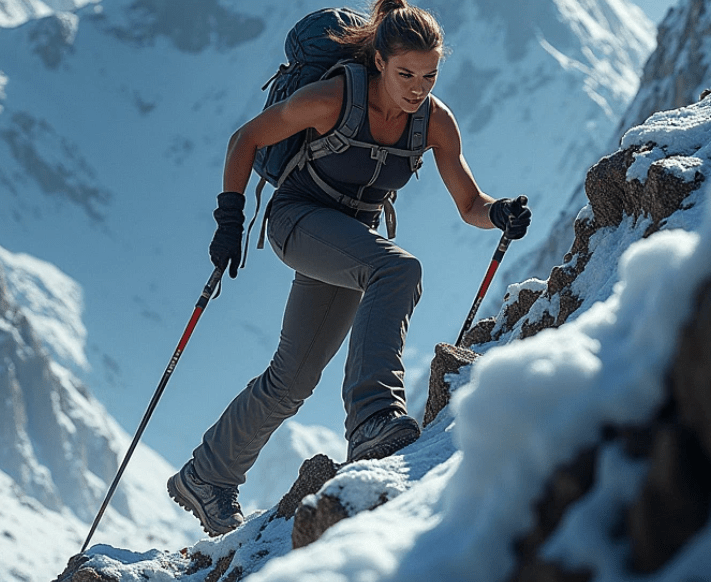
Final Thoughts From a Trail-Hardened Survivalist

Vermont isn’t Alaska, but don’t let that fool you into underestimating it. Between the dense woods, fast-changing weather, and deceptive elevation gains, you can find yourself in trouble quick if you’re not squared away. Here’s what I always pack, no matter the trail length:

  • Water filter (Sawyer Squeeze or similar)
  • Knife or multitool
  • Headlamp (yes, even on day hikes)
  • Compass and trail map
  • Layered clothing, wool socks
  • High-protein snacks
  • Duct tape (saves lives, literally)
  • Basic first aid
  • Bear spray (northern Vermont’s got traffic)

Bottom line: respect the trail and it will teach you things no classroom ever could. Get out there, push yourself, bleed a little, get rained on, curse the incline—and then feel that fire in your chest when you make it to the summit. You’re not just hiking; you’re becoming someone the wilderness doesn’t scare.

See you out there.

Virginia’s Deadliest Hiking Trails: Popular Paths You Shouldn’t Underestimate

As a seasoned prepper who’s spent countless hours navigating the rugged backcountry of Virginia, I can tell you that there’s no such thing as a “safe” trail when it comes to hiking. The wilderness is an unforgiving place, and while hiking might be one of the most exhilarating ways to connect with nature, it’s also a humbling reminder of the elements’ raw power. Virginia, with its lush forests, dramatic mountains, and winding rivers, offers some of the most picturesque hiking routes in the country. But don’t be fooled by the beauty – these trails can be dangerous if you’re unprepared.

Whether you’re a weekend warrior, an experienced hiker, or a full-blown survivalist, you must respect these trails. It’s crucial to understand that even the most popular paths can lead to perilous situations if you’re not properly prepared. So, let’s dive into the top 20 hiking trails in Virginia that you should approach with caution – trails that can easily take you by surprise if you’re not vigilant. And remember, the difference between a successful hike and a disaster often boils down to preparation, knowledge, and awareness.

1. Old Rag Mountain (Shenandoah National Park)

This is perhaps the most iconic trail in Virginia, and also one of the most dangerous. The ascent to Old Rag is a challenging rock scramble, and one wrong move can send you tumbling hundreds of feet down the mountainside. The trail is extremely steep, with narrow ridgelines and exposed rock faces. Weather conditions can change rapidly, making the trail slippery and treacherous. Don’t let the popularity of this trail lull you into a false sense of security.

2. McAfee Knob (Appalachian Trail)

Known for its jaw-dropping panoramic views, McAfee Knob draws hikers from all over. However, the exposure on the summit is not for the faint of heart. High winds and unstable footing on the rocky outcrop have led to numerous accidents. It’s important to stay focused and avoid the temptation to take risky selfies near the edge. The descent is steep and can be just as dangerous, particularly when the trail is wet.

3. The Devil’s Marbleyard (Jefferson National Forest)

The Devil’s Marbleyard offers an exciting rock-hopping adventure, but it’s not one to underestimate. The trail leads you across a massive boulder field, which is exhilarating but extremely hazardous. It’s easy to twist an ankle, lose your footing, or get stuck between rocks. This trail requires agility and caution – it’s a thrill, but a dangerous one if you’re not paying attention.

4. The Three Ridges Trail (George Washington National Forest)

The Three Ridges Trail is a demanding hike that rewards you with incredible views, but it’s also notorious for its challenging terrain. It climbs rapidly, and the summit can be treacherous, especially in wet conditions. With loose rocks, steep drop-offs, and tricky navigation, it’s easy to get lost or injured. This is not a beginner’s trail, and it should be approached with experience and the right gear.

5. Buzzard Rock Trail (George Washington National Forest)

While this trail offers some of the best views of the Shenandoah Valley, it can be a risky one to navigate. The route is rocky and steep, and the climb can be physically taxing, especially for those not accustomed to long, intense hikes. There’s also a significant exposure near the top, and falling rocks are common on windy days. Be cautious of sudden weather changes and the potential for icy conditions during the colder months.

6. Linville Gorge Trail (George Washington National Forest)

This trail leads hikers into one of Virginia’s most rugged and remote wilderness areas, and it doesn’t hold back when it comes to difficulty. The Linville Gorge Trail is steep, with unstable footing and uneven surfaces that can make it treacherous, especially when descending. The dense forest can disorient you, and the remoteness means you’re far from help if something goes wrong.

7. The Mount Rogers Trail (Mount Rogers National Recreation Area)

This trail is the highest point in Virginia, and its ascent is no small feat. The terrain is harsh, with dense forests, rocky slopes, and unpredictable weather. Hikers often underestimate the strenuous nature of the climb, which can lead to exhaustion and altitude sickness. The weather at higher elevations can change without warning, so always be prepared for rapid temperature drops and storms.

8. The Appalachian Trail (Southern Section)

While the Appalachian Trail itself isn’t inherently deadly, certain sections, particularly in the southern part of Virginia, are prone to flash floods, tricky rock scrambles, and steep inclines. The terrain varies widely, from soft, muddy patches to slippery rock outcroppings. Hikers should take note of weather patterns, as heavy rains can make certain portions of the trail impassable.

9. The Timber Hollow Trail (Shenandoah National Park)

This relatively short trail is deceptively tough. It is steep, and although it doesn’t have the same notoriety as some other trails in Virginia, the climb is demanding. The terrain can be muddy, and exposure to the sun can lead to overheating, especially in summer months. Overuse has eroded parts of the path, making footing tricky and creating opportunities for slips and falls.

10. The Bearfence Mountain Trail (Shenandoah National Park)

Short but steep, this trail features a rock scramble that requires both strength and stamina. One false step can send you off balance, and the exposed ridge is not for those afraid of heights. This trail can be particularly dangerous in rainy or snowy weather, making it vital to check conditions before heading out.

11. The North Mountain Trail (George Washington National Forest)

The North Mountain Trail offers panoramic views, but it’s a tough, strenuous hike. The trail is steep, and the rocky paths can quickly become slippery in wet weather. The lack of shelter on the trail makes it dangerous if you get stuck during bad weather or at night.

12. The Dark Hollow Falls Trail (Shenandoah National Park)

This trail, although short, is one of the steepest in the park. The trail to the falls can become treacherous, especially after a rainfall. The rocks near the waterfall are often slick, and the descent can quickly turn into a dangerous slide if you’re not careful. Inexperienced hikers should avoid this path when conditions are wet or icy.

13. The Tye River Trail (George Washington National Forest)

The Tye River Trail is less frequently hiked, but its difficulty makes it worthy of attention. The path is rough and overgrown, and it’s easy to lose your way if you’re not following the markers closely. The river crossings can be dangerous, and the steep climbs can exhaust you quickly, leaving you vulnerable.

14. The South Fork Trail (Shenandoah National Park)

This trail leads you along the South Fork of the Shenandoah River and provides stunning views. However, it is also notorious for its muddy, slippery patches and difficult navigation. The trail can be especially hazardous after rain or during the spring thaw. The riverbanks are steep, and getting too close to the water can lead to an accident.

15. The Dragon’s Back Trail (George Washington National Forest)

This trail’s sharp inclines and dramatic ridges are why it has earned its place on this list. The exposed sections can be treacherous in wind or rain, and the narrow ridgelines can leave you feeling vulnerable. If you’re not prepared for the technical sections, this trail can easily lead to missteps or injury.

16. The Stony Man Trail (Shenandoah National Park)

Though it’s a relatively short hike, the Stony Man Trail is steep and rocky, and it can be particularly dangerous during winter. Ice can form quickly, making the rock surfaces extremely slick. The lack of guardrails or handholds on the rocks makes it more hazardous for those who are not steady on their feet.

17. The Laurel Fork Trail (Jefferson National Forest)

Known for its isolation, the Laurel Fork Trail can be a dangerous route to take if you’re not prepared for its remoteness. The path is overgrown in sections, and getting lost is a real risk. Add to that the fact that it’s a strenuous hike, and you’ve got a trail that demands attention and respect.

18. The Big Schloss Trail (George Washington National Forest)

Big Schloss offers fantastic views, but the climb to the summit is tough, and the descent is no easier. The rocky outcrops and high elevation mean that this hike can be challenging in any weather, especially if conditions change unexpectedly. Hiking during off-season months increases the risk of ice and snow on the rocks, making it slippery and hazardous.

19. The Little Devil Stairs Trail (Shenandoah National Park)

This trail’s name should be enough to tell you that it’s not for beginners. The trail is short but steep, and it includes an aggressive descent along an unstable rock-strewn path. The rocky steps and uneven terrain make this a difficult and risky hike, particularly during wet or snowy conditions.

20. The North Fork Mountain Trail (George Washington National Forest)

The North Fork Mountain Trail is known for its cliffside views and challenging terrain. The trail includes steep rock faces and narrow ridgelines that make it incredibly dangerous, especially if you’re unprepared. The exposure to the elements is extreme, and it requires a steady hand to traverse safely.


In conclusion, these trails all have one thing in common: they’re not to be underestimated. Each of them offers a beautiful, albeit dangerous, experience in Virginia’s wild landscapes. Before you head out, make sure you’ve got the right gear, a solid understanding of the trail, and a preparedness mindset. The wilderness doesn’t play favorites, and even experienced hikers can find themselves in a tough spot if they’re not vigilant. Stay safe, respect the trail, and prepare for the unexpected – that’s the key to surviving these deadliest hikes in Virginia.

Hiking Trails in Washington: Danger Lurks at Every Turn

Hiking Trails in Washington: Danger Lurks at Every Turn
By a Survivalist Who’s Seen the Worst and Lives for the Wild


I’ve spent the better part of my life navigating the unrelenting terrain of the Pacific Northwest. Washington State, in particular, is both heaven and hell for hikers. Its beauty? Unmatched. Its danger? Underestimated. Every serene alpine lake or sun-dappled forest you pass could be hiding a deadly twist—slippery shale ledges, rogue bears, sudden whiteouts, or simply the slow fade of hypothermia after a surprise spring snow squall. That’s the double-edged axe of nature: the more breathtaking it is, the more brutal it can be.

So, if you think hiking in Washington is a walk in the park, think again. You’re entering the lion’s den of terrain where the Earth makes no apologies—and where being unprepared can cost you your life. But for those of us who love to hike with a go-bag and a blade, this is paradise.

Let me walk you through the top 20 hiking trails in Washington—but understand, these aren’t just trails. These are proving grounds. They’ll either harden you or humble you.


1. The Enchantments – Alpine Lakes Wilderness

You want magic? You’ll get it—with a side of misery. Permit-only and sitting high in the Cascades, this is a jagged gauntlet of granite, goat-tracked paths, and lakes so cold they’ll knock the wind out of your lungs if you dare take a dip. The elevation gain is brutal, and the weather can turn on you in seconds.

2. Mount Rainier’s Wonderland Trail

93 miles of pure punishment circling the beast that is Rainier. Glacier crossings, river fords, and swarms of mosquitoes that feast like it’s their last meal. Bring gaiters, trekking poles, and don’t skimp on the calories. You’ll earn every mile.

3. Colchuck Lake Trail

A gateway drug to the Enchantments. The views? Unreal. The crowds? Thick. But don’t let the Instagram pics fool you—those granite switchbacks bite, and early snow can ice over the trail like glass.

4. Tolmie Peak Trail – Mount Rainier NP

A short but sneaky one. Starts sweet, ends steep. Bear activity is common, and the fog here can be disorienting. If you think 6 miles is child’s play, you’ll learn humility at elevation.

5. Mount Si – North Bend

This is where Seattle’s weekend warriors try to find themselves—and sometimes lose footing. Over 3,000 feet of gain in four miles will test your lungs. Don’t underestimate this mountain just because it’s near the city.

6. Spider Gap – Glacier Peak Wilderness

Snowfields. Stream crossings. Miles from help. This loop is a wilderness crucible, and the views will sear themselves into your soul if the cold doesn’t get you first.

7. Kendall Katwalk – Pacific Crest Trail

A knife-edge trail with sheer drops and rockfalls. The exposure here is real, and if you don’t respect it, you might not come back. Pack layers—the wind cuts like a blade.

8. Rattlesnake Ledge – Rattlesnake Mountain

Short, steep, and tragically popular. The ledge has no guardrails. People have died here. That view over Rattlesnake Lake? Worth it—if you live to tell the tale.

9. Skyline Trail – Paradise, Mount Rainier

Don’t let the name fool you—it’s not all sunshine and lollipops. This loop climbs through snowfields and volcanic terrain. Glacial runoff can flood sections unpredictably.

10. Hoh River Trail – Olympic National Park

A rainforest hike with a quiet menace. Slippery boardwalks, unpredictable river crossings, and more elk and black bears than you’d think. The humidity alone can crush your will.

11. Lake Serene & Bridal Veil Falls

Rockslides are no joke here. A hike of extremes—waterfall spray on your face, then a grueling climb that tests every tendon. The lake is aptly named; the trail, not so much.

12. Mailbox Peak – North Bend

The old route is straight-up Type II fun: brutal, relentless, and demoralizing. You’ll gain 4,000 feet in 2.5 miles. Think you’re tough? Mailbox Peak will verify.

13. Blue Lake Trail – North Cascades

Short, sweet, and slippery. Rock-hopping is mandatory. Wild goats and ice on the trail even in late summer. It’s beautiful, but if you go light on gear, you’ll pay.

14. Ebey’s Landing – Whidbey Island

Looks like a beach walk, feels like a military endurance course when the wind is howling and the tide’s coming in. Cliffside erosion is real—don’t hike too close to the edge.

15. Sourdough Mountain – North Cascades

This trail doesn’t mess around. It’s one of the steepest in the state. A relentless climb with minimal water access. If you’re not ready, this trail will chew you up and spit you out.

16. Mount Pilchuck Lookout

The final scramble can be icy, even in summer. The old fire lookout is worth the trip, but you better have a good headlamp if you linger too long—you do not want to descend in the dark.

17. Goat Rocks Wilderness – Snowgrass Flat to Goat Lake

You’re hiking on a ridge with cliffs on both sides. Goats may look cute, but they’ve been known to charge. Bring bear spray. This trail feels like another planet—and it’ll test your mental game.

18. Cape Alava Loop – Ozette Triangle

The coast is no joke. Tides can trap you, seaweed-covered rocks are slicker than oil, and fog rolls in like a curtain. It’s primal out there. Don’t assume there’s a signal to call for help.

19. Maple Pass Loop – North Cascades

One of the most scenic and most deceiving loops out there. Starts easy, then kicks up with exposed ridgelines and loose scree. One wrong step and you’ll be rolling.

20. Mount Adams – South Climb

This isn’t a hike—it’s an ascent. Glacial travel, crampons, and an early start are non-negotiable. Altitude sickness can hit hard, and you’ll need every ounce of grit to summit and descend safely.


Prepper’s Pro Tips for Surviving Washington’s Wild Side

  1. Never trust the weather forecast. Mount Rainier can whip up a storm out of clear skies. Always pack for four seasons—even in July.
  2. Carry more water than you think you’ll need. Filters can fail. Rivers dry up. Dehydration doesn’t care how “fit” you are.
  3. Bear spray isn’t optional. You’re not just out for a hike—you’re stepping into bear and cougar country. They’re not scared of your trekking poles.
  4. Tell someone your route. You’re not invincible. I’ve seen SAR teams comb the woods for days over a simple misstep.
  5. Carry a map and compass—and know how to use them. GPS dies. Phones drop. Analog navigation doesn’t need a signal.
  6. Boots matter. Don’t wear bargain gear on life-or-death trails. Blisters can become infections fast.
  7. Know your limits. Pride has put more hikers in body bags than cliffs have. Turn around if it doesn’t feel right.

Washington is a wild one. She’s stunning, yes—but she’s a killer, too. Respect her, prepare for her, and she might just let you glimpse her most secret places. But forget your rain shell, wander off trail, or take her for granted? She’ll remind you who’s boss.

So, lace up, gear up, and pack like your life depends on it—because out here, it just might.

Hiking Trails in Texas: Beauty Hides the Dangers You Can’t Ignore

Hiking Trails in Texas: Beauty Hides the Dangers You Can’t Ignore

If there’s one thing a seasoned survival prepper knows, it’s that Mother Nature doesn’t play fair. The land can be beautiful, majestic, and awe-inspiring, but it’s also unforgiving, unpredictable, and at times, deadly. That’s why any hiker worth their salt doesn’t just pack their gear and hit the trail without first considering what dangers lie ahead. And while Texas boasts some of the most stunning hiking trails in the country, they come with their own set of risks. So, if you plan on tackling any of these trails, do it with caution, respect, and preparedness.

Before we dive into the top 20 hiking trails in Texas, let me emphasize the importance of survival prepping. While these trails can be absolutely gorgeous, it’s critical to remember that Texas is a massive state with diverse terrains ranging from deserts to dense forests. With that in mind, let’s go over a few things that will keep you alive and thriving in the wilderness:

Hiking Trails: Texas Hiking Trails

1. Know Your Terrain

Whether it’s the rocky hills of Big Bend or the swamplands of the Piney Woods, Texas offers many different ecosystems, each with its own unique set of hazards. You need to know what you’re walking into—whether it’s venomous snakes, dehydration risks, or tricky footing on rugged trails. That means researching the trail you’re planning on hiking and paying attention to seasonal changes.

2. Pack Smart

The essentials go beyond just food and water. Pack extra layers, especially in the higher elevations or desert areas where temperatures can fluctuate drastically. A basic first-aid kit, a good multi-tool, fire-starting equipment, a compass (or a GPS device), and a headlamp should be standard items. Don’t forget about sun protection—Texas has plenty of sunny, dry areas where you’ll need more than just sunscreen. Hat, sunglasses, and lightweight clothing that covers your skin are must-haves.

3. Hydrate, Hydrate, Hydrate

Texas can get extremely hot, particularly in the summer months. If you’re out on the trail in temperatures above 90°F, dehydration can become a serious issue. Carry enough water for your entire trip, and if you’re hiking in an area where you can filter water from streams, know how to do so safely. Consider carrying water purification tablets or a filtration system as part of your survival gear.

4. Snakes and Wildlife

Venomous snakes like the Western Diamondback Rattlesnake, Copperhead, and the infamous Coral Snake call Texas home. While these creatures are generally not aggressive, it’s important to stay alert, watch where you step, and be aware of your surroundings. Additionally, keep your distance from larger wildlife, like mountain lions or wild boars, and be cautious when venturing into areas known for these animals.

5. Stay Aware of the Weather

Texas weather is notorious for its unpredictability. A sudden storm can change the landscape, increase flooding risks, or cause hypothermia if the temperature drops too quickly. Be sure to check weather reports before you head out and bring the necessary gear to deal with sudden weather changes. Lightning strikes are a serious threat, so be especially cautious during thunderstorm season.

With those important points in mind, let’s take a look at the top 20 hiking trails in Texas, each offering its own unique beauty and hidden dangers.

1. The Lost Mine Trail – Big Bend National Park

Big Bend is a hiker’s paradise, but it’s also a land that demands respect. The Lost Mine Trail is one of the most popular hikes, offering spectacular views of the desert and the Chisos Mountains. The trail is moderate in difficulty, but hikers should be prepared for steep sections and the hot, dry conditions that can be dangerous in the summer.

2. Guadalupe Peak Trail – Guadalupe Mountains National Park

The highest point in Texas, Guadalupe Peak stands at 8,751 feet. This challenging hike is a must for any experienced hiker, but it’s not for the faint of heart. The steep, rocky trail can be demanding, and the weather can shift unexpectedly. Hikers should carry enough water, wear sturdy boots, and be prepared for high-altitude conditions.

3. Santa Elena Canyon Trail – Big Bend National Park

This 1.7-mile trail offers stunning views of the Rio Grande River and towering canyon walls. The trail is relatively short but does involve some scrambling over rocks, so make sure you have good footwear and be cautious of loose terrain. Remember that temperatures here can soar in the summer months.

4. Window Trail – Big Bend National Park

A relatively easy 5.6-mile trail with breathtaking views of the desert landscape, the Window Trail is a favorite for many. The trail culminates at a rock formation that frames a beautiful view of the desert below. Keep in mind, though, that the heat can be intense, so prepare with plenty of water.

5. Enchanted Rock Summit Trail – Enchanted Rock State Natural Area

Enchanted Rock is a massive pink granite dome that rises 425 feet above the surrounding landscape. The 1.3-mile summit trail is a relatively short but strenuous hike. Be prepared for hot weather, especially during the summer months, and make sure you bring enough water and wear sun protection.

6. Palo Duro Canyon Lighthouse Trail – Palo Duro Canyon State Park

Palo Duro Canyon, the second-largest canyon in the U.S., offers stunning views and diverse terrain. The Lighthouse Trail is a 6.6-mile round trip with a challenging climb at the end. The trail is rocky and exposed, making hydration and sun protection a priority.

7. Caprock Canyons Trailway – Caprock Canyons State Park

This trailway runs 64 miles through remote, rugged terrain, offering a unique Texas landscape. It’s perfect for those looking for a more remote, backcountry experience. Expect isolation, challenging weather conditions, and the possibility of wildlife encounters.

8. Cedar Breaks Trail – Cleburne State Park

A relatively short and easy hike, the Cedar Breaks Trail provides a beautiful view of Cedar Lake and the surrounding forest. It’s an ideal beginner’s trail, but be aware of ticks and poison ivy that are common in the area.

9. Devil’s Waterhole Trail – Longhorn Cavern State Park

This short trail takes you to a hidden waterhole surrounded by rocky terrain. It’s great for swimming, but the steep, uneven trail can be dangerous if not approached with caution.

10. McKinney Falls Trail – McKinney Falls State Park

A popular spot near Austin, this trail is great for a relaxing day hike. With beautiful waterfalls and creek crossings, it’s a favorite for families. However, beware of slippery rocks and the occasional flooding after heavy rains.

11. South Rim Trail – Big Bend National Park

One of the most iconic hikes in Texas, the South Rim Trail offers panoramic views of the desert and mountain landscapes. At over 12 miles, it’s a strenuous hike, so make sure you’re prepared for altitude and temperature shifts.

12. Indian Head Trail – Big Bend National Park

This steep and strenuous trail leads to an incredible vantage point with sweeping views of the Rio Grande River and the surrounding desert. Be sure to pack sufficient water and take breaks, as the ascent can be challenging.

13. Hill of Life Trail – Barton Creek Greenbelt

For a more urban hiking experience, this trail offers a scenic route along Barton Creek. It’s a moderate hike with rocky terrain and some creek crossings. The trail is popular among locals, so it can get crowded during weekends.

14. Backbone Trail – Government Canyon State Natural Area

This 10-mile trail offers a mix of rugged terrain and scenic vistas. The trail is challenging and requires careful navigation, especially in the heat of summer. Keep an eye out for rattlesnakes and other wildlife.

15. Lick Creek Trail – Lick Creek Park

A peaceful, 2.5-mile loop in College Station, Lick Creek Trail is a great place to enjoy nature without venturing far from town. The trail is mostly flat, but you’ll still need to watch out for ticks and occasional wildlife.

16. Blue Hole Trail – Hamilton Pool Preserve

A short but beautiful hike that leads to the iconic Hamilton Pool, a natural swimming hole surrounded by a waterfall. The trail is easy but can be crowded, especially in the summer months.

17. The Gorman Falls Trail – Colorado Bend State Park

This 1.5-mile trail leads to the stunning Gorman Falls, a hidden gem in the Hill Country. The trail is short but steep and can be slippery, especially during wet conditions.

18. Coyote Trail – Franklin Mountains State Park

For a challenging desert hike, the Coyote Trail provides a rugged experience with sweeping views of the surrounding mountains. Expect steep climbs and rocky footing.

19. Sunset Trail – San Angelo State Park

This moderate 2.4-mile loop offers a peaceful hike with beautiful views of the reservoir. It’s a great option for a short, scenic hike in a less-visited area.

20. Soggy Bottom Trail – Lake Livingston State Park

A 3-mile trail that winds through dense pine forests, the Soggy Bottom Trail can get muddy after rains. Wear sturdy footwear and be cautious of slippery patches.

Final Thoughts

While these 20 trails offer some of the best hiking experiences in Texas, they each come with their own set of challenges and risks. As a survival prepper, the most important thing to remember is that nature doesn’t care about your plans. Stay prepared, respect the land, and hike responsibly. Always know your limits, and never leave home without the essentials—because in Texas, beauty hides the dangers you can’t ignore.

The Most Popular Hiking Trails in Utah, and Why They’re So Dangerous

Utah is a land of extremes — a place where red rock can burn your hands and a blue sky can cook your skull. It’s beautiful, sure. World-famous, even. But don’t let the Instagram feeds and tourist brochures fool you. Those picture-perfect trails? They’re not safe, and they definitely aren’t forgiving.

As a survival prepper who’s spent years hiking, camping, and going off-grid across this country, I’ve learned the hard way: Utah doesn’t care how much experience you think you have. It’ll chew up your boots, dry out your body, and drop you into a slot canyon that floods faster than you can say “I should’ve checked the weather.” Hiking Trails: Utah Hiking Trails

You want raw adventure? Utah’s got it. But you better pack like you’re not coming back. Because if you slip up out here — even on a so-called “popular” trail — there might not be anyone around to help.

So here it is: the top 20 most popular hiking trails in Utah, with a survivalist’s breakdown of why they’re so dangerous. If you’re headed out there, don’t say I didn’t warn you.


🔥 Top 20 Most Popular — and Dangerous — Hiking Trails in Utah


1. Angels Landing

Location: Zion National Park
Length: ~5.4 miles round trip
Why it’s dangerous: Narrow spine, 1,000-foot drop-offs, and crowded ledges. One gust of wind or misplaced foot and it’s lights out.


2. The Narrows

Location: Zion National Park
Length: Up to 16 miles
Why it’s dangerous: Flash floods. When the water rises, it rises fast — and there’s nowhere to go. Cold water and strong currents can sweep you away.


3. Delicate Arch Trail

Location: Arches National Park
Length: ~3 miles
Why it’s dangerous: Exposed terrain, slickrock, no shade. It’s beautiful… until you’re dehydrated and lost in 100-degree heat.


4. The Subway (Left Fork)

Location: Zion National Park
Length: ~9 miles (route-finding required)
Why it’s dangerous: Technical route. Water crossings, slippery boulders, and flash flood zones. Rescue access is limited.


5. Bryce Canyon Rim Trail

Location: Bryce Canyon National Park
Length: ~11 miles
Why it’s dangerous: Loose gravel near cliff edges, elevation gain, and sudden storms with lightning strikes.


6. Devils Garden Trail

Location: Arches National Park
Length: ~7.9 miles
Why it’s dangerous: Rock scrambles, steep drop-offs, poor trail markings on the Primitive Loop. Easy to get disoriented.


7. Peekaboo and Spooky Gulch

Location: Grand Staircase-Escalante
Length: ~3.5-mile loop
Why it’s dangerous: Slot canyons that get pitch black, tight squeezes, and real flood risk. Claustrophobia warning.


8. Mount Timpanogos Trail

Location: Wasatch Range
Length: 14-15 miles
Why it’s dangerous: Altitude sickness, snowfields into summer, and mountain lion territory. Weather turns brutal fast.


9. Observation Point via East Mesa Trail

Location: Zion National Park
Length: ~7 miles
Why it’s dangerous: Long drop-offs, loose rock, and the illusion of being “easy.” Heatstroke is common.


10. Red Pine Lake Trail

Location: Little Cottonwood Canyon
Length: ~7.4 miles
Why it’s dangerous: Steep ascents, sudden snow, and ice even in spring. One misstep on wet granite could be fatal.


11. Lake Blanche Trail

Location: Big Cottonwood Canyon
Length: ~6.9 miles
Why it’s dangerous: Steep incline, exposed rock faces, and moose encounters. Many underestimate the descent.


12. Kanarra Falls Trail

Location: Near Zion
Length: ~4.4 miles
Why it’s dangerous: Slippery ladders, cold water, flash flooding. Injuries are common on the climb.


13. Canyon Overlook Trail

Location: Zion National Park
Length: ~1 mile
Why it’s dangerous: Easy hike, but very exposed. No railings. Tourists love to test fate on the edges.


14. Snow Canyon Lava Tubes Trail

Location: Snow Canyon State Park
Length: ~2.5 miles
Why it’s dangerous: Collapsible lava tubes, loose footing, extreme summer heat. Headlamp is mandatory.


15. Grandstaff Canyon to Morning Glory Bridge

Location: Near Moab
Length: ~4.5 miles
Why it’s dangerous: Flash flood zone, slippery creek beds, and hidden drop-offs.


16. Coyote Gulch

Location: Grand Staircase-Escalante
Length: ~11 miles
Why it’s dangerous: Water crossings, quicksand, isolation. Permits required for a reason — it’s no joke.


17. Fisher Towers Trail

Location: Near Moab
Length: ~4.4 miles
Why it’s dangerous: Sheer cliffs, sudden storms, and desert sun that’ll dry you out like jerky.


18. Slot Canyon Loop (Willis Creek)

Location: Grand Staircase-Escalante
Length: ~5 miles
Why it’s dangerous: Flash floods and disorientation. Looks easy, but the canyon winds forever. Hard to escape fast.


19. Deseret Peak Loop

Location: Stansbury Mountains
Length: ~7.4 miles
Why it’s dangerous: High altitude, remote setting, lightning risk above treeline. Hypothermia in summer? Yep.


20. The Wave (South Coyote Buttes – technically in Arizona, but accessed via Utah)

Location: Near Kanab
Length: ~6.4 miles
Why it’s dangerous: No marked trail, extreme heat, and disorientation. GPS recommended — and even that can fail.


🧭 Survival Tips for Hiking in Utah

Let’s get one thing straight: Utah’s terrain isn’t dangerous because it hates you — it’s dangerous because it doesn’t care if you’re ready or not. And most folks? They’re not.

You’re not hiking in a theme park. You’re stepping into real-deal wilderness, often miles from help, water, or shade. Here’s my essential prep checklist before I even step onto a Utah trail:

🧰 My Non-Negotiable Loadout:

  • 3L of water minimum, with backup purification tabs
  • Fixed-blade survival knife (not your folding pocket toy)
  • First aid kit with trauma gear
  • Topographic map + compass + downloaded offline GPS maps
  • Electrolytes, jerky, hard carbs
  • Sun hat, SPF 50+, sunglasses
  • Emergency bivy or tarp shelter
  • Headlamp (even on day hikes — because you might not make it out before dark)
  • Satellite communicator or whistle/mirror combo

Bonus: I also carry a small water straw and a ferro rod, because I don’t trust tech-only gear in red rock country.


👣 Final Thoughts from a Dirt-Ready Survivalist

A lot of people come to Utah looking for adventure. And they get it. But they also get heatstroke, twisted ankles, dehydration, and in the worst cases — body bags. That’s not fear-mongering. That’s facts.

But here’s the flip side: If you go in prepared, these trails will reward you with the most unforgettable views and soul-rattling solitude you’ll find anywhere in the U.S.

The sun setting over Delicate Arch. The view from Angels Landing after a brutal climb. The silence of a slot canyon where you can hear your own heartbeat. That’s why we hike. But it’s also why we prepare — because you don’t earn those moments without risk.

Utah doesn’t want your weakness. It demands your respect. Give it, and you’ll walk away stronger, smarter, and more in tune with the wild than ever before.

Stay sharp. Stay alive. I’ll see you on the next ridgeline.

The Truth Behind South Dakota’s Most Treacherous Hiking Trails

Let me tell you something most folks won’t: South Dakota is a sleeping beast.

People think of it as flat prairie, Mount Rushmore, maybe some bison and cornfields. But if that’s all you know, then you’ve never laced up your boots and walked into the Black Hills with a pack on your back and silence all around you — the kind of silence that tells you you’re not at the top of the food chain anymore. Hiking Trails: South Dakota Hiking Trails

As someone who lives and breathes survival prepping and lives for the long, lung-burning hikes most people quit halfway through, South Dakota has earned my respect — and that’s saying something. The terrain may look tame from the road, but step off the trailhead and you’ll find out quick that this state has teeth.

Flash storms, rattlesnakes, sheer drop-offs, wildfire zones, and terrain that will chew up the soft and spit them into ravines. Some of these trails are so remote, you could break a leg and wait two days before another human stumbles across your body. That’s real. That’s why I don’t hike without a first-aid kit, survival knife, paracord, and enough water filtration gear to last me a week in case I get pinned down by a storm or worse.

So if you’re itching for the truth — the real truth — about South Dakota’s wildest, most treacherous hiking trails, you came to the right place. This isn’t some Instagrammable “top 10 list.” This is the rundown from someone who has walked them, sweated through them, and seen what happens when the land doesn’t care if you make it back.


⚠️ The Top 20 Most Treacherous Hiking Trails in South Dakota

By someone who hikes to survive and survives to hike.


1. Harney Peak (Black Elk Peak via Norbeck Trail)

Location: Black Hills National Forest
Length: ~7 miles round trip
Why it might kill you: Steep ascents, unpredictable weather, and altitude exposure at 7,242 feet — South Dakota’s highest point.


2. Cathedral Spires Trail

Location: Custer State Park
Length: ~1.5 miles one-way
Why it might kill you: Sharp rock formations, loose gravel, and narrow ledges. One wrong step and you’re toast.


3. Black Elk Wilderness Loop

Location: Black Hills
Length: 12–13 miles
Why it might kill you: Remote wilderness, poor cell reception, aggressive wildlife. No shortcut out.


4. Lover’s Leap Trail

Location: Custer State Park
Length: ~4 miles loop
Why it might kill you: Misleading name. Slippery when wet, cliffs at the overlook, and rattlers near the trail.


5. Sunday Gulch Trail

Location: Sylvan Lake
Length: ~4 miles loop
Why it might kill you: Boulder scrambles, creek crossings, and slick footing. One of the most physically demanding short hikes in the state.


6. French Creek Natural Area Trail

Location: Custer State Park
Length: 12 miles one-way
Why it might kill you: Wild bison territory, river crossings, and deep isolation. Bring a topo map — the trail markers vanish.


7. Crow Peak Trail

Location: Black Hills National Forest
Length: ~7 miles
Why it might kill you: Bears, blowdowns, and rapid elevation gain. Wind gusts on the peak can knock you flat.


8. Hell Canyon Trail

Location: Black Hills
Length: ~5.5 miles
Why it might kill you: Heatstroke danger in summer, rattlesnakes along the trail, and some dicey ledges.


9. Buzzard’s Roost Trail

Location: Near Rapid City
Length: ~3.5 miles
Why it might kill you: Popular with mountain lions in off-seasons. Bring your situational awareness.


10. Badlands Notch Trail (includes Saddle Pass & Castle Trail)

Location: Badlands National Park
Length: Varies, up to 10 miles combined
Why it might kill you: Extreme heat, disorienting terrain, and sudden drops. Water is life — and it’s scarce.


11. Sheep Mountain Table Trail

Location: Badlands National Park
Length: ~4.5 miles
Why it might kill you: Remote and exposed with unstable cliff edges. No shade, no water, no mercy.


12. Bear Butte Summit Trail

Location: Bear Butte State Park
Length: ~2 miles
Why it might kill you: Lightning magnet in storms, sacred land (respect it), and steep, wind-exposed switchbacks.


13. Centennial Trail (Full Thru-Hike)

Location: Wind Cave to Bear Butte
Length: ~111 miles
Why it might kill you: Long-distance isolation, dehydration risks, and rugged elevation changes. Not for first-timers.


14. Little Devils Tower Trail

Location: Custer State Park
Length: ~3 miles
Why it might kill you: Rock scramble at the summit. One misstep, and it’s a long, hard fall.


15. Willow Creek Trail

Location: Black Hills National Forest
Length: ~2.5 miles
Why it might kill you: Hidden by dense pine, easy to lose trail. Mountain lions are active here.


16. Medicine Root Loop

Location: Badlands
Length: ~4 miles
Why it might kill you: Exposed sun, badlands terrain tears up boots, no water access. Bring electrolytes or regret it.


17. Poet’s Table (Unofficial Trail)

Location: Black Hills
Length: ~2 miles (off-map)
Why it might kill you: Not on official maps. Off-trail scrambling, private property risks, and zero rescue access.


18. Cold Brook Canyon Trail

Location: Wind Cave National Park
Length: ~1.5 miles
Why it might kill you: Tall grass hides snakes and burrows. Bring gaiters and watch your step.


19. Rankin Ridge Trail

Location: Wind Cave National Park
Length: ~1 mile
Why it might kill you: Looks easy — until a sudden storm rolls in. Lightning strikes here often.


20. Savoy Trail System (Roughlock Falls to 11th Hour Gulch)

Location: Spearfish Canyon
Length: Varies
Why it might kill you: Ice patches in shoulder seasons, rockfall, and flash flood zones. Check weather before you go.


🧭 Survival Musts for South Dakota Trails

If you’re planning to hike any of these bad boys, don’t be a fool — prep like your life depends on it. Because out there, it might.

My Go-To Loadout:

  • Water filter pump + backup iodine tabs
  • Fixed-blade knife with fire-starting capability
  • Metal canteen (boil water ready)
  • Snake bite kit + full trauma-first aid
  • Survival bivvy + mylar blanket
  • Topo map, compass, and backup headlamp
  • Beef jerky, nuts, electrolyte packets
  • Bear spray + whistle
  • Lightweight tarp (shelter or emergency signal)

South Dakota may not be Alaska, but it doesn’t have to be. A six-mile trail can turn into a survival situation fast if the weather shifts or your ankle rolls 3 miles from help. Be ready, and you’ll walk away stronger. Come in cocky, and the land will teach you some hard lessons.

The Indiana Hiking Trails You Should Avoid—Unless You’re Ready

As a seasoned survival prepper and avid hiker, I’ve traversed countless trails across the Hoosier State. While Indiana boasts some stunning landscapes, certain trails demand respect and preparation. These aren’t your average hikes; they challenge your skills, endurance, and judgment. If you’re up for the test, here’s a curated list of Indiana’s most formidable trails.


1. Schooner Trace Trail – Brown County State Park

Often dubbed the most dangerous hike in Indiana, the Schooner Trace Trail is not for the faint of heart. This 6-mile trail features narrow paths, rocky terrain, and sections requiring hand-over-foot climbing. With steep cliffs and challenging conditions, it’s a favorite among experienced hikers seeking a serious challenge.


2. Shades State Park – Trail 8

Trail 8 in Shades State Park offers rugged terrain, steep descents, and natural obstacles like fallen trees. It’s a cross-country experience that demands physical fitness and mental fortitude. The trail’s challenging nature makes it suitable only for those prepared for a strenuous hike. Hiking the Indiana State Parks


3. Clifty Falls State Park – Trail 3

Trail 3 at Clifty Falls State Park is known for its steep inclines, slippery rocks, and cascading waterfalls. The trail’s difficulty increases during wet conditions, making it treacherous for the unprepared. Hikers should exercise caution and be prepared for sudden weather changes. Best Local Things


4. Turkey Run State Park – Trail 3

Trail 3 at Turkey Run State Park is renowned for its rugged terrain, including ladders and log crossings. The trail’s challenging features require agility and a head for heights. It’s a favorite among experienced hikers seeking adventure.Hiking the Indiana State Parks+1Turkey Run State Park+1


5. Hoosier National Forest – Trail 5

Trail 5 in Hoosier National Forest offers a remote hiking experience with dense vegetation and uneven terrain. The trail’s isolation makes it essential to be well-prepared with navigation tools and emergency supplies.


6. Morgan-Monroe State Forest – Low Gap Trail

The Low Gap Trail in Morgan-Monroe State Forest features a mix of flatter terrain and hilly sections. While moderate, the trail’s length and variable conditions require hikers to be prepared for changing weather and terrain. Best Local Things


7. Brown County State Park – Trail 7

Trail 7 in Brown County State Park offers a challenging hiking experience with steep ascents and descents. The trail’s rugged nature requires physical endurance and careful navigation.Only In Your State+1Brown County State Park+1


8. Indiana Dunes National Park – Cowles Bog Trail

The Cowles Bog Trail in Indiana Dunes National Park offers a diverse landscape, including wetlands and forested areas. The trail’s varying conditions require hikers to be prepared for mud and uneven footing.


9. Chain O’Lakes State Park – Trail 4

Trail 4 at Chain O’Lakes State Park features a mix of terrain, including wooded areas and open fields. The trail’s length and variable conditions require hikers to be prepared for changing weather and terrain.


10. Tippecanoe River State Park – Trail 2

Trail 2 at Tippecanoe River State Park offers a scenic hiking experience along the river. The trail’s conditions can vary, requiring hikers to be prepared for muddy sections and uneven footing.


11. Chain O’Lakes State Park – Trail 3

Trail 3 at Chain O’Lakes State Park offers a moderate hiking experience with varying terrain. The trail’s length and conditions require hikers to be prepared for changing weather and terrain.


12. Hoosier National Forest – Trail 6

Trail 6 in Hoosier National Forest offers a remote hiking experience with dense vegetation and uneven terrain. The trail’s isolation makes it essential to be well-prepared with navigation tools and emergency supplies.


13. Brown County State Park – Trail 5

Trail 5 in Brown County State Park offers a challenging hiking experience with steep ascents and descents. The trail’s rugged nature requires physical endurance and careful navigation.


14. Indiana Dunes National Park – Dune Ridge Trail

The Dune Ridge Trail in Indiana Dunes National Park offers a challenging hike with steep ascents and descents. The trail’s conditions can vary, requiring hikers to be prepared for changing weather and terrain.


15. Shades State Park – Trail 6

Trail 6 in Shades State Park offers a rugged hiking experience with steep inclines and natural obstacles. The trail’s challenging features require agility and a head for heights.


16. Turkey Run State Park – Trail 2

Trail 2 at Turkey Run State Park offers a moderate hiking experience with varying terrain. The trail’s length and conditions require hikers to be prepared for changing weather and terrain.


17. Hoosier National Forest – Trail 4

Trail 4 in Hoosier National Forest offers a remote hiking experience with dense vegetation and uneven terrain. The trail’s isolation makes it essential to be well-prepared with navigation tools and emergency supplies.


18. Morgan-Monroe State Forest – Trail 1

Trail 1 in Morgan-Monroe State Forest offers a moderate hiking experience with varying terrain. The trail’s length and conditions require hikers to be prepared for changing weather and terrain.

19. Clifty Falls State Park – Trail 1

Don’t let the lower number fool you—Trail 1 in Clifty Falls isn’t some walk in the park. It’s a narrow, rocky path that hugs steep ridges and dives through dense underbrush. In the winter, ice slicks can make this trail especially dangerous. In the summer, dense vegetation can obscure the route. Either way, this is a trail that bites if you’re not watching your step or you stray too far off course. Cell reception? Forget about it. You’re on your own out there. Carry a topo map, know your azimuths, and double-check your bearings.


20. Charles C. Deam Wilderness – Peninsula Trail

Part of Hoosier National Forest’s most remote area, this trail is less traveled and more wild. You’ll hit everything from steep switchbacks to exposed ridgelines and stream crossings that’ll soak you to the bone if you’re not agile or waterproofed. What makes Peninsula Trail especially grueling is its length—clocking in at around 10 miles round trip. That’s nothing if the weather’s fair and your legs are fresh, but toss in a storm and thick Indiana humidity, and you’ll find yourself slogging through terrain that feels like it wants to swallow you whole. Water sources are sparse and wildlife sightings are common—some peaceful, others not so much.


Final Words from the Trail

Now listen up—this ain’t your average Sunday stroll list. These 20 trails are the kind you earn. They’ll humble you, test your grit, and spit you out tougher than when you walked in. This is Indiana like most folks never see it: wild, weathered, and whispering old secrets through the trees. These are the trails that separate casual hikers from hardened wanderers.

But don’t get me wrong—it’s not just about risk. It’s about preparation. It’s about understanding the land, respecting the elements, and knowing how to handle yourself when things go sideways. I’ve seen people march onto Schooner Trace with just a bottle of water and a dream, only to need help down a ravine or limp back with twisted ankles and rattled nerves.

You need layers—moisture-wicking base, insulating middle, and a waterproof shell. You need 3 liters of water minimum, and purification tabs or a Sawyer Mini if you’re going off-grid. Don’t skimp on your trail snacks. I don’t mean gummy bears. I mean calorie-dense, high-fat fuel: jerky, peanut butter, trail mix, and if you’re like me, a flask of something smoky for morale. Don’t forget your first aid kit, compass, and a backup light source. Batteries die. Trails don’t.

And one last piece of wisdom from a guy who’s patched up enough blisters and bruised egos to know—there’s no shame in turning back. Survival ain’t about ego. It’s about listening to your gut and respecting your limits.

So if you’re feeling brave—no, scratch that—ready… pack your gear, lace your boots tight, and pick one of these Indiana beasts. They won’t roll out the welcome mat. But if you make it through, if you climb out of the ravine with mud on your face and fire in your chest, you’ll understand what I mean when I say:

Some trails you avoid…
Unless you’re ready.

Stay sharp. Stay wild.
– A Fellow Trail-Hardened Hoosier

North Carolina’s Most Dangerous Hiking Trails: Beauty That Can Kill

If you’re anything like me, you don’t hike to take selfies or post your trail snacks on social media. You hike because it’s in your blood. You hike because out there—where the wind cuts through pine and the mountains don’t care if you make it home or not—you remember who you really are. North Carolina is a survivalist’s dream and a danger-seeker’s playground, but don’t let the postcard views fool you. The trails here are as deadly as they are beautiful. And if you’re not prepared—mentally, physically, tactically—they’ll chew you up and spit your bones down a ravine.

Hiking Trails: North Carolina Hiking Trails

Here’s my rundown of North Carolina’s most dangerous hiking trails, along with survival tips I swear by. These are not your family-friendly strolls. These are for those of us who know how to read topographic maps, build a shelter from saplings, and purify water in our sleep.


1. Profile Trail to Calloway Peak (Grandfather Mountain)

Distance: 3.6 miles (one way)
Danger Level: 8/10

Let’s start with a beast. The Profile Trail to Calloway Peak isn’t just steep—it’s a test of grit. You’re gaining over 1,800 feet in elevation, and much of the climb feels like you’re scaling a staircase designed by a sadist. Steel ladders cling to rock faces. One misstep on a wet day, and you’re a headline.

Why it’s dangerous: Sheer drop-offs, unpredictable weather, and ladders that turn into ice slides in the cold months.

Prepper Tip: Always carry a paracord and microspikes, even in spring. Don’t trust the weather report. I’ve seen sun turn to sleet up there in under an hour.


2. Art Loeb Trail (Shining Rock Wilderness)

Distance: 30.1 miles
Danger Level: 9/10

The Art Loeb Trail is infamous in survival circles for being both stunning and brutal. It cuts through Pisgah National Forest like a scar, across exposed balds and knife-edged ridgelines. It doesn’t offer mercy, and it sure as hell doesn’t offer much water.

Why it’s dangerous: Navigation is hell. Fog rolls in fast. You’ll deal with dehydration, isolation, and temperature swings that’ll humble the overconfident.

Prepper Tip: Bring a detailed topo map and compass. GPS won’t always save you. Cache water if you’re doing the whole thing. And for the love of your lungs, know the signs of hyponatremia—it’s not just dehydration that’ll kill you.


3. Mount Le Conte via Alum Cave (Great Smoky Mountains)

Distance: 11 miles round trip
Danger Level: 7/10

Alum Cave sounds like a cozy place to sip coffee and read Thoreau, but don’t be fooled. It’s a grueling climb to Mount Le Conte, with narrow ledges, steep drop-offs, and wet, slippery rock faces. Add ice or snow, and this becomes a serious hazard.

Why it’s dangerous: Icy cliffs, foot traffic congestion, and exposure. Plus, the temperature at the summit can be 20 degrees colder than the trailhead.

Prepper Tip: Layer up, even in summer. Trekking poles are essential here, not optional. And carry a mylar bivy sack—just in case you get stuck overnight.


4. Black Mountain Crest Trail (Mount Mitchell to Bowlens Creek)

Distance: 12 miles
Danger Level: 10/10

Now we’re talking. This trail is a warpath across the highest peaks east of the Mississippi. You’ll summit multiple 6,000-footers, battle razor-thin ridgelines, and climb nearly 4,000 vertical feet. It’s remote, it’s vicious, and if you get hurt, help isn’t coming quickly.

Why it’s dangerous: Remoteness, physical exhaustion, rapid weather changes, and no bail-out points.

Prepper Tip: Only attempt this if you’re in peak condition. Bring a personal locator beacon (PLB). You won’t have service, and this is no place to crawl for help.


5. Linville Gorge Wilderness (Various Trails)

Danger Level: Variable, but potentially lethal

They call it the “Grand Canyon of the East,” but the Linville Gorge is more like the Bermuda Triangle for weekend warriors. Trails here are unmarked or poorly maintained. The terrain is rugged, the cliffs are sheer, and the river? That’ll sweep your soul out to sea.

Why it’s dangerous: Falls, bushwhacking, river crossings, and a high likelihood of getting lost.

Prepper Tip: Leave a detailed trip plan with someone you trust. Pack extra food, firestarter, and a water filter with redundancy. Linville has eaten more hikers than we’ll ever know.


6. Deep Gap Trail to Standing Indian Mountain

Distance: ~11 miles
Danger Level: 6/10

This trail runs through the Nantahala Wilderness, and while it doesn’t offer the sheer cliffs of others, it’s deceiving. Long, remote, and snaking through bear territory, it’s not a trail to underestimate.

Why it’s dangerous: Wildlife, remoteness, exposure to storms, and difficult emergency access.

Prepper Tip: Bring bear spray and know how to use it. I also recommend carrying a survival tarp—not just for shelter, but for signaling. Fog blankets this area like a death shroud.


Final Words from a Hardcore Hiker

Look, I get it. The mountains call, and we answer. But too many hikers head into North Carolina’s backcountry thinking it’s an Instagram backdrop. These trails aren’t theme parks. They are raw, ancient, and indifferent. And that’s exactly why I love them.

I hike with a full survival kit every time I go out—firestarter, water purification tabs, first-aid, a fixed-blade knife, and at least two forms of navigation. People say I’m overprepared. But I’ve helped carry broken bodies down trails where help was hours away. I’ve bivouacked overnight because a freak storm made it impossible to descend. And I’ve seen what happens when someone thinks they’re just out for a “quick hike.”

Don’t let the beauty lull you into complacency. These mountains are sacred, wild, and deadly. Respect them, and they might let you live. Disrespect them, and they’ll bury your story beneath a canopy of rhododendron.

So pack smart. Tell someone your plan. Train harder than you think you need to. And always—always—hike like your life depends on it.

Because out here, it just might.


Stay sharp. Stay wild.
—A Fellow Survivalist Who’d Rather Bleed in the Woods Than Rot in the Suburbs

Kentucky’s Most Treacherous Hiking Trails: Are You Brave Enough to Conquer Them?

If you’re the type who packs a go-bag for weekend getaways and keeps a firestarter next to your toothbrush, you’ll understand when I say this: not all trails are created equal. Some were forged by the soft-footed and the selfie crowd. Others? They’re carved by time, storms, and sheer grit. Kentucky—wild, wonderful Kentucky—has trails that will chew you up and spit you out if you step in unprepared. And that, my friend, is exactly why I love them.

I’m not talking about your Sunday stroll with a granola bar and a water bottle from the gas station. I’m talking about hikes that demand respect—where your boots better be broken in, your compass well-used, and your mind sharper than your blade. These trails aren’t just a walk in the woods. They’re survival challenges disguised as scenic routes. Ready to test yourself? Let’s dig into Kentucky Hiking Trails


1. Eagle Falls Trail – Cumberland Falls State Resort Park

Don’t let the short mileage of Eagle Falls Trail fool you. At just under two miles round-trip, you might think this is a casual hike. Rookie mistake. This trail earns its reputation with slick rocks, narrow ledges, and the ever-present mist from the mighty Cumberland Falls, especially after a hard rain.

I once saw a guy in flip-flops try to navigate the stone steps here—ended up with a busted shin and a bruised ego. Bring real gear. Traction is key. So is timing. Hit this trail in late fall when the leaves are down and the crowds are gone, but watch your step—wet leaves and sandstone are a deadly combo.


2. The Rough Trail – Red River Gorge

There’s a reason they call it the Rough Trail. This 8.5-mile gauntlet slices through the heart of the Red River Gorge like a wilderness endurance test. Elevation changes? Constant. Rock scrambles? Frequent. Water crossings? You better believe it.

I treat this one like a full-day mission. Pack for rain even if it’s sunny. I’ve hiked it during a freak summer downpour—my fire-starting kit saved the night when my gear got soaked crossing Chimney Top Creek. This trail doesn’t just test your legs—it tests your preparedness.

Bonus tip: keep an eye out for side trails. There are unofficial, unmarked paths leading to hidden overlooks and cliff edges. They’re beautiful—and dangerous. Don’t go off-map unless you’ve got solid land-nav skills.


3. Sheltowee Trace Trail – The Backbone of Kentucky

Now we’re talking long haul. The Sheltowee Trace isn’t a trail—it’s a journey. Stretching over 300 miles, it slices through Daniel Boone National Forest like a rattlesnake through tall grass. I’ve hiked big sections of it, and every time I discover a new kind of hard.

Expect solitude. This isn’t a popular, well-groomed path. It’s often overgrown, muddy, and wild. Navigation is crucial—blazes are spaced far apart in sections. I’ve spent nights huddled under emergency bivy sacks just miles from trailheads after storms turned streams into rivers.

Wildlife encounters? Count on them. I’ve seen more copperheads, coyotes, and black bear sign here than anywhere else in the state. If you don’t know how to hang a bear bag, learn before you hike.

Pro prepper tip: treat this trail like a field test for your bug-out bag. You’ll learn real fast what works—and what doesn’t—when you’re knee-deep in backcountry mud.


4. Gray’s Arch Loop – Red River Gorge

A beautiful beast. That’s what Gray’s Arch is. The loop is around five miles, but it feels longer when your quads are screaming from steep ascents and your calves are burning from slippery descents.

I’ve seen folks get caught out here without water, without maps, even without flashlights. Don’t be one of them. Bring a headlamp always. You’d be shocked how fast daylight dies in the Gorge once the sun dips behind the cliffs.

There’s a section on this trail—down by Rush Branch—that turns into a swampy mess after rain. Trekking poles and waterproof boots aren’t optional. They’re survival gear.

And the arch itself? It’s stunning. Worth every ounce of sweat. But those cliffs nearby have claimed lives. Stay sharp near the edge.


5. Rock Bridge Trail – Red River Gorge

Now, I know some folks call this one “easy.” Let me tell you something: “easy” doesn’t mean “safe.” The Rock Bridge Trail loops through some of the Gorge’s slickest, slipperiest terrain, and I’ve seen hikers twist ankles on roots just steps from the parking lot.

What makes this one treacherous is its deceptive nature. You drop down into a gorge—easy going. But what goes down must come up, and that final climb out can break spirits when it’s muddy and humid. Trust me, I’ve carried a pack that felt twice its weight climbing out of that bowl in July heat.

Don’t underestimate low mileage hikes in Kentucky. Sometimes the short ones bite hardest.


6. Indian Staircase and Cloud Splitter (Unmarked, Off-Trail)

These aren’t official trails. They’re “routes,” known to locals and those who aren’t afraid of scrambling up sheer rock faces with nothing but friction and guts.

Indian Staircase is carved into a rock face, and yes—you climb it. With no rope. One slip, and you’re done. I’ve done it twice. Once with a buddy who climbed Everest Base Camp. He said it was “sketchier than anything outside the Khumbu.”

Cloud Splitter is equally intense. You’ll need hands and feet to climb, and it’s a squeeze at the top. Claustrophobics beware. The views are life-changing, but only for those confident in their scrambling and navigation.

Important: These routes are dangerous. Don’t attempt unless you have experience in climbing, scrambling, and backcountry first aid. And for the love of all things wild, leave no trace.


Final Thoughts from a Trail-Tested Prepper

Hiking in Kentucky isn’t just recreation—it’s a proving ground. These treacherous trails are more than scenic escapes. They’re battlefields where you test your gear, your mindset, and your survival readiness.

I always carry the “10 essentials” plus a few extra:

  • Firestarter (I carry three kinds)
  • Water filter and iodine tabs
  • Knife and multitool
  • Map and compass (don’t rely on phones)
  • Emergency bivy
  • Flashlight and spare batteries
  • Paracord
  • First-aid kit built for real injuries
  • Signal mirror and whistle
  • Duct tape (because duct tape fixes everything)

Kentucky doesn’t forgive the unprepared. But if you come ready—mind sharp, gear tight, boots broken in—these trails will reward you with the kind of beauty most folks only see on postcards.

So I ask again: are you brave enough to conquer them?

If so, I’ll see you on the trail—probably crouched over a topo map, boiling creek water, and grinning like a madman.

Stay wild. Stay ready. Stay alive.

Hiking Trails in Oregon: Where Adventure Meets Danger

Oregon’s diverse landscapes—from rugged coastlines to towering mountains—offer some of the most scenic and varied hiking experiences in the Pacific Northwest. Here are 20 of the state’s top hiking trails, each showcasing unique natural beauty.

  1. Trail of Ten Falls (Silver Falls State Park) – A 7.8-mile loop featuring ten stunning waterfalls, including the iconic South Falls, which hikers can walk behind.
  2. Garfield Peak (Crater Lake National Park) – A 3.5-mile out-and-back trail offering panoramic views of Crater Lake and Wizard Island.
  3. Eagle Creek Trail (Columbia River Gorge) – A 13-mile round-trip hike passing dramatic waterfalls like Tunnel Falls, with a section behind the falls.
  4. Timberline Trail (Mount Hood) – A challenging 40.7-mile loop around Mount Hood, offering alpine meadows, glaciers, and panoramic views.
  5. Mount Scott Trail (Crater Lake National Park) – A 5-mile round-trip hike to the highest point in the park, providing sweeping views of the caldera.
  6. Herman Creek Trail (Columbia River Gorge) – An 8.6-mile round-trip hike through lush forests and past seasonal waterfalls.
  7. Tamanawas Falls Trail (Mount Hood) – A 4.2-mile round-trip hike leading to a 100-foot waterfall in a mossy canyon.
  8. Blue Basin Loop (John Day Fossil Beds) – A 4-mile loop showcasing colorful rock formations and fossil deposits.
  9. Elk Mountain–King Mountain Loop (Tillamook State Forest) – A strenuous 10-mile loop with nearly 4,000 feet of elevation gain, offering expansive forest views.
  10. Discovery Point Trail (Crater Lake National Park) – A 2-mile trail leading to breathtaking views of Crater Lake.
  11. Mount Jefferson Wilderness (Jefferson Park) – Accessed via the Whitewater Trail, this area offers alpine meadows, lakes, and panoramic mountain views.
  12. Pacific Crest Trail (Oregon Section) – A 430-mile stretch through Oregon, offering diverse landscapes from desert to alpine environments.
  13. Mount Hood’s Timberline Trail – A 40.7-mile loop around Mount Hood, providing alpine meadows, glaciers, and panoramic views.
  14. Oregon Skyline Trail – A historic 260-mile trail connecting Mount Hood to Crater Lake, part of the Pacific Crest Trail system.
  15. Mount Jefferson Wilderness – A remote area accessible by foot or horse, featuring alpine lakes and meadows.
  16. Crater Lake Rim Trail – A scenic trail offering panoramic views of Crater Lake and surrounding landscapes.
  17. Cascade Head Trail (Central Oregon Coast) – A 4-mile trail leading to ocean vistas and through coastal meadows.
  18. Opal Creek Trail (Willamette National Forest) – A 6.5-mile trail through old-growth forest to the historic Opal Creek.
  19. McKenzie River Trail (Willamette National Forest) – A 26-mile trail known for its turquoise waters and waterfalls.
  20. Mount Thielsen Trail (Umpqua National Forest) – A challenging hike leading to a jagged peak with panoramic views.

These trails offer a glimpse into the diverse natural beauty of Oregon, catering to all levels of hikers. Whether you’re seeking waterfalls, alpine vistas, or coastal views, Oregon’s trails provide unforgettable experiences.

Let me tell you something right out the gate: Oregon isn’t for the faint of heart. Sure, the postcards show waterfalls and meadows blooming with wildflowers, and yes, you’ll find those. But real hikers—those of us who eat trail mix like it’s sacred ritual and sharpen our blades before sunrise—we know the truth. Out here, the wilderness doesn’t just whisper. It growls. And for every breathtaking summit view, there’s a sheer cliff waiting to test your resolve.

I’ve hiked across most of the Lower 48, from the granite peaks of the Sierra Nevadas to the swampy backroads of the Everglades. But Oregon? Oregon demands your respect. You either come prepared, or you don’t come back.

The Rogue River Trail – Wild Country, No Second Chances

Down in southern Oregon, the Rogue River Trail carves through 40 miles of unforgiving terrain. Don’t let the name fool you—it’s not just a river. It’s a lifeline, a snake coiled through deep canyons and under jagged ridgelines. If you’re the kind that likes soft switchbacks and cell service, turn around now.

The trail is remote, with no easy bail-out points. This is where the wild things roam—black bears, cougars, and more than a few rattlers that blend into the rocks like ghosts. I carry a .357 out here, not because I’m scared, but because I’m smart. And don’t even think about trying this trail in shoulder season without a survival kit. Temps swing like a mood-drunk pendulum. I’ve seen guys in shorts get hypothermia within hours of a cold front.

Bring a filter and iodine tablets—redundancy keeps you breathing. The river’s beautiful, sure, but upstream isn’t always clear. Giardia doesn’t care how fit you are.

Mount Hood – Beauty With an Edge

You can see Mount Hood from Portland, standing like a sentinel over the land. But don’t mistake visibility for safety. Climbing around Hood—even just the trails near Timberline Lodge—is a whole other game. Storms move in fast, blinding fog rolls in without warning, and snow can linger well into summer on the upper reaches.

The Timberline Trail circles the mountain for 40 miles, and it’s one of the best tests of endurance and preparedness in the Pacific Northwest. River crossings will challenge your balance, and mudslides from spring melt can wipe out sections overnight. Carry a topo map, not just your phone with GPS. Electronics fail. Paper doesn’t.

I’ve hiked parts of this trail when it felt like a battlefield. One minute the sun is out and the next you’re in a whiteout with ice crystals biting your cheeks. That’s why I say: layer like your life depends on it—because it does.

Eagle Creek – A Trail Forged in Fire

This one’s legendary, both for its jaw-dropping beauty and its brutal reminder of nature’s fury. The 2017 Eagle Creek Fire scorched thousands of acres, transforming parts of the Columbia River Gorge into a blackened wasteland. But the trail is back—partially—and it’s still a must-do if you’ve got the grit.

You’ll walk narrow ledges blasted into basalt cliffs, water thundering hundreds of feet below. And yeah, there’s a cable to hold onto in spots, but don’t rely on it like it’s gospel. I’ve seen cables snap, and I’ve seen hikers freeze mid-step because they didn’t respect the drop. This is the kind of trail where a moment’s distraction means a helicopter evacuation—if you’re lucky.

The area’s regrowth is stunning, but also fragile. Don’t start fires. Don’t mess around. And watch for loose rock. The Gorge isn’t done shifting.

The Wallowas – Oregon’s Forgotten Mountains

Over in eastern Oregon, the Wallowa Mountains get less foot traffic than they deserve—and maybe that’s a good thing. They’re remote, steep, and riddled with grizzly-grade solitude. Nicknamed the “Alps of Oregon,” the Wallowas give you views so grand they feel almost fake, like someone painted them just to mess with you.

But out here, you need serious backcountry savvy. We’re talking multi-day treks with no service, minimal signage, and terrain that turns hostile fast. Thunderstorms in the Wallowas aren’t just noisy—they’re killers. Lightning hits high ridges like sniper fire. I’ve hunkered under a granite overhang, clutching my pack like a shield, praying I wasn’t the tallest object for a mile.

This is prime territory for your full kit: compass, fire starter, thermal blanket, med pack, extra calories. I recommend stashing a second set of maps and a signaling mirror too. If something happens out here, you’re your only rescue team.

Crater Lake – A False Sense of Security

Everyone thinks Crater Lake is just a family destination with ranger talks and scenic overlooks. Let me tell you, that caldera holds secrets. Rim Trail hikes are deceptively tough, with exposure that’ll catch you off guard and sudden elevation gains that drain your lungs like a siphon.

And the weather? In spring or early summer, a sunny morning can turn into a sleet storm by lunch. Visibility plummets and the trail markers might as well vanish into the mist. I’ve had to break trail with microspikes more than once while clueless tourists wandered around in sneakers.

You want to hike here? Come early, watch the sky, and always pack for winter—even in August.

Survival Mindset: The Oregon Creed

Here’s the deal. Hiking in Oregon isn’t a walk in the woods. It’s a test. Every trail is a gamble. The deck is stacked with rockfalls, flash floods, hypothermia, and predators. But you don’t come here for comfort. You come for the raw edge of the world.

Your gear matters. Don’t skimp. Boots should be broken-in and bombproof. Always pack a knife, a multi-tool, a fire source, and a water filter—even for short day hikes. The number of people I’ve seen turn around because of wet socks or blistered heels? Embarrassing.

Mindset is everything. If you panic out there, you’re already lost. I’ve spent nights huddled under tarps, soaked to the bone, eating jerky while rain thundered like war drums. But I’ve never once thought of quitting. Why? Because I trained for it. I live for it.

Learn the land. Study the terrain. Know your trailheads. Tell someone where you’re going and when you’ll be back. That’s not paranoia. That’s respect.


Oregon doesn’t hand out its secrets. You earn every view, every ridge line, every canyon echoing with nothing but the sound of your breath. The trails here are beautiful, yes—but they’re dangerous by design. That’s what makes them worth it.

So if you’re heading out, don’t just bring your pack—bring your grit.

Because in Oregon, adventure always comes with teeth.